


Updated October 2026 · 10 picks re-checked for availability and current spec, reader ratings refreshed live.
Every destination has a best month. These ten US picks are at their best in June — for weather, wildlife, access, or simply the absence of crowds. Conditions vary year to year; check current forecasts and park alerts before you go.
The short answer

Going-to-the-Sun Road typically opens late month; waterfalls peak.
Why it wins
Trail Ridge Road opens; elk in the meadows, snow on the peaks.
Why it wins
All roads open; long daylight for geyser basins and wildlife.
Why it winsCompare all 10 picks at a glance
Editorial ranking, what each pick is best at, and how we assessed it. Tap a name to jump to the full write-up.
| # | Pick | Best for | Key spec | Evidence |
|---|---|---|---|---|
| 1 | Glacier National Park Montana | Early-season alpine road cycling | Location: Northwestern Montana | Research only |
| 2 | Yellowstone National Park Wyoming | Dawn wildlife spotting | Location: Northwestern Wyoming, Montana, Idaho | Research only |
| 3 | Grand Teton National Park Wyoming | Early summer valley day hiking | Location: Northwestern Wyoming, Jackson Hole valley | Research only |
| 4 | Rocky Mountain National Park Colorado | High-altitude scenic alpine drives | Location: Front Range, Northern Colorado | Research only |
| 5 | Acadia National Park Maine | Granite ridge scrambling | Location: Mount Desert Island, Maine | Research only |
| 6 | Boundary Waters Minnesota | Multi-day canoe expeditions | Total Area: 1,098,000 protected wilderness acres | Research only |
| 7 | Olympic National Park Washington | Coastal wilderness backpacking | Primary Gateway: Port Angeles, Washington | Research only |
| 8 | Isle Royale National Park Michigan | Point-to-point backpacking traverses | Location: Lake Superior, Michigan | Research only |
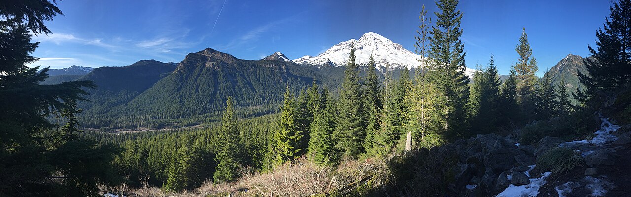
| 9 | Mount Rainier National Park Washington | Glacial mountaineering ascents | Elevation Range: 1,880 feet to 14,411 feet at the summit | Research only |
| 10 | Great Sand Dunes National Park Colorado | Early June family wading | Location: San Luis Valley, Southern Colorado | Research only |
How we picked
Ranked by Adele Marchetti, Destinations Editor
We built this ranking from trip reports, agency data, permit records, and our editors' own time on the ground. 10 places made the final cut out of a much longer working list, and each one had to clear the same set of criteria before it earned a spot.
- Quality of the terrain
- Landscape, route variety, and whether the place rewards multiple days rather than one overlook.
- Season and weather windows
- How long the reliable window is, and how badly the shoulder seasons punish a bad forecast.
- Access and permits
- Trailhead logistics, permit odds, quotas, and how much lead time a trip realistically takes.
- Solitude vs. crowding
- How far you have to walk before the place feels like wilderness instead of a queue.
- Wildlife and ecology
- What you can reasonably expect to see, and what you have to plan around.
- Risk and skill required
- Navigation, water crossings, exposure, and rescue distance — stated plainly.
How often we recheck this: Reviewed on a rolling basis and rechecked at least once a year, or sooner if a pick is discontinued, revised, or beaten by something new.
Best of the Best · Head to Head
Glacier National Park vs Yellowstone National Park
#1 vs #2 — side-by-side specs, pros & cons, and the final verdict.
Compare any two picks
Build your own side-by-side
Choose any two of these 10 picks and compare specs, price, pros, cons and reader ratings.
Topic summary
Ten US destinations where June is the right month — weather, wildlife, and crowds all considered.
Key takeaways
- #1 Glacier National Park — Montana
- #2 Yellowstone National Park — Wyoming
- #3 Grand Teton National Park — Wyoming
- #4 Rocky Mountain National Park — Colorado
- #5 Acadia National Park — Maine
- #6 Boundary Waters — Minnesota
Intended uses
Places
Verification notes
Editorial ranked list, 10 entries. Evidence mix — 10 research only. Buy links open the maker or a retailer search. Last reviewed October 2026.
Best us destinations in june for a specific job
Skip the ranking — jump to the pick that matches how you actually use it.
- Best for early-season alpine road cycling
- #1 Glacier National Park — MontanaGoing-to-the-Sun Road typically opens late month; waterfalls peak.Read the full profile
- Best for dawn wildlife spotting
- #2 Yellowstone National Park — WyomingAll roads open; long daylight for geyser basins and wildlife.Read the full profile
- Best for early summer valley day hiking
- #3 Grand Teton National Park — WyomingWildflowers under the Tetons; Jenny Lake and Cascade Canyon shine.Read the full profile
- Best for high-altitude scenic alpine drives
- #4 Rocky Mountain National Park — ColoradoTrail Ridge Road opens; elk in the meadows, snow on the peaks.Read the full profile
- Best for granite ridge scrambling
- #5 Acadia National Park — MaineWarm days, cool ocean, and the full island in bloom.Read the full profile
- Best for multi-day canoe expeditions
- #6 Boundary Waters — MinnesotaCanoe season in full swing; long days and loons on the lakes.Read the full profile
- Best for coastal wilderness backpacking
- #7 Olympic National Park — WashingtonHigh country melts out; rainforest, mountains, and coast in one trip.Read the full profile
- Best for point-to-point backpacking traverses
- #8 Isle Royale National Park — MichiganRemote Lake Superior island opens for its short season; moose and wolves.Read the full profile
Our editors test the gear, pick the ten, and set the order the day a list publishes. After that, the ranking is live: every member star rating feeds the community order, so picks climb or slide as real owners report back. Editorial judgment decides what earns a spot — you help decide where it sits.
- Editors set the field
Hands-on testing and spec research choose the ten and the published order.
- Readers re-rank it
Your 1–5 star ratings drive the community order on every list.
- Rankings keep moving
Picks rise or fall over time — nothing is frozen at launch day.
Rank this list
Loading community ratings… Ratings re-order the picks — they never change which products make the list.
Sign in to add your own ratings — it's free.
- Pros
- Peak runoff delivers magnificent, roaring waterfalls across every mountain drainage
- Car-free cycling on upper Going-to-the-Sun Road before the full automotive opening
- High wildlife density and visibility along lower riverbanks and valley floors
- Noticeably smaller tourist crowds than the peak summer rush of July and August
Cons- High-elevation passes remain impassable or require technical snow travel skills
- Going-to-the-Sun Road vehicle access is not guaranteed until late in the month
- Unpredictable spring storms bring sudden driving rain and high-elevation snowfall
Key features- June Temperatures
- 40°F to 72°F; sudden freezing shifts possible
- Location
- Northwestern Montana
- Primary Gateways
- West Glacier, St. Mary, Two Medicine
- Core Highlight
- Going-to-the-Sun Road and alpine cirques
- Required Passes
- Park pass plus corridor vehicle reservations
- Apex Wildlife
- Grizzly and black bears, moose, bighorn sheep
Best forEarly-season alpine road cycling, Valley and lakeshore day hiking, Peak snowmelt waterfall viewing, Frontcountry wildlife photography
Pros- Peak runoff delivers magnificent, roaring waterfalls across every mountain drainage
- Car-free cycling on upper Going-to-the-Sun Road before the full automotive opening
- High wildlife density and visibility along lower riverbanks and valley floors
- Noticeably smaller tourist crowds than the peak summer rush of July and August
Cons- High-elevation passes remain impassable or require technical snow travel skills
- Going-to-the-Sun Road vehicle access is not guaranteed until late in the month
- Unpredictable spring storms bring sudden driving rain and high-elevation snowfall
Assessed by Adele Marchetti against our ranking criteria.No ratings yet - Pros
- All major park roads and high mountain passes fully open by June
- Peak season for newborn wildlife calves and predator activity
- Fifteen-plus hours of daylight for early and late excursion windows
- Waterfalls and thermal features surge with peak spring snowmelt runoff
Cons- Severe vehicle traffic and parking gridlock at popular geyser basins
- Volatile mountain weather brings sudden freezes and heavy summer hail
- High-elevation backcountry routes remain blocked by snowdrifts into July
Key features- Location
- Northwestern Wyoming, Montana, Idaho
- Total Area
- 2,219,789 acres
- Average Elevation
- 7,500 to 8,000 feet
- June Road Status
- All park entrances and major passes open
- Primary Hazards
- Bison encounters, thermal scalding, bears
- Backcountry Permits
- Required year-round via Recreation.gov
Best forDawn wildlife spotting, Full park loop driving, Low-elevation early backpacking, Geothermal landscape photography
Pros- All major park roads and high mountain passes fully open by June
- Peak season for newborn wildlife calves and predator activity
- Fifteen-plus hours of daylight for early and late excursion windows
- Waterfalls and thermal features surge with peak spring snowmelt runoff
Cons- Severe vehicle traffic and parking gridlock at popular geyser basins
- Volatile mountain weather brings sudden freezes and heavy summer hail
- High-elevation backcountry routes remain blocked by snowdrifts into July
Assessed by Adele Marchetti against our ranking criteria.No ratings yet - Pros
- Lower valley crowds compared to the peak rush of July and August
- Abundant wildlife viewing as bears and moose forage in accessible lower valleys
- Stunning visual contrast of vibrant green meadows beneath heavily snowcapped peaks
- Lush wildflower blooms across Antelope Flats and lower lake trails
Cons- High mountain passes and the Teton Crest Trail remain snowbound and hazardous
- Trailhead parking lots at Jenny Lake and String Lake fill rapidly by mid-morning
- Volatile spring weather brings sudden afternoon thunderstorms and freezing nights
Key features- June Temperatures
- Highs near 70°F, lows in the upper 30s°F
- Location
- Northwestern Wyoming, Jackson Hole valley
- Elevation Range
- 6,320 ft at valley floor to 13,775 ft at Grand Teton
- Backcountry Permits
- Required year-round; advance reservation or walk-up
- Bear Safety
- Mandatory bear spray carry; food canisters required
- Primary Gateway
- Jackson, Wyoming
Best forEarly summer valley day hiking, Wildlife watching and photography, Lower elevation canoe paddling, Shoulder season landscape photography
Pros- Lower valley crowds compared to the peak rush of July and August
- Abundant wildlife viewing as bears and moose forage in accessible lower valleys
- Stunning visual contrast of vibrant green meadows beneath heavily snowcapped peaks
- Lush wildflower blooms across Antelope Flats and lower lake trails
Cons- High mountain passes and the Teton Crest Trail remain snowbound and hazardous
- Trailhead parking lots at Jenny Lake and String Lake fill rapidly by mid-morning
- Volatile spring weather brings sudden afternoon thunderstorms and freezing nights
Assessed by Adele Marchetti against our ranking criteria.No ratings yet - Pros
- Trail Ridge Road provides direct vehicle access to fragile alpine tundra environments
- Active wildlife calving season offers exceptional elk and moose viewing in low valleys
- Peaks retain dramatic winter snow caps against clear, crisp early-summer skies
- Waterfalls and mountain cascades operate at maximum volume from peak snowmelt
Cons- High-elevation trails demand traction devices and technical snow navigation skills
- Mandatory timed-entry reservations require rigid pre-trip schedule management
- Volatile afternoon lightning storms create severe hazards on exposed terrain
Key features- Location
- Front Range, Northern Colorado
- Highest Elevation
- Longs Peak (14,259 feet)
- Highway Summit
- Trail Ridge Road (12,183 feet)
- Primary Gateways
- Estes Park (East) and Grand Lake (West)
- Access Requirement
- Timed Entry Permit Reservation plus park pass
- Total Area
- 265,807 acres
Best forHigh-altitude scenic alpine drives, Early-season valley wildlife viewing, Mixed-snow mountaineering conditioning, Spring runoff waterfall photography
Pros- Trail Ridge Road provides direct vehicle access to fragile alpine tundra environments
- Active wildlife calving season offers exceptional elk and moose viewing in low valleys
- Peaks retain dramatic winter snow caps against clear, crisp early-summer skies
- Waterfalls and mountain cascades operate at maximum volume from peak snowmelt
Cons- High-elevation trails demand traction devices and technical snow navigation skills
- Mandatory timed-entry reservations require rigid pre-trip schedule management
- Volatile afternoon lightning storms create severe hazards on exposed terrain
Assessed by Adele Marchetti against our ranking criteria.No ratings yet - Pros
- World-class coastal views from easily accessible granite summits
- Extensive carriage road network ideal for car-free gravel cycling
- Free Island Explorer shuttle simplifies point-to-point day hikes
- June brings active bird migrations and blooming wild lupine
Cons- Dense sea fog can entirely eliminate summit views for multiple days
- Key trailheads and parking lots reach capacity before mid-morning
- Peregrine falcon nesting often closes popular cliff routes like Precipice
Key features- June Temperature Range
- Highs around 70°F, lows near 50°F
- Location
- Mount Desert Island, Maine
- Primary Terrain
- Glaciated granite domes, spruce-fir woods, cobble coastline
- Entrance Fee
- Standard NPS park pass required
- Cadillac Summit Access
- Timed vehicle reservation required mid-May to mid-October
- Trail Network
- 158 miles of hiking trails, 45 miles of carriage roads
Best forGranite ridge scrambling, Gravel bike touring, Early summer coastal hiking, Sea kayak day excursions
Pros- World-class coastal views from easily accessible granite summits
- Extensive carriage road network ideal for car-free gravel cycling
- Free Island Explorer shuttle simplifies point-to-point day hikes
- June brings active bird migrations and blooming wild lupine
Cons- Dense sea fog can entirely eliminate summit views for multiple days
- Key trailheads and parking lots reach capacity before mid-morning
- Peregrine falcon nesting often closes popular cliff routes like Precipice
Assessed by Adele Marchetti against our ranking criteria.No ratings yet - Pros
- World-class, motor-free wilderness canoeing across thousands of pristine lakes
- Peak early-season freshwater fishing for walleye, smallmouth, and pike
- Eighteen hours of daylight ideal for high-mileage backcountry travel
- Extensive network of designated campsites with fire grates and wilderness latrines
Cons- Intense mosquito and black fly hatches throughout June require full protective gear
- Portaging heavy packs and canoes over rocky terrain demands high physical fitness
- Cold water temperatures and rapid weather shifts create severe capsize hazards
Key features- Total Area
- 1,098,000 protected wilderness acres
- Managing Agency
- U.S. Forest Service (Superior National Forest)
- Primary Access Hubs
- Ely and Grand Marais, Minnesota
- June Water Temps
- 55°F to 65°F
- Permit System
- Entry-point quota required May through September
- Designated Campsites
- Roughly 2,000 primitive sites with latrine and grate
Best forMulti-day canoe expeditions, Wilderness freshwater angling, Self-reliant backcountry travel, Primitive lakefront camping
Pros- World-class, motor-free wilderness canoeing across thousands of pristine lakes
- Peak early-season freshwater fishing for walleye, smallmouth, and pike
- Eighteen hours of daylight ideal for high-mileage backcountry travel
- Extensive network of designated campsites with fire grates and wilderness latrines
Cons- Intense mosquito and black fly hatches throughout June require full protective gear
- Portaging heavy packs and canoes over rocky terrain demands high physical fitness
- Cold water temperatures and rapid weather shifts create severe capsize hazards
Assessed by Adele Marchetti against our ranking criteria.No ratings yet - Pros
- Three distinct biomes within a single day of travel
- Long daylight hours maximize trail time across remote routes
- Rainforest river valleys offer lush, snow-free early-season hiking
- Roosevelt elk and black bears are exceptionally active in June
Cons- High alpine passes remain snow-covered and require technical route finding
- Persistent coastal fog and drizzle can linger for multiple days
- Severe vehicle congestion at popular entry points like the Hoh Rainforest
Key features- Park Size
- Roughly 922,000 acres
- June Temperatures
- 45°F to 65°F in lowlands
- Primary Gateway
- Port Angeles, Washington
- Terrain Types
- Pacific coast, temperate rainforest, glaciated alpine
- Essential Gear
- Bear canister, tide tables, waterproof outer shell
- Permit System
- Recreation.gov backcountry quota reservations
Best forCoastal wilderness backpacking, Temperate rainforest day hikes, Multi-ecosystem road trips, Early-summer wildlife photography
Pros- Three distinct biomes within a single day of travel
- Long daylight hours maximize trail time across remote routes
- Rainforest river valleys offer lush, snow-free early-season hiking
- Roosevelt elk and black bears are exceptionally active in June
Cons- High alpine passes remain snow-covered and require technical route finding
- Persistent coastal fog and drizzle can linger for multiple days
- Severe vehicle congestion at popular entry points like the Hoh Rainforest
Assessed by Adele Marchetti against our ranking criteria.No ratings yet - Pros
- Complete wilderness isolation with strictly limited daily visitor numbers
- Unparalleled wildlife viewing, particularly for moose and loons
- Established network of free backcountry shelters and tent sites
- Superb interior lake paddling and backcountry pike fishing
Cons- Aggressive blackflies and mosquitoes intensify rapidly by mid-June
- Ferry and seaplane access is expensive and highly weather-dependent
- Medical evacuation is difficult with zero cellular reception
Key features- Location
- Lake Superior, Michigan
- Access
- Passenger ferry or seaplane only
- Peak Window
- Mid-June through August
- Primary Trail
- Greenstone Ridge Trail (40 miles)
- Permits
- Required for overnight backcountry stays
- Key Wildlife
- Moose, gray wolves, loons, red foxes
Best forPoint-to-point backpacking traverses, Inland lake canoe expeditions, Wildlife observation and photography, Solitary off-grid wilderness retreats
Pros- Complete wilderness isolation with strictly limited daily visitor numbers
- Unparalleled wildlife viewing, particularly for moose and loons
- Established network of free backcountry shelters and tent sites
- Superb interior lake paddling and backcountry pike fishing
Cons- Aggressive blackflies and mosquitoes intensify rapidly by mid-June
- Ferry and seaplane access is expensive and highly weather-dependent
- Medical evacuation is difficult with zero cellular reception
Assessed by Adele Marchetti against our ranking criteria.No ratings yet - Pros
- Peak waterfall flow fed by massive early-season glacial and snow melt
- Lower valley trails and old-growth groves are fully snow-free and quiet
- Prime mountaineering window with solid early-season snow bridges on glaciers
- Significantly smaller trail crowds than during the peak July and August rush
Cons- Subalpine trails including Skyline remain buried under deep, slushy snowpack
- Sunrise road and eastern alpine visitor centers are generally closed until July
- Timed-entry reservation system requires strict advance planning for entry
Key features- Elevation Range
- 1,880 feet to 14,411 feet at the summit
- Road Status
- Paradise corridor open; Sunrise typically closed until July
- Primary Hazard
- Snow bridges, rapid snowmelt, and sudden whiteouts
- Timed Entry
- Required for Nisqually and Sunrise corridors in daytime
- Camping Access
- Cougar Rock and Ohanapecosh open for reservations
- Wilderness Permits
- Mandatory year-round for all overnight backcountry stays
Best forGlacial mountaineering ascents, Low-elevation old-growth day hikes, High-volume waterfall photography, Subalpine snowshoe day trips
Pros- Peak waterfall flow fed by massive early-season glacial and snow melt
- Lower valley trails and old-growth groves are fully snow-free and quiet
- Prime mountaineering window with solid early-season snow bridges on glaciers
- Significantly smaller trail crowds than during the peak July and August rush
Cons- Subalpine trails including Skyline remain buried under deep, slushy snowpack
- Sunrise road and eastern alpine visitor centers are generally closed until July
- Timed-entry reservation system requires strict advance planning for entry
Assessed by Adele Marchetti against our ranking criteria.No ratings yet - Pros
- Rare convergence of snowmelt surge-flow creek and towering dunes
- Pristine night sky visibility inside a certified Dark Sky Park
- Open backcountry dune camping without rigid campsite assignments
- Diverse terrain ranging from sage flats to alpine summits
Cons- Midday sand surface temperatures easily exceed 140 degrees Fahrenheit
- High winds generate abrasive, blinding sandstorms with zero cover
- Creek flow diminishes rapidly alongside biting insect spikes by late June
Key features- Location
- San Luis Valley, Southern Colorado
- Elevation Range
- 7,520 to 13,604 feet
- Managing Agency
- National Park Service
- Peak Surface Temp
- Up to 150°F (65°C) on open sand in June
- Primary Waterway
- Medano Creek (seasonal surge flow)
- Backcountry Permits
- Required via Recreation.gov
Best forEarly June family wading, Dark sky astrophotography, Dawn sandboard descents, High-clearance 4WD overlanding
Pros- Rare convergence of snowmelt surge-flow creek and towering dunes
- Pristine night sky visibility inside a certified Dark Sky Park
- Open backcountry dune camping without rigid campsite assignments
- Diverse terrain ranging from sage flats to alpine summits
Cons- Midday sand surface temperatures easily exceed 140 degrees Fahrenheit
- High winds generate abrasive, blinding sandstorms with zero cover
- Creek flow diminishes rapidly alongside biting insect spikes by late June
Assessed by Adele Marchetti against our ranking criteria.No ratings yet



Award picks
The ranking above is price-blind and judged on merit. These awards call out the pick we'd hand a specific person with a specific need.
Best Overall: Glacier National Park — Montana
Going-to-the-Sun Road typically opens late month; waterfalls peak.
Ranked #1Runner-Up: Yellowstone National Park — Wyoming
All roads open; long daylight for geyser basins and wildlife.
Ranked #2Best for Solitude: Olympic National Park — Washington
High country melts out; rainforest, mountains, and coast in one trip.
Ranked #7Best for First-Timers: Grand Teton National Park — Wyoming
Wildflowers under the Tetons; Jenny Lake and Cascade Canyon shine.
Ranked #3Best Big-Mountain Objective: Rocky Mountain National Park — Colorado
Trail Ridge Road opens; elk in the meadows, snow on the peaks.
Ranked #4Best Water Trip: Acadia National Park — Maine
Warm days, cool ocean, and the full island in bloom.
Ranked #5How to choose between these us destinations in june
Every pick on this page was judged against the same criteria. If you want the short answer, Glacier National Park by Montana is the one we point most people at. If you want to decide for yourself, here is what actually separates a good us destinations in june from an expensive one.
Quality of the terrain
Landscape, route variety, and whether the place rewards multiple days rather than one overlook.
Season and weather windows
How long the reliable window is, and how badly the shoulder seasons punish a bad forecast.
Access and permits
Trailhead logistics, permit odds, quotas, and how much lead time a trip realistically takes.
Solitude vs. crowding
How far you have to walk before the place feels like wilderness instead of a queue.
Wildlife and ecology
What you can reasonably expect to see, and what you have to plan around.
Risk and skill required
Navigation, water crossings, exposure, and rescue distance — stated plainly.
Match the trip to your season and skill
The right us destinations in june depends on what you are actually doing with it: Early-season alpine road cycling; Valley and lakeshore day hiking; Peak snowmelt waterfall viewing; Frontcountry wildlife photography; Dawn wildlife spotting; Full park loop driving. Start from the use case, then work down the ranking until you hit the first pick that covers it.
Common mistakes
- Booking travel before checking permit windows and quota draw dates.
- Planning peak-season mileage without a weather-day buffer.
- Assuming an access road or ferry runs year-round.
- Ignoring local fire, bear, and camping regulations for the unit you are entering.
Frequently asked questions
- What is the best us destinations in june in 2026?
- Glacier National Park by Montana takes the top spot. Going-to-the-Sun Road typically opens late month; waterfalls peak.
- How did The Wild10 choose and rank these us destinations in june?
- We judged every pick against the same criteria — quality of the terrain, season and weather windows, access and permits, solitude vs. crowding — and ranked them on merit regardless of price. Ten US destinations where June is the right month — weather, wildlife, and crowds all considered.
- Which of these us destinations in june is easiest to plan on a budget?
- Great Sand Dunes National Park by Colorado — Medano Creek flows at the dunes' base — a seasonal beach in the mountains.
- Glacier National Park vs Yellowstone National Park — which should I pick?
- Glacier National Park ranks first: Going-to-the-Sun Road typically opens late month; waterfalls peak. Yellowstone National Park is the close second: All roads open; long daylight for geyser basins and wildlife. Our full head-to-head compares them side by side.
- How often is this list updated?
- We review this ranking on a rolling basis and update it whenever a pick is discontinued, meaningfully revised, or beaten by something new. Rankings are editorial — brands do not see them before publication and affiliate links never change the order.
Get The Field List
One short, honest email a week: gear we actually trust, planning guides, and survival-TV coverage. Free, unsubscribe anytime.