


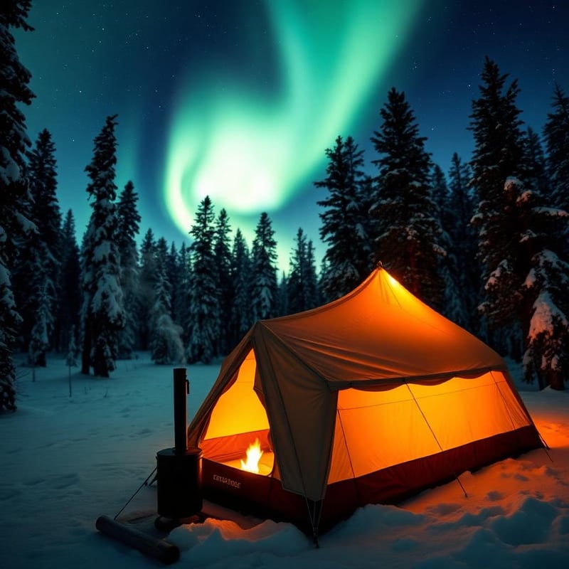
Updated October 2026 · 10 picks re-checked for availability and current spec, reader ratings refreshed live.
Every destination has a best month. These ten US picks are at their best in November — for weather, wildlife, access, or simply the absence of crowds. Conditions vary year to year; check current forecasts and park alerts before you go.
The short answer


Compare all 10 picks at a glance
Editorial ranking, what each pick is best at, and how we assessed it. Tap a name to jump to the full write-up.
| # | Pick | Best for | Key spec | Evidence |
|---|---|---|---|---|
| 1 | Death Valley National Park California | Badlands wash scrambling | Location: Inyo County, California & Nevada | Research only |
| 2 | Big Bend National Park Texas | Shoulder-season desert backpacking | Location: Southwest Texas, Mexican border | Research only |
| 3 | Joshua Tree National Park California | Late fall trad climbing | Managing Agency: National Park Service | Research only |
| 4 | Everglades National Park Florida | Multi-day coastal sea kayaking | Location: Southern Florida | Research only |
| 5 | Saguaro National Park Arizona | Late fall desert hiking | Location: Pima County, Arizona | Research only |
| 6 | Sedona Arizona | Technical slickrock mountain biking | Base Elevation: 4,350 feet | Research only |
| 7 | Grand Canyon National Park Arizona | Strenuous inner canyon day hiking | Elevation: South Rim 7,000 ft; Colorado River 2,400 ft | Research only |
| 8 | Channel Islands National Park California | Late-season sea kayaking | Gateway Port: Ventura Harbor, California | Research only |
| 9 | Great Sand Dunes National Park Colorado | Cold-weather sand hiking | Elevation: 8,200 to 13,604 feet | Research only |
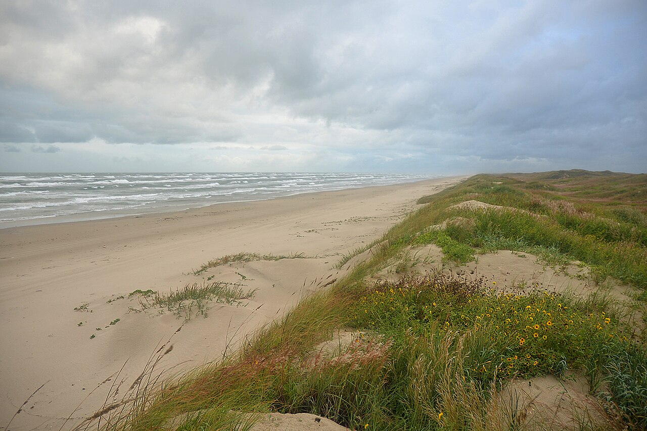
| 10 | Padre Island National Seashore Texas | Primitive 4WD Beach Camping | Location: Kleberg and Kenedy Counties, Texas | Research only |
How we picked
Ranked by Adele Marchetti, Destinations Editor
We built this ranking from trip reports, agency data, permit records, and our editors' own time on the ground. 10 places made the final cut out of a much longer working list, and each one had to clear the same set of criteria before it earned a spot.
- Quality of the terrain
- Landscape, route variety, and whether the place rewards multiple days rather than one overlook.
- Season and weather windows
- How long the reliable window is, and how badly the shoulder seasons punish a bad forecast.
- Access and permits
- Trailhead logistics, permit odds, quotas, and how much lead time a trip realistically takes.
- Solitude vs. crowding
- How far you have to walk before the place feels like wilderness instead of a queue.
- Wildlife and ecology
- What you can reasonably expect to see, and what you have to plan around.
- Risk and skill required
- Navigation, water crossings, exposure, and rescue distance — stated plainly.
How often we recheck this: Reviewed on a rolling basis and rechecked at least once a year, or sooner if a pick is discontinued, revised, or beaten by something new.
Best of the Best · Head to Head
Death Valley National Park vs Big Bend National Park
#1 vs #2 — side-by-side specs, pros & cons, and the final verdict.
Compare any two picks
Build your own side-by-side
Choose any two of these 10 picks and compare specs, price, pros, cons and reader ratings.
Topic summary
Ten US destinations where November is the right month — weather, wildlife, and crowds all considered.
Key takeaways
- #1 Death Valley National Park — California
- #2 Big Bend National Park — Texas
- #3 Joshua Tree National Park — California
- #4 Everglades National Park — Florida
- #5 Saguaro National Park — Arizona
- #6 Sedona — Arizona
Intended uses
Places
Verification notes
Editorial ranked list, 10 entries. Evidence mix — 10 research only. Buy links open the maker or a retailer search. Last reviewed October 2026.
Best us destinations in november for a specific job
Skip the ranking — jump to the pick that matches how you actually use it.
- Best for badlands wash scrambling
- #1 Death Valley National Park — CaliforniaHiking season begins — cool days, empty trails, long light.Read the full profile
- Best for shoulder-season desert backpacking
- #2 Big Bend National Park — TexasDesert hiking season opens; Rio Grande runs cool and clear.Read the full profile
- Best for late fall trad climbing
- #3 Joshua Tree National Park — CaliforniaClimbing and hiking season in full swing by month's end.Read the full profile
- Best for multi-day coastal sea kayaking
- #4 Everglades National Park — FloridaDry season begins; mosquitoes fade and wildlife concentrates.Read the full profile
- Best for late fall desert hiking
- #5 Saguaro National Park — ArizonaPleasant desert walking returns as the heat breaks.Read the full profile
- Best for technical slickrock mountain biking
- #6 Sedona — ArizonaCool, clear days on the red rocks; golden cottonwoods in Oak Creek.Read the full profile
- Best for strenuous inner canyon day hiking
- #7 Grand Canyon National Park — ArizonaSouth Rim stays open; cold, clear air and near-empty overlooks.Read the full profile
- Best for late-season sea kayaking
- #8 Channel Islands National Park — CaliforniaCalm seas return; island hiking without summer crowds.Read the full profile
Our editors test the gear, pick the ten, and set the order the day a list publishes. After that, the ranking is live: every member star rating feeds the community order, so picks climb or slide as real owners report back. Editorial judgment decides what earns a spot — you help decide where it sits.
- Editors set the field
Hands-on testing and spec research choose the ten and the published order.
- Readers re-rank it
Your 1–5 star ratings drive the community order on every list.
- Rankings keep moving
Picks rise or fall over time — nothing is frozen at launch day.
Rank this list
Loading community ratings… Ratings re-order the picks — they never change which products make the list.
Sign in to add your own ratings — it's free.
- Pros
- Ideal mid-70s daytime temperatures for fully exposed hiking
- Long low-angled autumn light highlights dramatic geology
- Substantially thinner crowds than winter and spring peak seasons
- Internationally recognized dark sky conditions for stargazing
Cons- Short autumn daylight hours limit extended backcountry treks
- Massive driving distances require extensive fuel and time planning
- Frigid overnight temperatures caught unprepared high-elevation campers
Key features- Location
- Inyo County, California & Nevada
- Total Area
- 3,422,024 acres
- November Highs
- 73°F to 77°F (basin floor)
- November Lows
- 46°F to 50°F (basin floor)
- Elevation Range
- -282 ft to 11,049 ft
- Entrance Fee
- $30 per vehicle (valid 7 days)
Best forBadlands wash scrambling, Dispersed desert vehicle camping, Cool-weather canyon day hiking, Late-autumn dark sky photography
Pros- Ideal mid-70s daytime temperatures for fully exposed hiking
- Long low-angled autumn light highlights dramatic geology
- Substantially thinner crowds than winter and spring peak seasons
- Internationally recognized dark sky conditions for stargazing
Cons- Short autumn daylight hours limit extended backcountry treks
- Massive driving distances require extensive fuel and time planning
- Frigid overnight temperatures caught unprepared high-elevation campers
Assessed by Adele Marchetti against our ranking criteria.No ratings yet - Pros
- Ideal daytime hiking temperatures across both desert and alpine zones
- Internationally recognized dark skies provide exceptional stargazing
- Calm autumn river levels make Santa Elena Canyon paddling accessible
- Vast backcountry trail network offers true solitude outside holiday weeks
Cons- Severe water scarcity requires heavy, self-supported carries on most trails
- Thanksgiving week causes extreme traffic and trailhead parking shortages
- Remote location requires a four-hour drive from the nearest commercial airport
Key features- Location
- Southwest Texas, Mexican border
- Park Acreage
- 801,163 acres
- Elevation Range
- 1,800 to 7,825 feet
- November Highs
- 65°F to 75°F (desert lowlands)
- November Lows
- 35°F to 48°F (colder at elevation)
- Backcountry Permits
- Required; online and in-person
Best forShoulder-season desert backpacking, Low-water canyon canoe trips, High-clearance overland route touring, Deep-sky wilderness astrophotography
Pros- Ideal daytime hiking temperatures across both desert and alpine zones
- Internationally recognized dark skies provide exceptional stargazing
- Calm autumn river levels make Santa Elena Canyon paddling accessible
- Vast backcountry trail network offers true solitude outside holiday weeks
Cons- Severe water scarcity requires heavy, self-supported carries on most trails
- Thanksgiving week causes extreme traffic and trailhead parking shortages
- Remote location requires a four-hour drive from the nearest commercial airport
Assessed by Adele Marchetti against our ranking criteria.No ratings yet - Pros
- Crisp daytime temperatures ideal for climbing and ridge hiking
- World-class friction on thousands of traditional climbing routes
- Exceptional dark-sky stargazing during clear late-fall nights
- Vast off-trail navigation opportunities across open terrain
Cons- Campgrounds book out months ahead on November weekends
- Zero natural surface water requires carrying full trip volume
- Harsh post-sunset temperature drops down near freezing
Key features- Managing Agency
- National Park Service
- November Highs
- Mid-60s to low 70s Fahrenheit
- November Lows
- High 30s to mid-40s Fahrenheit
- Surface Water
- None; pack in all drinking water
- Backcountry Permits
- Required; self-register or via Recreation.gov
- Elevation Range
- 536 to 5,814 feet above sea level
Best forLate fall trad climbing, Self-supported desert backpacking, Dark sky astrophotography, Shoulder-season day hiking
Pros- Crisp daytime temperatures ideal for climbing and ridge hiking
- World-class friction on thousands of traditional climbing routes
- Exceptional dark-sky stargazing during clear late-fall nights
- Vast off-trail navigation opportunities across open terrain
Cons- Campgrounds book out months ahead on November weekends
- Zero natural surface water requires carrying full trip volume
- Harsh post-sunset temperature drops down near freezing
Assessed by Adele Marchetti against our ranking criteria.No ratings yet - Pros
- Mosquito numbers drop substantially as summer rains taper off
- Receding water levels concentrate apex predators and wading birds
- Open-water chickee platforms offer uniquely remote paddle-in camping
- Milder daytime temperatures make extended flatwater touring practical
Cons- Requires carrying every drop of drinking water into the backcountry
- Inattentive paddlers can be stranded on mudflats by receding tides
- Windless evenings can still produce high concentrations of biting midges
Key features- November Temperatures
- Highs around 80°F, lows around 65°F
- Location
- Southern Florida
- Total Area
- 1.5 million acres
- Prime Season
- November to April
- Backcountry Permits
- Required via Recreation.gov
- Water Type
- Freshwater slough to marine estuary
Best forMulti-day coastal sea kayaking, Remote platform chickee camping, Late-fall bird photography, Flatwater canoe expedition touring
Pros- Mosquito numbers drop substantially as summer rains taper off
- Receding water levels concentrate apex predators and wading birds
- Open-water chickee platforms offer uniquely remote paddle-in camping
- Milder daytime temperatures make extended flatwater touring practical
Cons- Requires carrying every drop of drinking water into the backcountry
- Inattentive paddlers can be stranded on mudflats by receding tides
- Windless evenings can still produce high concentrations of biting midges
Assessed by Adele Marchetti against our ranking criteria.No ratings yet - Pros
- Ideal daytime temperatures in the 70s throughout November
- Spectacular, dense stands of mature saguaro cactus forests
- Convenient access to trailheads from Tucson amenities
- High-elevation wilderness backpacking available in the eastern district
Cons- A 45-minute urban commute separates the two distinct units
- Zero reliable natural water sources along lower-elevation trails
- City skyline and residential borders visible from many frontcountry routes
Key features- Location
- Pima County, Arizona
- Districts
- Tucson Mountain (West) & Rincon Mountain (East)
- Elevation Range
- 2,180 to 8,666 feet
- November Average
- High 73°F / Low 45°F
- Trail Mileage
- Over 165 maintained trail miles
- Camping
- East District wilderness sites only; permit needed
Best forLate fall desert hiking, Shoulder season wilderness backpacking, Winter trail running training, Dry landscape photography
Pros- Ideal daytime temperatures in the 70s throughout November
- Spectacular, dense stands of mature saguaro cactus forests
- Convenient access to trailheads from Tucson amenities
- High-elevation wilderness backpacking available in the eastern district
Cons- A 45-minute urban commute separates the two distinct units
- Zero reliable natural water sources along lower-elevation trails
- City skyline and residential borders visible from many frontcountry routes
Assessed by Adele Marchetti against our ranking criteria.No ratings yet - Pros
- Daytime temperatures are optimal for hard climbing and distance running
- Sandstone offers maximum dry traction for boots and bike tires
- Oak Creek delivers vivid golden foliage against red rock walls
- Flash flood risks are drastically lower than during summer monsoons
Cons- Severe vehicle congestion on Highway 179 and core trailheads
- Rapid post-sunset temperature drops catch unprepared hikers off guard
- High local lodging and camping fees across the Verde Valley
Key features- Base Elevation
- 4,350 feet
- Land Manager
- Coconino National Forest (Red Rock Ranger District)
- November Temps
- Highs around 64°F, lows around 38°F
- Required Pass
- Red Rock Pass or America the Beautiful Interagency Pass
- Primary Hazards
- Trailhead congestion, cold creek crossings, slick frost
- Peak Foliage
- Late October through mid-November in Oak Creek Canyon
Best forTechnical slickrock mountain biking, Riparian canyon day hikes, Strenuous red rock scrambling, High-contrast landscape photography
Pros- Daytime temperatures are optimal for hard climbing and distance running
- Sandstone offers maximum dry traction for boots and bike tires
- Oak Creek delivers vivid golden foliage against red rock walls
- Flash flood risks are drastically lower than during summer monsoons
Cons- Severe vehicle congestion on Highway 179 and core trailheads
- Rapid post-sunset temperature drops catch unprepared hikers off guard
- High local lodging and camping fees across the Verde Valley
Assessed by Adele Marchetti against our ranking criteria.No ratings yet - Pros
- Inner canyon conditions are prime for strenuous high-mileage trekking
- Rim overlook crowds and vehicle congestion drop dramatically
- Low autumn sun angles create exceptional definition across rock strata
- Eliminates the dangerous, extreme summer heat of the lower gorge
Cons- Upper trail switchbacks routinely freeze into hazardous sheets of ice
- Vehicle access to the North Rim is closed for the winter season
- Compressed daylight hours require strict, pre-dawn departure times
Key features- Elevation
- South Rim 7,000 ft; Colorado River 2,400 ft
- South Rim Weather
- Highs near 52°F, nighttime lows near 24°F
- Inner Canyon Weather
- Highs in the mid-60s°F, nighttime lows near 45°F
- Backcountry Permits
- Required for all overnight camping below rim
- North Rim Access
- Closed to vehicle traffic for winter
- Primary Gateway
- Tusayan, Arizona via Highway 64
Best forStrenuous inner canyon day hiking, Shoulder-season corridor backpacking, Low-light landscape photography, Solitary rim trail walking
Pros- Inner canyon conditions are prime for strenuous high-mileage trekking
- Rim overlook crowds and vehicle congestion drop dramatically
- Low autumn sun angles create exceptional definition across rock strata
- Eliminates the dangerous, extreme summer heat of the lower gorge
Cons- Upper trail switchbacks routinely freeze into hazardous sheets of ice
- Vehicle access to the North Rim is closed for the winter season
- Compressed daylight hours require strict, pre-dawn departure times
Assessed by Adele Marchetti against our ranking criteria.No ratings yet - Pros
- Clearest ocean water and peak diving visibility of the entire year
- Significantly reduced ferry and campground crowds compared to summer
- Mild, comfortable hiking temperatures across completely unshaded bluffs
- Frequent encounters with endemic island foxes and abundant marine life
Cons- Ferry cancellations can occur abruptly when winter swells or winds kick up
- No potable water on Anacapa, San Miguel, or Santa Barbara islands
- Exposed campsites require total self-reliance and strict food-storage discipline
Key features- Gateway Port
- Ventura Harbor, California
- Primary Transport
- Island Packers Catamaran Ferry
- November Temps
- 50°F to 68°F
- Potable Water
- Available only on Santa Cruz and Santa Rosa
- Camp Permits
- Required via Recreation.gov before arrival
- Top First-Time Base
- Scorpion Anchorage, Santa Cruz Island
Best forLate-season sea kayaking, Cold-water kelp forest diving, Primitive coastal backpacking, Shoulder-season wildlife photography
Pros- Clearest ocean water and peak diving visibility of the entire year
- Significantly reduced ferry and campground crowds compared to summer
- Mild, comfortable hiking temperatures across completely unshaded bluffs
- Frequent encounters with endemic island foxes and abundant marine life
Cons- Ferry cancellations can occur abruptly when winter swells or winds kick up
- No potable water on Anacapa, San Miguel, or Santa Barbara islands
- Exposed campsites require total self-reliance and strict food-storage discipline
Assessed by Adele Marchetti against our ranking criteria.No ratings yet - Pros
- Cool sand temperatures eliminate the blistering heat of summer treks
- Virtually crowd-free ridges and unobstructed viewpoints
- Striking visual contrast between golden dunes and snow-capped peaks
- Exceptional clarity for night skies and cold-weather astrophotography
Cons- Freezing overnight temperatures regularly drop into the teens
- High winds can cause intense sandblasting and damage delicate electronics
- Medano Creek is often dry or frozen, eliminating easy base-level water
Key features- Elevation
- 8,200 to 13,604 feet
- Location
- San Luis Valley, Southern Colorado
- November Highs
- 45°F to 52°F
- November Lows
- 15°F to 22°F
- Total Area
- 149,028 acres
- Backcountry Permits
- Required via Recreation.gov
Best forCold-weather sand hiking, Late-fall landscape photography, Primitive winter backcountry camping, Quiet high-desert solitude
Pros- Cool sand temperatures eliminate the blistering heat of summer treks
- Virtually crowd-free ridges and unobstructed viewpoints
- Striking visual contrast between golden dunes and snow-capped peaks
- Exceptional clarity for night skies and cold-weather astrophotography
Cons- Freezing overnight temperatures regularly drop into the teens
- High winds can cause intense sandblasting and damage delicate electronics
- Medano Creek is often dry or frozen, eliminating easy base-level water
Assessed by Adele Marchetti against our ranking criteria.No ratings yet - Pros
- Miles of uncrowded, free dispersed camping right on the Gulf shoreline
- Mild late-autumn temperatures provide relief from oppressive summer heat
- Lower insect activity compared to humid spring and summer months
- Prime seasonal birding along an undeveloped stretch of the Central Flyway
- World-class flatwater windsurfing and shallow-water kayak fishing
Cons- Driving down island requires 4WD, sand recovery gear, and tide vigilance
- Salt spray, blowing sand, and sudden cold fronts stress vehicles and camp gear
- Complete lack of water, shade, and facilities along the primitive beach driving route
Key features- Location
- Kleberg and Kenedy Counties, Texas
- Managing Agency
- National Park Service
- Protected Shoreline
- Approximately 66 miles
- November Weather
- Highs mid-70s, lows mid-60s, moderate winds
- Beach Driving
- 4WD required beyond Mile 5 on South Beach
- Camping
- Primitive beach camping plus two developed campgrounds
Best forPrimitive 4WD Beach Camping, Late-Autumn Shorebird Watching, Shallow Flats Kayak Fishing, Self-Sufficient Overlanding Trips
Pros- Miles of uncrowded, free dispersed camping right on the Gulf shoreline
- Mild late-autumn temperatures provide relief from oppressive summer heat
- Lower insect activity compared to humid spring and summer months
- Prime seasonal birding along an undeveloped stretch of the Central Flyway
- World-class flatwater windsurfing and shallow-water kayak fishing
Cons- Driving down island requires 4WD, sand recovery gear, and tide vigilance
- Salt spray, blowing sand, and sudden cold fronts stress vehicles and camp gear
- Complete lack of water, shade, and facilities along the primitive beach driving route
Assessed by Adele Marchetti against our ranking criteria.No ratings yet


Award picks
The ranking above is price-blind and judged on merit. These awards call out the pick we'd hand a specific person with a specific need.
Best Overall: Death Valley National Park — California
Hiking season begins — cool days, empty trails, long light.
Ranked #1Runner-Up: Big Bend National Park — Texas
Desert hiking season opens; Rio Grande runs cool and clear.
Ranked #2Best for Solitude: Everglades National Park — Florida
Dry season begins; mosquitoes fade and wildlife concentrates.
Ranked #4Best for First-Timers: Channel Islands National Park — California
Calm seas return; island hiking without summer crowds.
Ranked #8Best Big-Mountain Objective: Joshua Tree National Park — California
Climbing and hiking season in full swing by month's end.
Ranked #3Best Water Trip: Grand Canyon National Park — Arizona
South Rim stays open; cold, clear air and near-empty overlooks.
Ranked #7How to choose between these us destinations in november
Every pick on this page was judged against the same criteria. If you want the short answer, Death Valley National Park by California is the one we point most people at. If you want to decide for yourself, here is what actually separates a good us destinations in november from an expensive one.
Quality of the terrain
Landscape, route variety, and whether the place rewards multiple days rather than one overlook.
Season and weather windows
How long the reliable window is, and how badly the shoulder seasons punish a bad forecast.
Access and permits
Trailhead logistics, permit odds, quotas, and how much lead time a trip realistically takes.
Solitude vs. crowding
How far you have to walk before the place feels like wilderness instead of a queue.
Wildlife and ecology
What you can reasonably expect to see, and what you have to plan around.
Risk and skill required
Navigation, water crossings, exposure, and rescue distance — stated plainly.
Match the trip to your season and skill
The right us destinations in november depends on what you are actually doing with it: Badlands wash scrambling; Dispersed desert vehicle camping; Cool-weather canyon day hiking; Late-autumn dark sky photography; Shoulder-season desert backpacking; Low-water canyon canoe trips. Start from the use case, then work down the ranking until you hit the first pick that covers it.
Common mistakes
- Booking travel before checking permit windows and quota draw dates.
- Planning peak-season mileage without a weather-day buffer.
- Assuming an access road or ferry runs year-round.
- Ignoring local fire, bear, and camping regulations for the unit you are entering.
Frequently asked questions
- What is the best us destinations in november in 2026?
- Death Valley National Park by California takes the top spot. Hiking season begins — cool days, empty trails, long light.
- How did The Wild10 choose and rank these us destinations in november?
- We judged every pick against the same criteria — quality of the terrain, season and weather windows, access and permits, solitude vs. crowding — and ranked them on merit regardless of price. Ten US destinations where November is the right month — weather, wildlife, and crowds all considered.
- Which of these us destinations in november is easiest to plan on a budget?
- Padre Island National Seashore by Texas — Mild beach camping weather on the longest undeveloped barrier island.
- Death Valley National Park vs Big Bend National Park — which should I pick?
- Death Valley National Park ranks first: Hiking season begins — cool days, empty trails, long light. Big Bend National Park is the close second: Desert hiking season opens; Rio Grande runs cool and clear. Our full head-to-head compares them side by side.
- How often is this list updated?
- We review this ranking on a rolling basis and update it whenever a pick is discontinued, meaningfully revised, or beaten by something new. Rankings are editorial — brands do not see them before publication and affiliate links never change the order.
Get The Field List
One short, honest email a week: gear we actually trust, planning guides, and survival-TV coverage. Free, unsubscribe anytime.