



Where on earth
Satellite imagery flying in from a world view to Finland — Halti and Käsivarsi Wilderness, Polar Regions. Use the + / − buttons, or click the map to zoom with your scroll wheel; drag to pan and pinch to zoom on touch.
- Region
- Finland
- Country
- Polar Regions
- Biome
- Arctic tundra (400–1,324 m)
- Best season
- July – September
- Difficulty
- moderate
- Backpacking
- Hiking
- Winter Camping
- Wildlife Viewing
Key takeaways
- Biome: Arctic tundra (400–1,324 m)
- Best season: July – September
- Difficulty: moderate
- Top activity: backpacking
Photos of Finland — Halti and Käsivarsi Wilderness
Topic summary
A 5-7 day trek to Finland's high point (1,324 m) via the Käsivarsi Wilderness.
Key takeaways
- Difficulty: moderate
- Best season: July – September
Intended uses
backpacking
Climate suitability
Arctic tundra (400–1,324 m)
Tools for a trip here
Picked for how, when and where you're going. Free, no signup.
- Sleep System Temp CalculatorCold nights: check your bag and pad add up to a safe sleep.
- Base Weight CalculatorEvery ounce is carried — total your kit and find your base weight.
- Pack Volume SizerSize the pack for your trip length and season.
- Water Purification MatrixTreat water from streams and lakes on trail.
- Layering CalculatorCold-season miles: layer for climbs and camp.
Plan with verified data
Finland — Halti and Käsivarsi Wilderness trip tools
How to get there
Kilpisjärvi is the named starting point of the Kilpisjärvi–Halti hiking route. Use Kilpisjärvi Visitor Centre for information about the wilderness and its routes; Enontekiö Tourist Information is another local planning contact.
- Kilpisjärvi
Starting point named in the 55-kilometre Kilpisjärvi–Halti hiking route, the main described approach toward Halti.
- Kilpisjärvi Visitor Centre
An information stop for Käsivarsi Wilderness Area and its routes, rather than a confirmed trailhead. Seek route details here before setting out.
Sources: Wikipedia · Wikivoyage. Confirm road and trailhead conditions with the managing agency before you leave.
Popular pursuits at Finland — Halti and Käsivarsi Wilderness
- Backpacking
Multi-day travel with everything on your back — see the packing blocks below.
- Hiking
Day miles on marked trail, with route notes and trail links below.
- Winter Camping
Cold-season travel and camp craft; layering matters more than mileage.
- Wildlife Viewing
Best light, best season, and where animals move.
Animals around Finland — Halti and Käsivarsi Wilderness
 Wildlife guideTimber wolfCanis lupus
 Wildlife guideCanada lynxLynx canadensis
 Wildlife guideWolverineGulo gulo
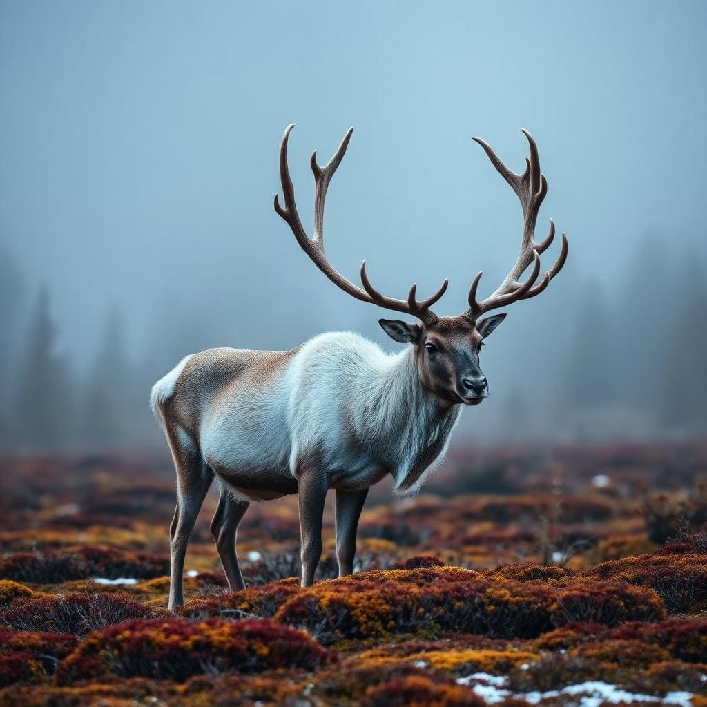 Wildlife guideWoodland caribouRangifer tarandus caribou
 Wildlife guideNorth American beaverCastor canadensis
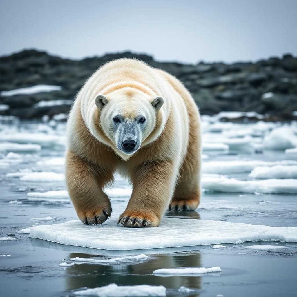 Wildlife guidePolar bearUrsus maritimus
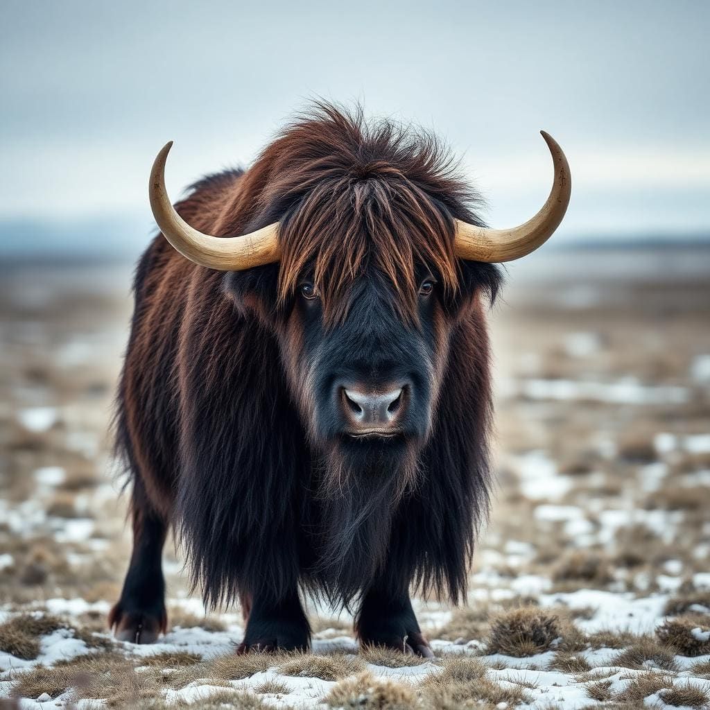 Wildlife guideMuskoxOvibos moschatus
 Wildlife guideMooseAlces alces
Maps, GPS & compass for this trip
Carry a waterproof paper map and a compass you can steer by, and treat the GPS as the backup — not the other way round. Buying links go to Amazon; Wild10 earns a commission at no cost to you.
Waterproof topo maps
- Waterproof topographic map — Finland — Halti and Käsivarsi WildernessAmazon search for waterproof, tear-resistant topo maps covering this area.
- National Geographic Trails IllustratedThe waterproof Trails Illustrated series — check for a sheet covering this area.
- Waterproof map case & compass lanyardKeep a paper map readable in rain, spray and a swamped boat.
Fishing at Finland — Halti and Käsivarsi Wilderness
Planning to fish Finland — Halti and Käsivarsi Wilderness? Fishing licences, open seasons and catch limits in Finland are set by the local wildlife authority and change every year — check the official source before you cast a line.
Do I need a fishing licence at Finland — Halti and Käsivarsi Wilderness?
- A Finland fishing licence is normally required for anyone over the local youth age.
- Read the current Finland fishing regulations for special waters, barbless-hook or catch-and-release rules.
- Clean, drain and dry boats and gear between waters to stop invasive species.
- Finland — Halti and Käsivarsi Wilderness may add its own fishing rules on top of Finland law — check the managing agency too.
Hunting near Finland — Halti and Käsivarsi Wilderness
Thinking about hunting Finland — Halti and Käsivarsi Wilderness? Hunting seasons, tags and draws in Finland are set by the wildlife authority each year. Confirm the rules for your species and unit before you go.
Is hunting allowed at Finland — Halti and Käsivarsi Wilderness?
- Hunting is prohibited or heavily restricted in many national parks, wilderness and protected areas — confirm with the Finland — Halti and Käsivarsi Wilderness land manager before planning a hunt, and look to surrounding public land.
What do I need to hunt in Finland?
- A Finland hunting licence — most jurisdictions also require hunter education certification.
- Species tags or draw results for big game such as deer, elk, moose or bear where they occur.
- Knowledge of firearm and bow transport rules, which differ by land type and border crossing.
Finland’s high-fell wilderness
Käsivarsi Wilderness Area covers 2,206 square kilometres in the northwestern arm of Finnish Lapland. It is Finland’s second-largest wilderness reserve, with a concentration of high ground unmatched elsewhere in the country: every Finnish fell above 1,000 metres lies here except nearby Saana. Halti, at about 1,324 metres, is the main high-country objective in the northern part of the area. This is a destination for walking through broad fell country rather than linking closely spaced settlements. Wide areas of the surrounding municipality, Enontekiö, lie above the tree line, so shelter from wind and weather cannot be taken for granted. Plan clothing, navigation and daily walking ambitions around that exposure, rather than treating the modest-looking elevations as a measure of how forgiving the terrain will be.
Choosing a walk
The 55-kilometre Kilpisjärvi–Halti hiking route is the clearest named option for a journey into the wilderness toward Halti. That stated length should not be treated as a complete out-and-back itinerary; establish the route layout and return plan before setting daily stages. The Nordkalottleden also passes through Käsivarsi, placing the area within a much longer walking network. Its full length is 800 kilometres, not the distance of the section inside this wilderness. Nearby Saana has a marked path to the top and provides a separate fell objective outside Käsivarsi’s concentration of high peaks. Kilpisjärvi Visitor Centre is the practical place to seek information about the area and routes. Choose between these options according to available time, navigation experience and readiness for exposed ground.
Lapland context and preparation
Käsivarsi sits within Enontekiö, a sparsely populated municipality with fewer than 2,000 people spread across more than 8,000 square kilometres. Finnish and Northern Sámi both have official status there, and the wilderness is also known by its Northern Sámi name, Giehtaruohttasa meahcceguovlu. Established in 1991, Käsivarsi is managed by Parks & Wildlife Finland, part of Metsähallitus, and adjoins Norway’s Reisa National Park. Despite its remote setting, it has the highest visitor numbers among Finland’s wilderness areas. Northern latitude also shapes trip planning: summer brings midnight sun, while winter brings polar darkness. Neither season removes the need for a realistic itinerary. Match equipment and navigation plans to the daylight and conditions expected during the trip, and seek current local route advice before heading into the fells.
Route options
- Kilpisjärvi–Halti hiking route55 km
A hiking route linking Kilpisjärvi with Halti in the northern part of Käsivarsi Wilderness Area. Confirm the return arrangement and stage lengths when planning the full trip.
- Nordkalottleden through Käsivarsi
This long-distance trail passes through the wilderness. The complete trail is 800 kilometres long; the length of the Käsivarsi section is not specified.
- Saana marked path
A marked path climbs nearby Saana, the only Finnish fell above 1,000 metres outside Käsivarsi Wilderness Area. Treat it as a separate objective from the Halti route.
Sample itineraries
- Saana and Kilpisjärvi orientation · 1 day
Start at Kilpisjärvi Visitor Centre for route information, then consider the marked path up nearby Saana if conditions and fitness allow. Saana is outside Käsivarsi Wilderness Area. Treat this as a fell day rather than an introduction to the full Halti route.
- Kilpisjärvi–Halti wilderness trek · 7 days
Use a week as an initial planning allowance for a Halti-focused trek, not a confirmed route schedule. The Kilpisjärvi–Halti hiking route is 55 km long. Confirm stages, overnight arrangements and the return journey at Kilpisjärvi Visitor Centre before committing; allow flexibility for exposed fell conditions.
Seasonal conditions
Spring
Spring transition
Do not assume spring means snow-free walking in northern Lapland's high fells. Confirm conditions before choosing a hiking itinerary, and carry protection against cold and wet weather.
Summer
Summer midnight-sun period
Very long daylight supports flexible walking hours, but does not remove the need for rest or weather margins. Wide areas lie above the tree line, so pack wind protection and warm layers even for summer outings.
Fall
Autumn transition
As summer's extended daylight fades, plan shorter walking stages and carry a headlamp. For high-fell travel, prepare for cold, wet conditions and check the current state of the route before departure.
Winter
Winter darkness
Northern Lapland experiences pronounced winter darkness. Limited light and cold make navigation, insulation and emergency planning central to any outing. A summer walking itinerary should not be treated as a winter travel plan.
| Season | Window | Conditions |
|---|---|---|
| Spring | Spring transition | Do not assume spring means snow-free walking in northern Lapland's high fells. Confirm conditions before choosing a hiking itinerary, and carry protection against cold and wet weather. |
| Summer | Summer midnight-sun period | Very long daylight supports flexible walking hours, but does not remove the need for rest or weather margins. Wide areas lie above the tree line, so pack wind protection and warm layers even for summer outings. |
| Fall | Autumn transition | As summer's extended daylight fades, plan shorter walking stages and carry a headlamp. For high-fell travel, prepare for cold, wet conditions and check the current state of the route before departure. |
| Winter | Winter darkness | Northern Lapland experiences pronounced winter darkness. Limited light and cold make navigation, insulation and emergency planning central to any outing. A summer walking itinerary should not be treated as a winter travel plan. |
Permits, fees & closures
Confirm current access rules, permit requirements and overnight arrangements with Parks & Wildlife Finland (Metsähallitus) before travel.
Confirm current permits, fees, and closures with the managing agency before you go.
Hazards & regulations
- Exposure above the tree line: wide open terrain offers limited shelter from wind, wet weather and cold.
- Remote travel: this is a large wilderness in a sparsely populated municipality; plan to manage delays without immediate assistance.
- Navigation in poor visibility: carry independent navigation tools rather than relying on clear views across the fells.
- Winter darkness: limited light can complicate navigation and slow progress.
- Distance and fatigue: the 55 km Kilpisjärvi–Halti route requires realistic staging and a separately confirmed return plan.
What to pack for Finland — Halti and Käsivarsi Wilderness
- Waterproof jacket and trousers
- Warm insulating layers
- Warm hat and gloves
- Sturdy footwear suited to current conditions
- Route map and compass
- Offline navigation with backup power
- Headlamp and spare power
- First-aid kit and emergency shelter
- Shelter and sleeping equipment matched to the season
- Food with a contingency margin
- Water containers and a treatment method
- Cooking equipment suited to confirmed local rules
Finland — Halti and Käsivarsi Wilderness FAQ
- Where is Käsivarsi Wilderness Area?
- It lies in Finland's northwestern arm, in Finnish Lapland. The wilderness covers 2,206 square kilometres and is adjacent to Reisa National Park in Norway.
- How long is the Kilpisjärvi–Halti route?
- The hiking route is 55 km long. Do not treat that figure as a complete out-and-back itinerary; confirm the route layout and return arrangements before setting daily stages.
- Where can current route information be obtained?
- Kilpisjärvi Visitor Centre provides information about the wilderness and its routes. Parks & Wildlife Finland, part of Metsähallitus, manages the area.
- Is Saana inside Käsivarsi Wilderness Area?
- No. Nearby Saana is the exception among Finland's fells over 1,000 metres: the others are within Käsivarsi Wilderness Area. A marked path goes up Saana.
- Does a longer trail pass through the wilderness?
- Yes. The 800 km Nordkalottleden Trail passes through Käsivarsi Wilderness Area. That distance describes the longer trail, not just its section within the wilderness.
- What language context should visitors know?
- Enontekiö is officially bilingual in Finnish and Northern Sámi. The wilderness area's Finnish name is Käsivarren erämaa-alue; its Northern Sámi name is Giehtaruohttasa meahcceguovlu.