



- Region
- TX, USA
- Country
- United States
- Best for
- hiking
- Best season
- Spring, Summer
- Permits
- Confirm wilderness permit requirements wit…
- Managed by
- U.S. Forest Service, Sabine National Forest. Indian Mounds Recreation Area, outside the wilderness, is operated and maintained by the Sabine River Authority of Texas.
Plan with verified data
Indian Mounds Wilderness trip tools
Tools for a trip here
Picked for how, when and where you're going. Free, no signup.
Photos of Indian Mounds Wilderness
How to get there
For Indian Mounds Recreation Area, outside the wilderness’s southeastern border, follow Highway 83 east from Hemphill for 8 miles. Turn right (south) onto FM 3382 and continue for 3.5 miles, then turn left onto Forest Service Road 130 to the entrance. Recreation-area coordinates are 31.3086, -93.6953. These directions lead to the recreation area, not a designated wilderness trailhead.
- Indian Mounds Recreation Area
Located outside the wilderness’s southeastern border, this recreation area provides camping and reservoir access, with a boat ramp and fishing pier. Do not assume the campground entrance is a signed wilderness trailhead.
- Toledo Bend Reservoir
Boats can reach parts of the wilderness from the reservoir. Identify the wilderness boundary and a suitable shore approach before setting out; no specific wilderness landing is identified.
Sources: fs.usda.gov · University of Montana / federal agency partners · Wilderness Connect / federal wilderness boundary inventory. Confirm road and trailhead conditions with the managing agency before you leave.
TX, USA · United States
- Sea Kayaking
- Beachcombing
- Hiking
- Backpacking
- Wildlife Viewing
- Canoeing
- Fishing
A divided wilderness on Toledo Bend
Indian Mounds Wilderness protects forest near Toledo Bend Reservoir in East Texas, close to the Louisiana state line. Designated in 1984, it covers roughly 12,214 acres, but it is not one uninterrupted block: three non-wilderness roads and a gas-pipeline corridor divide it into seven sections. That layout makes boundary awareness an important part of trip planning. Abandoned roads provide access for hikers and horseback riders, while boats can reach parts of the area from the reservoir. Indian Mounds Recreation Area sits outside the wilderness’s southeastern border and should not be confused with the wilderness itself. Both places take their name from unusual hills once attributed to prehistoric people but later identified as natural formations.
Pines, hardwood drainages, and surviving old growth
The forest changes with the terrain. Loblolly and shortleaf pines occupy the periphery, while hardwoods follow the drainages of Indian Creek, Bull Creek, and Hurricane Bayou. A few acres of old-growth trees survive near the reservoir, and mature American beech groves are among the area’s notable features. Yellow lady’s slipper, an orchid, also occurs here. Before logging worked through the area prior to 1930, longleaf pine, beech, oak, and magnolia were part of a forest that supported a turpentine industry. Today, a visit is better framed around forest exploration than a single landmark. Do not plan on seeing red-cockaded woodpeckers: the colony associated with the area has been inactive for years. Leave plants and natural formations undisturbed.
Plan separately for the forest and the recreation area
Indian Mounds Recreation Area offers camping, fishing, and boating year-round on the 185,000-acre Toledo Bend Reservoir. Campsites have picnic tables and campfire rings, but the site has neither potable water nor restrooms. Bring drinking water and plan sanitation before arriving rather than expecting campground services. The recreation area is operated and maintained by the Sabine River Authority of Texas; the wilderness is under Forest Service management. Keep those different settings in mind when planning a combined shore, boating, and hiking trip. Reservoir boating access is not permission to take motorized equipment into wilderness. For practical recreation-area information, contact the Sabine River Authority at 409-565-2273. Check current fire conditions before relying on a campfire, and carry navigation that shows the wilderness’s separate sections.
Where on earth
Satellite imagery flying in from a world view to Indian Mounds Wilderness, United States. Use the + / − buttons, or click the map to zoom with your scroll wheel; drag to pan and pinch to zoom on touch.
Coordinates
- Decimal degrees
- 31.3411, -93.7669
- Latitude (DMS)
- 31° 20′ 28.0″ N
- Longitude (DMS)
- 93° 46′ 0.7″ W
Coordinates are an access-point reference for Indian Mounds Wilderness, not a route. Carry a paper map and confirm trailhead or put-in access with the managing agency before you go.
Topic summary
Prior to 1930, before loggers had worked their way through the area, longleaf pine, beech, oak, and magnolia trees supported a vigorous turpentine industry. Today, Indian Mounds Wilderness safeguards a...
Key takeaways
- Region: TX, USA
- Country: United States
- Good for: hiking
- Coordinates: 31.341, -93.767
Intended uses
hiking
Keep planning
Popular pursuits at Indian Mounds Wilderness
- Sea Kayaking
Coastal crossings, tides, and protected camps.
- Beachcombing
Tide-line walking between camps.
- Hiking
Day miles on marked trail, with route notes and trail links below.
- Backpacking
Multi-day travel with everything on your back — see the packing blocks below.
- Wildlife Viewing
Best light, best season, and where animals move.
- Canoeing
Paddle routes, portages, and put-ins.
Animals around Indian Mounds Wilderness
 Wildlife guideBlack bearUrsus americanus
 Big gameWhitetail DeerOdocoileus virginianus
 GamefishLargemouth BassMicropterus nigricans
 Wildlife guideWild turkeyMeleagris gallopavo
 Big gameWild HogSus scrofa
 GamefishRed DrumSciaenops ocellatus
 Big gameBlack BearUrsus americanus
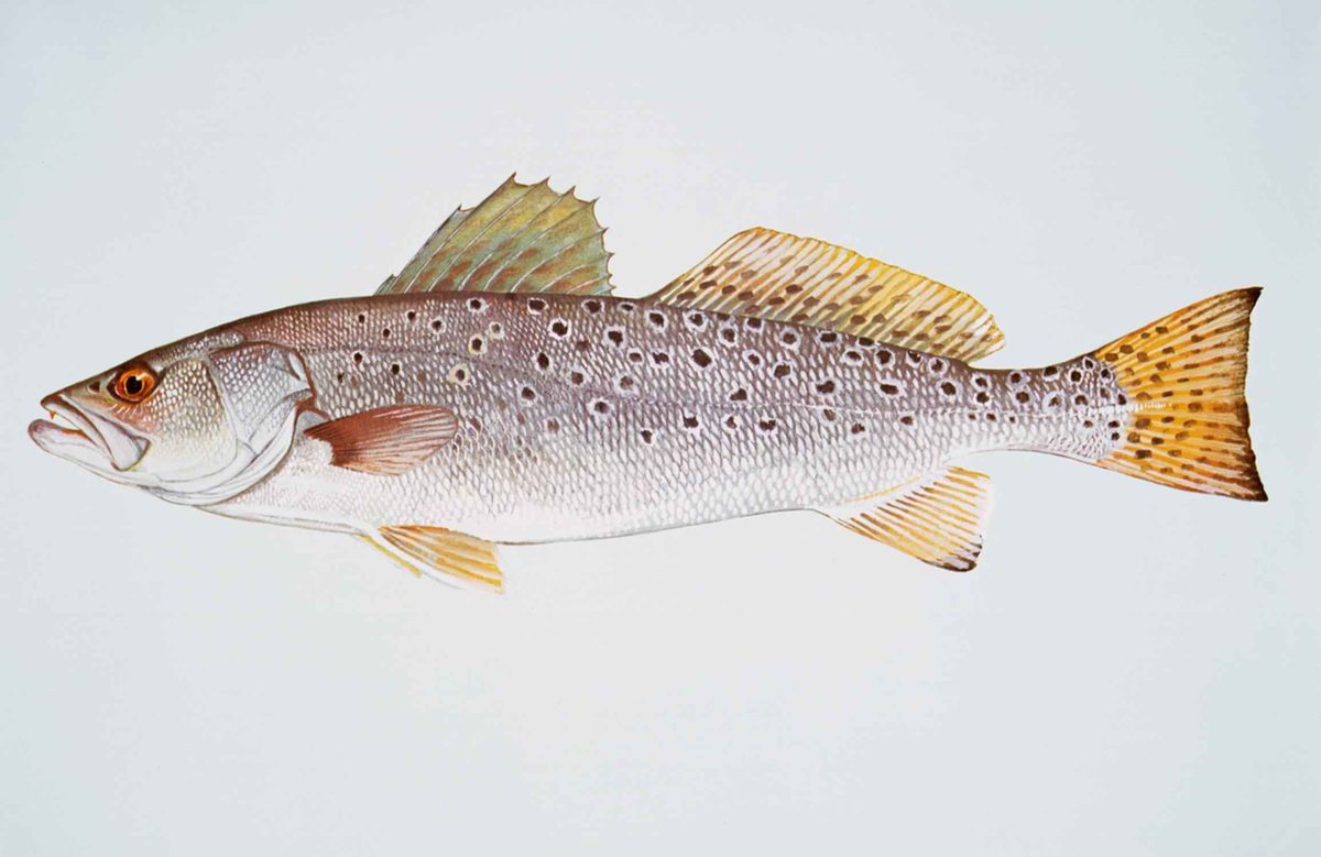 GamefishSpotted SeatroutCynoscion nebulosus
A divided wilderness on Toledo Bend
Indian Mounds Wilderness protects forest near Toledo Bend Reservoir in East Texas, close to the Louisiana state line. Designated in 1984, it covers roughly 12,214 acres, but it is not one uninterrupted block: three non-wilderness roads and a gas-pipeline corridor divide it into seven sections. That layout makes boundary awareness an important part of trip planning. Abandoned roads provide access for hikers and horseback riders, while boats can reach parts of the area from the reservoir. Indian Mounds Recreation Area sits outside the wilderness’s southeastern border and should not be confused with the wilderness itself. Both places take their name from unusual hills once attributed to prehistoric people but later identified as natural formations.
Pines, hardwood drainages, and surviving old growth
The forest changes with the terrain. Loblolly and shortleaf pines occupy the periphery, while hardwoods follow the drainages of Indian Creek, Bull Creek, and Hurricane Bayou. A few acres of old-growth trees survive near the reservoir, and mature American beech groves are among the area’s notable features. Yellow lady’s slipper, an orchid, also occurs here. Before logging worked through the area prior to 1930, longleaf pine, beech, oak, and magnolia were part of a forest that supported a turpentine industry. Today, a visit is better framed around forest exploration than a single landmark. Do not plan on seeing red-cockaded woodpeckers: the colony associated with the area has been inactive for years. Leave plants and natural formations undisturbed.
Plan separately for the forest and the recreation area
Indian Mounds Recreation Area offers camping, fishing, and boating year-round on the 185,000-acre Toledo Bend Reservoir. Campsites have picnic tables and campfire rings, but the site has neither potable water nor restrooms. Bring drinking water and plan sanitation before arriving rather than expecting campground services. The recreation area is operated and maintained by the Sabine River Authority of Texas; the wilderness is under Forest Service management. Keep those different settings in mind when planning a combined shore, boating, and hiking trip. Reservoir boating access is not permission to take motorized equipment into wilderness. For practical recreation-area information, contact the Sabine River Authority at 409-565-2273. Check current fire conditions before relying on a campfire, and carry navigation that shows the wilderness’s separate sections.
Route options
- Abandoned-road exploration
Use abandoned roads for hiking or horseback access into the wilderness. Plan around the seven separate sections and distinguish abandoned access roads from the non-wilderness roads and pipeline corridor. This is an exploration option, not a defined signed loop.
- Hike to the mounds
Visitors to Indian Mounds Recreation Area can hike to the natural hills that gave the area its name. Confirm the starting point and route locally; the recreation area is outside the wilderness boundary.
Sample itineraries
- Wilderness day hike · 1 day
Explore Indian Mounds Wilderness on abandoned roads used for hiking access. Look for pine forest and hardwood drainages, choosing an out-and-back route with a current boundary map. Three non-Wilderness roads and a pipeline corridor divide the wilderness into seven sections; do not assume a continuous marked trail.
- Recreation-area camping and forest exploration · 2 days
Camp at Indian Mounds Recreation Area, outside the wilderness’s southeastern border. Spend one day fishing or boating on Toledo Bend Reservoir and another hiking to the namesake mounds or exploring wilderness access on abandoned roads. Bring drinking water and a sanitation plan; the recreation area has neither potable water nor restrooms.
Seasonal conditions
Spring
Spring
Plan forest walks around current weather and conditions in the Indian Creek, Bull Creek, and Hurricane Bayou drainages. Recreation-area camping, fishing, and boating are offered year-round. Carry drinking water rather than relying on campground supplies.
Summer
Summer
For reservoir outings, carry sun protection, drinking water, and a life jacket. Adjust hiking plans to the forecast and personal water needs. The recreation area has no potable water or restrooms.
Fall
Fall
Check current hunting seasons before hiking. The reservoir supports waterfowl hunting, while deer and squirrel hunting occurs outside the campground. Wear visible clothing when hunting is underway; do not assume specific hunting dates.
Winter
Winter
Camping, fishing, and boating remain year-round recreation-area activities. Choose clothing and sleeping gear for the forecast, and consider wind exposure before boating on Toledo Bend Reservoir. Confirm current access and fire restrictions before departure.
| Season | Window | Conditions |
|---|---|---|
| Spring | Spring | Plan forest walks around current weather and conditions in the Indian Creek, Bull Creek, and Hurricane Bayou drainages. Recreation-area camping, fishing, and boating are offered year-round. Carry drinking water rather than relying on campground supplies. |
| Summer | Summer | For reservoir outings, carry sun protection, drinking water, and a life jacket. Adjust hiking plans to the forecast and personal water needs. The recreation area has no potable water or restrooms. |
| Fall | Fall | Check current hunting seasons before hiking. The reservoir supports waterfowl hunting, while deer and squirrel hunting occurs outside the campground. Wear visible clothing when hunting is underway; do not assume specific hunting dates. |
| Winter | Winter | Camping, fishing, and boating remain year-round recreation-area activities. Choose clothing and sleeping gear for the forecast, and consider wind exposure before boating on Toledo Bend Reservoir. Confirm current access and fire restrictions before departure. |
Permits, fees & closures
Confirm wilderness permit requirements with the Forest Service. For Indian Mounds Recreation Area requirements, contact its operator, the Sabine River Authority of Texas, at 409-565-2273.
Fees: Indian Mounds Recreation Area: camping costs $4 per campsite per night; day use costs $2 per vehicle per day. These are recreation-area fees, not stated wilderness-entry fees.
Official source: National Forests and Grasslands in Texas | Indian Mounds · Verified November 1, 2026
Hazards & regulations
- Navigation can be confusing: seven wilderness sections are separated by three non-Wilderness roads and a gas-pipeline corridor. Carry a boundary map and track your return route.
- Indian Mounds Recreation Area has no potable water or restrooms. Bring drinking water and plan for responsible waste disposal.
- Reservoir boating requires attention to weather and water safety. Wear a life jacket and check conditions before departing.
- Hunting occurs on the reservoir and outside the campground. Check current seasons and wear visible clothing when hunters may be present.
- Check current fire danger and restrictions before using a campground fire ring; the presence of a ring does not establish that fires are allowed.
What to pack for Indian Mounds Wilderness
- Current wilderness boundary map showing roads and the pipeline corridor
- Compass
- Offline navigation with a backup power source
- Drinking water for the full outing
- Extra water containers for camping
- Waste-disposal supplies and trash bags
- Forecast-appropriate layers and rain protection
- Sun protection
- Visible clothing during hunting activity
- First-aid kit
- Shelter and forecast-appropriate sleeping gear
- Life jacket for reservoir outings
- Waterproof storage for navigation and essential supplies
Indian Mounds Wilderness FAQ
- Is Indian Mounds Recreation Area inside the wilderness?
- No. It lies outside the wilderness’s southeastern border on Toledo Bend Reservoir. The Sabine River Authority of Texas operates the recreation area; the Forest Service manages the wilderness. Campground amenities and fees should not be assumed to apply within the wilderness.
- How do you reach the recreation area?
- From Hemphill, follow Highway 83 east for 8 miles. Turn right, south, onto FM 3382 for 3.5 miles, then turn left onto Forest Service Road 130 to the entrance. These directions lead to the recreation area, not a specified wilderness trailhead.
- What access is available within the wilderness?
- Abandoned roads provide hiking and horseback access, and boats can reach parts of the area from Toledo Bend Reservoir. Motorized equipment and mechanical transport are generally prohibited within wilderness. Reservoir boating opportunities do not establish permission to use motorboats inside wilderness boundaries.
- Were the mounds built by people?
- No. The unusual hills were once thought to be prehistoric human constructions, but they were later identified as products of natural processes. Both the wilderness and recreation area take their names from these features.
- What makes the forest distinctive?
- A few acres of old-growth trees remain near Toledo Bend Reservoir. Loblolly and shortleaf pines grow around the periphery, while hardwoods mark the Indian Creek, Bull Creek, and Hurricane Bayou drainages. Mature American beech groves and yellow lady’s slipper orchids may also be found.
- What facilities does the recreation-area campground provide?
- Each site has a picnic table and campfire ring. Potable water and restrooms are not available. Bring water, plan sanitation in advance, and check current fire restrictions before using a fire ring.