



- Region
- AK, USA
- Country
- United States
- Best for
- hiking
- Best season
- Spring, Summer
- Permits
- Confirm current permits, access rules and …
- Managed by
- U.S. Forest Service, Tongass National Forest, Wrangell Ranger District
Plan with verified data
Stikine-LeConte Wilderness trip tools
Tools for a trip here
Picked for how, when and where you're going. Free, no signup.
Photos of Stikine-LeConte Wilderness
How to get there
The wilderness is on the mainland north of Wrangell and east of Petersburg. Small boat is the most frequently used means of access. The Stikine River provides a water route from salt water through the wilderness toward the Canadian boundary. Summer access also includes paddling craft and floatplanes. Confirm the intended landing or river destination and current access rules with the Wrangell Ranger District before arranging transport.
- Stikine River estuary
The river’s saltwater approach leads through an estuary of grasslands and delta mudflats into the Stikine River corridor. This is a water-access area, not a specified boat launch or trailhead.
- LeConte Bay
A water-access destination within the wilderness’s western coastal setting, with LeConte Glacier and icebergs as its defining features. Plan transport for the bay specifically rather than assuming an overland connection from the Stikine.
Sources: fs.usda.gov · University of Montana / federal agency partners · Wilderness Connect / federal wilderness boundary inventory. Confirm road and trailhead conditions with the managing agency before you leave.
AK, USA · United States
- Hunting
- Climbing
- Mountaineering
- Sea Kayaking
- Beachcombing
- Birdwatching
- Hiking
- Wildlife Viewing
A mainland wilderness shaped by water and ice
Stikine-LeConte Wilderness lies on Alaska’s mainland north of Wrangell and east of Petersburg, within Tongass National Forest. Its 449,951 acres encompass the Stikine River and LeConte Bay watersheds and icefields, stretching from the Canadian boundary to the sea. These are two distinct settings for a trip: a forested river corridor with side sloughs and an extensive estuary, and a glacier-fed bay where LeConte Glacier deposits icebergs. Glacial erosion carved the Stikine’s U-shaped valley into granite bedrock. Above it, the Stikine Icefields form the largest icefield on the Tongass, and 10,002-foot Kate’s Needle is the forest’s highest peak. Most visitors travel by water rather than on foot. The river valley and LeConte Bay receive moderate to high summer use, while the adjacent icefields remain remote. Choose a trip around the river or bay rather than treating this large wilderness as a single, easily connected destination.
The Stikine is both a travel corridor and wildlife habitat
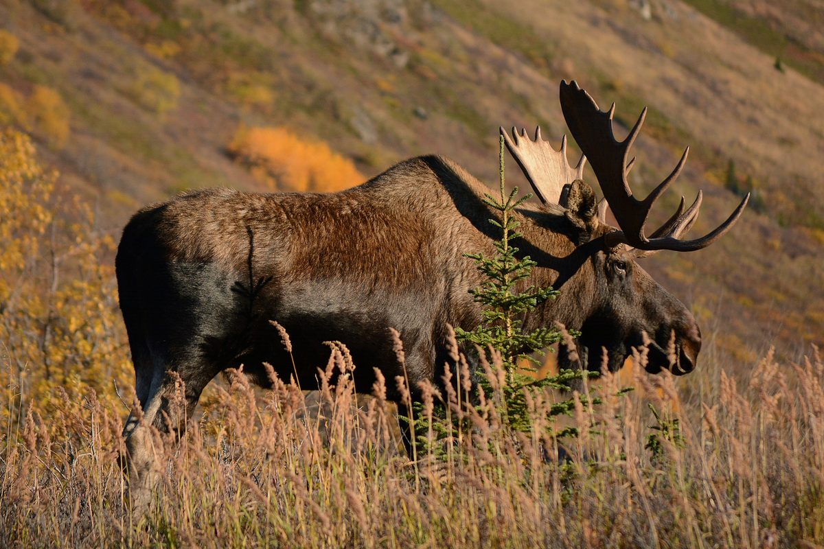
The Stikine River has carried people through the Coast Range for centuries, beginning with Alaska Native inhabitants and later serving fur traders and miners. It remains a working transportation corridor between the United States and Canada, supporting commercial fishing, Canadian mining operations, and culturally important subsistence practices. Expect to share parts of the river with motorboats and guided jet-boat sightseeing trips rather than finding an exclusively quiet paddling setting. Thick forest and side sloughs line the valley, with moose and brown bears sometimes appearing at the river’s edge. Downstream, extensive grasslands and delta mudflats support major bird concentrations. Spring brings large gatherings of bald eagles, and the estuary is an important shorebird stopover on the Western Flyway. Watch wildlife from a distance, keep food secure, and leave animals room to move between the forest and water. For birdwatching, the estuary offers a different focus from the forested river upstream.
Choosing a trip and preparing for water travel
Small boats are the most common means of reaching Stikine-LeConte Wilderness; summer access also includes paddling craft and floatplanes. On the Stikine, trip options range from quieter paddling in side sloughs to guided high-speed jet-boat sightseeing. Chief Shakes Hot Springs is a named destination along the river corridor, which also has public-use cabins and two hiking trails. LeConte Bay offers a separate focus on tidewater glacier scenery and icebergs. Match the outing to the craft, conditions, and experience of the group: the fast-flowing Stikine calls for careful route selection, and glacier waters require conservative decisions around ice. Carry weather protection, keep essential equipment dry, and plan for cold water. Confirm current access rules and any permit requirements with the Wrangell Ranger District before arranging transport. For cabin-based travel, verify availability and the practical details of reaching the cabin before building an itinerary around it.
Where on earth
Satellite imagery flying in from a world view to Stikine-LeConte Wilderness, United States. Use the + / − buttons, or click the map to zoom with your scroll wheel; drag to pan and pinch to zoom on touch.
Coordinates
- Decimal degrees
- 56.8000, -132.1565
- Latitude (DMS)
- 56° 47′ 60.0″ N
- Longitude (DMS)
- 132° 9′ 23.5″ W
Coordinates are an access-point reference for Stikine-LeConte Wilderness, not a route. Carry a paper map and confirm trailhead or put-in access with the managing agency before you go.
Topic summary
The mighty Stikine River is the lifeline flowing through this wilderness. It is North America's fastest, free flowing navigable river. LeConte Glacier also flows through the wilderness, if a bit slower....
Key takeaways
- Region: AK, USA
- Country: United States
- Good for: hiking
- Coordinates: 56.800, -132.157
Intended uses
hiking
Keep planning
Popular pursuits at Stikine-LeConte Wilderness
- Hunting
Seasons, tags, and the units that hold animals.
- Climbing
Rock and alpine lines with approach beta.
- Mountaineering
Glacier and high-route objectives with real consequence.
- Sea Kayaking
Coastal crossings, tides, and protected camps.
- Beachcombing
Tide-line walking between camps.
- Birdwatching
Migration windows and the habitat that concentrates birds.
Animals around Stikine-LeConte Wilderness




A mainland wilderness shaped by water and ice
Stikine-LeConte Wilderness lies on Alaska’s mainland north of Wrangell and east of Petersburg, within Tongass National Forest. Its 449,951 acres encompass the Stikine River and LeConte Bay watersheds and icefields, stretching from the Canadian boundary to the sea. These are two distinct settings for a trip: a forested river corridor with side sloughs and an extensive estuary, and a glacier-fed bay where LeConte Glacier deposits icebergs. Glacial erosion carved the Stikine’s U-shaped valley into granite bedrock. Above it, the Stikine Icefields form the largest icefield on the Tongass, and 10,002-foot Kate’s Needle is the forest’s highest peak. Most visitors travel by water rather than on foot. The river valley and LeConte Bay receive moderate to high summer use, while the adjacent icefields remain remote. Choose a trip around the river or bay rather than treating this large wilderness as a single, easily connected destination.
The Stikine is both a travel corridor and wildlife habitat
The Stikine River has carried people through the Coast Range for centuries, beginning with Alaska Native inhabitants and later serving fur traders and miners. It remains a working transportation corridor between the United States and Canada, supporting commercial fishing, Canadian mining operations, and culturally important subsistence practices. Expect to share parts of the river with motorboats and guided jet-boat sightseeing trips rather than finding an exclusively quiet paddling setting. Thick forest and side sloughs line the valley, with moose and brown bears sometimes appearing at the river’s edge. Downstream, extensive grasslands and delta mudflats support major bird concentrations. Spring brings large gatherings of bald eagles, and the estuary is an important shorebird stopover on the Western Flyway. Watch wildlife from a distance, keep food secure, and leave animals room to move between the forest and water. For birdwatching, the estuary offers a different focus from the forested river upstream.
Choosing a trip and preparing for water travel
Small boats are the most common means of reaching Stikine-LeConte Wilderness; summer access also includes paddling craft and floatplanes. On the Stikine, trip options range from quieter paddling in side sloughs to guided high-speed jet-boat sightseeing. Chief Shakes Hot Springs is a named destination along the river corridor, which also has public-use cabins and two hiking trails. LeConte Bay offers a separate focus on tidewater glacier scenery and icebergs. Match the outing to the craft, conditions, and experience of the group: the fast-flowing Stikine calls for careful route selection, and glacier waters require conservative decisions around ice. Carry weather protection, keep essential equipment dry, and plan for cold water. Confirm current access rules and any permit requirements with the Wrangell Ranger District before arranging transport. For cabin-based travel, verify availability and the practical details of reaching the cabin before building an itinerary around it.
Route options
- Stikine River boat trip
Travel the forested river corridor by small boat or guided jet-boat sightseeing trip. The river combines wildlife viewing with an active transportation corridor; select the turnaround and itinerary with the operator rather than assuming a fixed route.
- Stikine River side-slough paddling
Focus a paddling outing on the valley’s side sloughs, where quieter water experiences contrast with the fast-flowing main river. Choose the specific route according to conditions and paddling experience.
- Chief Shakes Hot Springs outing
Make Chief Shakes Hot Springs a destination within a Stikine River trip. The developed hot springs can attract other visitors, so do not plan on solitude. Confirm the approach and current site arrangements before departure.
- LeConte Bay glacier-viewing trip
Explore LeConte Bay by water for views of the tidewater glacier and the icebergs it deposits in the bay. Keep the itinerary flexible around water and ice conditions and maintain a conservative distance from glacier ice.
Sample itineraries
- Stikine River wildlife outing · 1 day
Plan a boat-based day focused on the Stikine River's forested valley, side sloughs and wildlife. A guided sightseeing trip suits visitors without local boating experience. Watch riverbanks for moose and brown bears, and allow room for commercial and high-speed boat traffic.
- LeConte Bay glacier outing · 1 day
Build a boat-based outing around LeConte Bay and views of LeConte Glacier, North America's southernmost tidewater glacier. Arrange access with a knowledgeable operator and keep clear of glacier ice and icebergs. Confirm trip feasibility before committing to a schedule.
- Stikine River overnight · 2 days
Plan an overnight river trip combining wildlife watching with a visit to Chief Shakes Hot Springs. Explore suitable side sloughs only with appropriate paddling skills and local advice. Confirm cabin availability or camping arrangements, boat transport and current conditions before departure.
Seasonal conditions
Spring
Spring eagle concentration
The Stikine supports a major spring gathering of bald eagles, with concentrations reaching 1,500. Its estuary, grasslands and delta mudflats also support substantial shorebird migration. Confirm local bird activity and river access before choosing travel dates.
Summer
Summer boating season
The Stikine River valley and LeConte Bay receive moderate to high use. Small boats are the most common access method; paddleboats and floatplanes also provide summer access. Expect other visitors along the river while the adjacent icefields remain remote.
Fall
Fall trip planning
Confirm river and bay conditions and transport availability before setting an itinerary. Do not assume summer access arrangements continue into fall. Pack weather protection and allow flexibility for a boat-based trip.
Winter
Winter access planning
Some winter access is by snowmachine. That does not establish safe travel conditions or authorization for a particular route. Confirm current access rules and conditions with the Wrangell Ranger District; the icefields remain remote terrain.
| Season | Window | Conditions |
|---|---|---|
| Spring | Spring eagle concentration | The Stikine supports a major spring gathering of bald eagles, with concentrations reaching 1,500. Its estuary, grasslands and delta mudflats also support substantial shorebird migration. Confirm local bird activity and river access before choosing travel dates. |
| Summer | Summer boating season | The Stikine River valley and LeConte Bay receive moderate to high use. Small boats are the most common access method; paddleboats and floatplanes also provide summer access. Expect other visitors along the river while the adjacent icefields remain remote. |
| Fall | Fall trip planning | Confirm river and bay conditions and transport availability before setting an itinerary. Do not assume summer access arrangements continue into fall. Pack weather protection and allow flexibility for a boat-based trip. |
| Winter | Winter access planning | Some winter access is by snowmachine. That does not establish safe travel conditions or authorization for a particular route. Confirm current access rules and conditions with the Wrangell Ranger District; the icefields remain remote terrain. |
Permits, fees & closures
Confirm current permits, access rules and cabin booking requirements with the Tongass National Forest's Wrangell Ranger District before traveling.
Official source: Tongass National Forest | Project Summary (#48727) | Forest Service · Verified November 4, 2026
Hazards & regulations
- Fast river current: the Stikine is a fast-flowing navigable river. Do not treat the main channel as casual paddling water; seek local advice about suitable side sloughs.
- Mixed boat traffic: high-speed sightseeing boats and commercial transport share the Stikine. Stay visible and give moving vessels ample room.
- Glacier ice: LeConte Glacier deposits icebergs into LeConte Bay. Keep clear of the glacier front and floating ice.
- Large wildlife: brown bears and moose may appear along riverbanks. Keep your distance, avoid blocking their movement and secure food.
- Remote icefields: the adjacent icefields are much more isolated than the frequently visited river valley and bay. Carry emergency communication and avoid terrain beyond your skills.
What to pack for Stikine-LeConte Wilderness
- Properly fitted personal flotation device
- Waterproof bags for clothing and electronics
- Navigation tools appropriate to the river or bay
- Emergency communication device
- Waterproof outer layers
- Insulating layers and dry spare clothing
- Shelter and sleeping equipment suited to the planned overnight
- First-aid kit and emergency supplies
- Binoculars
- Secure food storage appropriate to bear country
- Drinking water and a treatment method
- Footwear suitable for wet shore stops
Stikine-LeConte Wilderness FAQ
- Where is Stikine-LeConte Wilderness?
- It lies on Alaska's mainland, north of Wrangell and east of Petersburg, within Tongass National Forest. It encompasses the Stikine River and LeConte Bay watersheds and icefields, extending from the Canadian boundary to the sea.
- How do visitors get into the wilderness?
- Small boats are the most common means of access. Summer visitors also use paddleboats and floatplanes; some winter access is by snowmachine. The Stikine River provides a water corridor from salt water through the wilderness. Confirm rules for the specific transport and route planned.
- Is this primarily a hiking destination?
- The main visitor experience is boat-based. Two hiking trails are described along the river, alongside cabins, a developed hot springs and a swimming area. Obtain current trail and landing information before building a hiking itinerary.
- Are there public cabins?
- There are twelve public-use cabins along the river. Confirm individual cabin locations, facilities, availability and booking requirements with the managing agency before arranging transport. Do not assume a cabin is available without checking.
- Can beginners paddle the Stikine River?
- The valley offers tranquil paddling opportunities in side sloughs, but the main river is fast-flowing and carries high-speed and commercial traffic. Beginners should seek local guidance rather than assume the entire river is suitable.
- What distinguishes the glacier and mountain terrain?
- LeConte Glacier is North America's southernmost tidewater glacier. The wilderness also contains the Stikine Ice fields, the largest icefield on Tongass National Forest, and Kate's Needle, its highest peak at 10,002 feet. These remote areas require a different level of preparation from river sightseeing.