



Where on earth
Satellite imagery flying in from a world view to White Mountains National Forest: Pemigewasset Loop High Ridge Strategy, USA. Use the + / − buttons, or click the map to zoom with your scroll wheel; drag to pan and pinch to zoom on touch.
- Region
- North America
- Country
- USA
- Backpacking
- Hiking
- Climbing
- Mountaineering
- Winter Camping
- Skiing
- Surfing
- Wildlife Viewing
Key takeaways
- Top activity: backpacking
Topic summary
A demanding multi-day alpine loop through the heart of New Hampshire's high peaks.
Intended uses
backpacking
Verification notes
Last verified September 16, 2026.
Tools for a trip here
Picked for how, when and where you're going. Free, no signup.
- Sleep System Temp CalculatorCold nights: check your bag and pad add up to a safe sleep.
- Bear Country Food StorageBear country: canister, Ursack or hang, and the local rules.
- Base Weight CalculatorEvery ounce is carried — total your kit and find your base weight.
- Pack Volume SizerSize the pack for your trip length and season.
- Water Purification MatrixTreat water from streams and lakes on trail.
Plan with verified data
White Mountains National Forest: Pemigewasset Loop High Ridge Strategy trip tools
How to get there
The traditional starting point for the Pemigewasset Loop is the Lincoln Woods Trailhead, located about 4.5 miles east of Lincoln, NH, off the Kancamagus Highway (Route 112). However, the Lincoln Woods Trail from Route 112 to the Osseo Trail junction is closed from June 15 through November 2026 for riverbank repairs. During this closure, alternate access points are required, such as the Greenleaf Trail Parking at the Cannon Tram, Skookumchuck Trailhead, Garfield Trailhead on Gale River Road, or Gale River Trailhead.
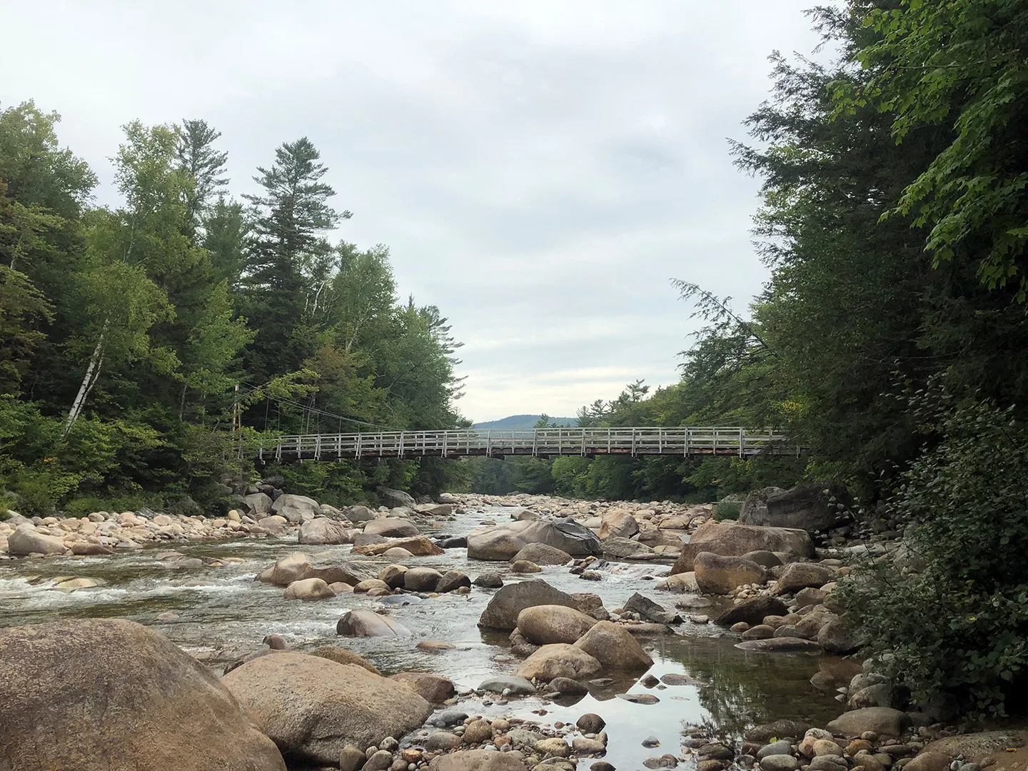
Photo: usfs_Eastern_Region / Public domain Lincoln Woods TrailheadLocated on the Kancamagus Highway (Route 112), 5 miles east of Lincoln, NH. This trailhead has ample parking, restrooms, and water fill-ups. Parking is $5 per day or a White Mountain National Forest Annual Recreation Pass can be used. The Lincoln Woods Trail itself, which is the first 1.4 miles of the traditional Pemi Loop, is closed from June 15 through November 2026, though the parking lot and suspension bridge are still accessible for other trails.

Photo: Gordon Hatton / CC BY-SA 2.0 East Side RoadAn alternative starting point used when the main Lincoln Woods Trail is closed. This route requires a river crossing across the Pemigewasset River to join the Lincoln Woods Trail past the Osseo junction.
- Greenleaf Trail Parking
This trailhead is located at the Cannon Tram and provides access to the Pemi Loop via the Greenleaf Trail, which is 3.8 miles long to reach Mount Lafayette.
- Skookumchuck Trailhead
Hikers can start here and hike 4.3 miles to join the Pemi Loop via the Garfield Ridge Trail, approximately one mile north of Mount Lafayette.
- Garfield Trailhead
Located on Gale River Road, off Route 3. This route is a 4.8-mile approach to access the Pemi Loop near Mount Garfield.
- Gale River Trailhead
Accessible from Route 3 on Gale River Road, this trailhead also serves as an alternative access point for the Pemi Loop.
Sources: Wikipedia · Wikivoyage · HikeNE · AllTrails. Confirm road and trailhead conditions with the managing agency before you leave.
Popular pursuits at White Mountains National Forest: Pemigewasset Loop High Ridge Strategy
- Backpacking
Multi-day travel with everything on your back — see the packing blocks below.
- Hiking
Day miles on marked trail, with route notes and trail links below.
- Climbing
Rock and alpine lines with approach beta.
- Mountaineering
Glacier and high-route objectives with real consequence.
- Winter Camping
Cold-season travel and camp craft; layering matters more than mileage.
- Skiing
Ski-touring access when the road closes for the season.
Animals around White Mountains National Forest: Pemigewasset Loop High Ridge Strategy
 Wildlife guideBlack bearUrsus americanus
 Big gameWhitetail DeerOdocoileus virginianus
 GamefishBrook TroutSalvelinus fontinalis
 Wildlife guideNorth American beaverCastor canadensis
 Big gameBlack BearUrsus americanus
 GamefishSmallmouth BassMicropterus dolomieu
 Wildlife guideSnowshoe hareLepus americanus
 Big gameWild HogSus scrofa
Maps, GPS & compass for this trip
Carry a waterproof paper map and a compass you can steer by, and treat the GPS as the backup — not the other way round. Buying links go to Amazon; Wild10 earns a commission at no cost to you.
Waterproof topo maps
- Waterproof topographic map — White Mountains National Forest: Pemigewasset Loop High Ridge StrategyAmazon search for waterproof, tear-resistant topo maps covering this area.
- National Geographic Trails IllustratedThe waterproof Trails Illustrated series — check for a sheet covering this area.
- Waterproof map case & compass lanyardKeep a paper map readable in rain, spray and a swamped boat.
Fishing at White Mountains National Forest: Pemigewasset Loop High Ridge Strategy
Planning to fish White Mountains National Forest: Pemigewasset Loop High Ridge Strategy, North America? Fishing licences, open seasons and catch limits in North America are set by the local wildlife authority and change every year — check the official source before you cast a line.
Do I need a fishing licence at White Mountains National Forest: Pemigewasset Loop High Ridge Strategy?
- A North America fishing licence is normally required for anyone over the local youth age.
- Read the current North America fishing regulations for special waters, barbless-hook or catch-and-release rules.
- Clean, drain and dry boats and gear between waters to stop invasive species.
We don't have a verified licensing link on file for North America yet — contact the park or land manager listed on this page for current hunting and fishing rules.
Hunting near White Mountains National Forest: Pemigewasset Loop High Ridge Strategy
Thinking about hunting White Mountains National Forest: Pemigewasset Loop High Ridge Strategy, North America? Hunting seasons, tags and draws in North America are set by the wildlife authority each year. Confirm the rules for your species and unit before you go.
Is hunting allowed at White Mountains National Forest: Pemigewasset Loop High Ridge Strategy?
- Confirm the land around White Mountains National Forest: Pemigewasset Loop High Ridge Strategy is open to hunting and which management unit it falls in.
What do I need to hunt in North America?
- A North America hunting licence — most jurisdictions also require hunter education certification.
- Species tags or draw results for big game such as deer, elk, moose or bear where they occur.
- Knowledge of firearm and bow transport rules, which differ by land type and border crossing.
We don't have a verified licensing link on file for North America yet — contact the park or land manager listed on this page for current hunting and fishing rules.
Destination and Planning Scope
This profile concerns the Pemigewasset Loop in the USA, with an emphasis on planning a high-ridge trip. A dependable destination profile needs more than a destination name: it needs verified trail connections, access information, route measurements, and local management guidance. Those details are not established here, so this profile does not assign a trailhead, recommend a direction of travel, or describe a complete itinerary. Treat it as an incomplete planning outline rather than navigation advice. Before choosing a route, obtain a current local trail map and confirm that the intended connections form the trip you want. The name alone is not enough to establish where a route starts, how it travels, or what completing it requires.
High-Ridge Strategy
A useful high-ridge strategy must be tied to the actual route rather than assumptions about the destination. The information needed includes which sections travel on ridges, where the route can be left, and how those alternatives connect to verified access points. No particular ridge segment, descent route, shelter, or water source can be identified confidently here. Without that groundwork, recommending a daily schedule or a preferred direction would imply a level of certainty that is not justified. Build the route around confirmed trail information, then assess whether its demands match the group's experience and available time. Do not treat an unspecified alternative as an established exit, or an unverified location as a dependable overnight stop.
Access and Management Checks
Confirm current access requirements with the managing agency before finalizing this trip. The responsible office, parking arrangements, overnight rules, and any applicable authorization requirements are not established here. No fee, reservation process, seasonal access date, or closure status is given. These are unresolved planning questions, not indications that access is unrestricted. Likewise, no driving time or route distance is supplied because neither can be stated reliably. Once the intended starting point and trail sequence are verified, check the rules that apply to those exact locations rather than relying on a broad destination label. Keep the final plan specific enough that access, overnight arrangements, and return transportation can each be checked independently before departure.
Sample itineraries
- One-day reconnaissance plan · 1 day
Use this as a planning framework, not a verified Pemigewasset Loop itinerary. Confirm an access point, route length, terrain and turnaround options with the managing agency before choosing a day hike.
- Two-day overnight planning framework · 2 days
Do not assume the loop fits a two-day schedule. Establish the route, overnight rules, water availability and exit options first. Choose daily stages only after checking current conditions and matching the terrain to the group's experience.
Seasonal conditions
Spring
Verify locally before selecting dates
Local spring trail and ridge conditions are not established here. Confirm footing, access and the forecast before committing to a route.
Summer
Verify locally before selecting dates
Local summer temperatures, water availability and weather patterns are not established here. Check current conditions rather than assuming summer guarantees suitable hiking weather.
Fall
Verify locally before selecting dates
Local fall conditions and seasonal transitions are not established here. Confirm the forecast and available daylight when setting daily hiking plans.
Winter
Verify locally before selecting dates
Local winter access and trail conditions are not established here. Obtain current guidance before deciding whether the route matches the group's equipment and skills.
| Season | Window | Conditions |
|---|---|---|
| Spring | Verify locally before selecting dates | Local spring trail and ridge conditions are not established here. Confirm footing, access and the forecast before committing to a route. |
| Summer | Verify locally before selecting dates | Local summer temperatures, water availability and weather patterns are not established here. Check current conditions rather than assuming summer guarantees suitable hiking weather. |
| Fall | Verify locally before selecting dates | Local fall conditions and seasonal transitions are not established here. Confirm the forecast and available daylight when setting daily hiking plans. |
| Winter | Verify locally before selecting dates | Local winter access and trail conditions are not established here. Obtain current guidance before deciding whether the route matches the group's equipment and skills. |
Permits, fees & closures
Confirm current permits, overnight rules and access requirements with the managing agency.
Confirm current permits, fees, and closures with the managing agency before you go.
Hazards & regulations
- Unverified route length and terrain make daily effort estimates unreliable.
- Unconfirmed water availability can leave a hiking plan without an adequate supply.
- Relying on broad regional weather descriptions can lead to unsuitable clothing and equipment.
- An overnight plan without confirmed camping rules and exit options may be impractical.
What to pack for White Mountains National Forest: Pemigewasset Loop High Ridge Strategy
- Current route map
- Offline navigation
- Confirmed access and exit information
- Layers selected for the local forecast
- Rain protection
- Footwear suited to confirmed trail conditions
- Water capacity matched to verified refill opportunities
- Food appropriate to the planned duration
- First-aid kit
- Headlamp
White Mountains National Forest: Pemigewasset Loop High Ridge Strategy FAQ
- Is there a verified Pemigewasset Loop route here?
- No. A dependable route description requires confirmed trails, access points, distances and terrain. Obtain those details before using either planning framework.
- What is the best high-ridge strategy?
- A place-specific ridge strategy cannot be established here. Confirm the route, forecast, water opportunities and exit options before deciding how to divide the hike.
- How many days should the loop take?
- A reliable duration is not established. The one-day and two-day entries are planning frameworks, not recommendations for completing the loop.
- Where can hikers camp?
- No camping locations or overnight regulations are established here. Confirm permitted overnight locations with the managing agency before planning stages.
- Which season is best?
- No destination-specific seasonal recommendation can be made here. Choose dates using current local conditions, the forecast and the group's experience.