



Where on earth
Satellite imagery flying in from a world view to Hornstrandir Nature Reserve, Polar Regions. Use the + / − buttons, or click the map to zoom with your scroll wheel; drag to pan and pinch to zoom on touch.
- Region
- Iceland
- Country
- Polar Regions
- Biome
- Sub-Arctic coast (0–650 m)
- Best season
- June – August
- Difficulty
- moderate
- Backpacking
- Hiking
- Sea Kayaking
- Beachcombing
- Winter Camping
- Wildlife Viewing
Key takeaways
- Biome: Sub-Arctic coast (0–650 m)
- Best season: June – August
- Difficulty: moderate
- Top activity: backpacking
Photos of Hornstrandir Nature Reserve
Topic summary
A 5-8 day trek across the uninhabited Westfjords peninsula — Iceland's wildest region.
Key takeaways
- Difficulty: moderate
- Best season: June – August
Intended uses
backpacking
Climate suitability
Sub-Arctic coast (0–650 m)
Tools for a trip here
Picked for how, when and where you're going. Free, no signup.
- Sleep System Temp CalculatorCold nights: check your bag and pad add up to a safe sleep.
- Base Weight CalculatorEvery ounce is carried — total your kit and find your base weight.
- Pack Volume SizerSize the pack for your trip length and season.
- Water Purification MatrixTreat water from streams and lakes on trail.
- Layering CalculatorCold-season miles: layer for climbs and camp.
Plan with verified data
Hornstrandir Nature Reserve trip tools
How to get there
The Westfjords are in northwestern Iceland, connected to the rest of the country by an isthmus between Gilsfjörður and Bitrufjörður. Regional roads are circuitous, and many experience ice-and-snow closures for several months each year. A specific onward connection into Hornstrandir is not established here; confirm that access leg before arranging the regional approach.
- Gilsfjörður
Regional orientation point on one side of the isthmus connecting the Westfjords with the rest of Iceland. This is not an established reserve entrance or trailhead.
- Bitrufjörður
Regional orientation point on the other side of the Westfjords’ mainland connection. An onward access route from here to Hornstrandir is not established.
Sources: Wikipedia. Confirm road and trailhead conditions with the managing agency before you leave.
Popular pursuits at Hornstrandir Nature Reserve
- Backpacking
Multi-day travel with everything on your back — see the packing blocks below.
- Hiking
Day miles on marked trail, with route notes and trail links below.
- Sea Kayaking
Coastal crossings, tides, and protected camps.
- Beachcombing
Tide-line walking between camps.
- Winter Camping
Cold-season travel and camp craft; layering matters more than mileage.
- Wildlife Viewing
Best light, best season, and where animals move.
Animals around Hornstrandir Nature Reserve
 Wildlife guideTimber wolfCanis lupus
 Wildlife guideCanada lynxLynx canadensis
 Wildlife guideWolverineGulo gulo
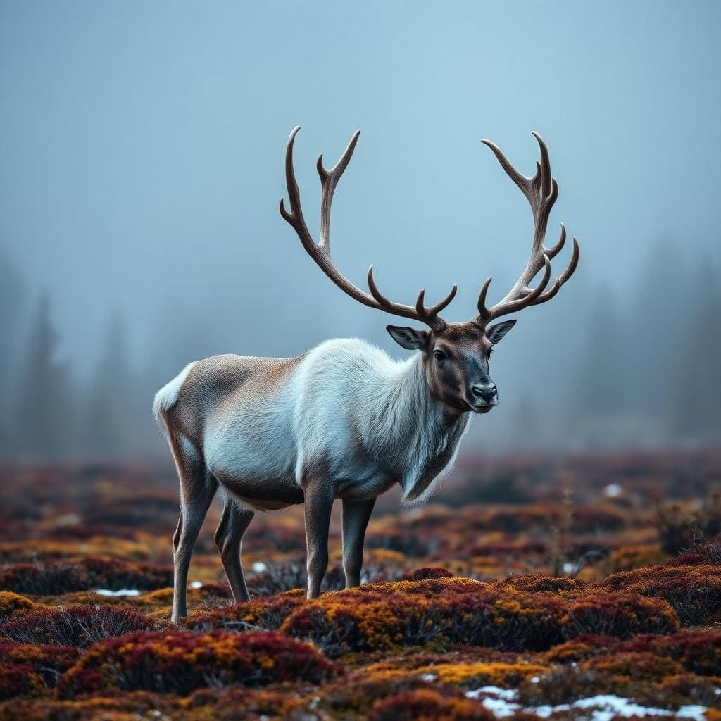 Wildlife guideWoodland caribouRangifer tarandus caribou
 Wildlife guideNorth American beaverCastor canadensis
 Wildlife guidePolar bearUrsus maritimus
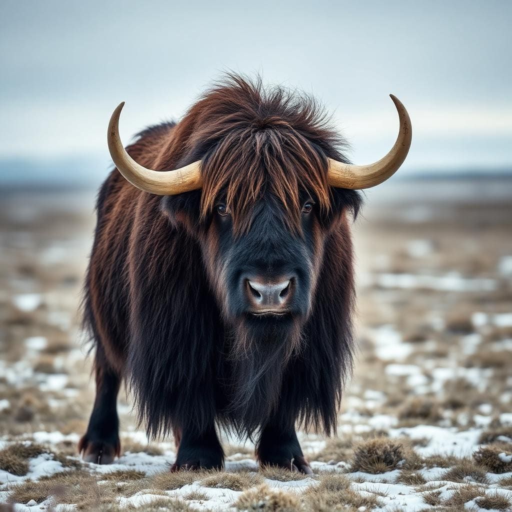 Wildlife guideMuskoxOvibos moschatus
 Wildlife guideMooseAlces alces
Maps, GPS & compass for this trip
Carry a waterproof paper map and a compass you can steer by, and treat the GPS as the backup — not the other way round. Buying links go to Amazon; Wild10 earns a commission at no cost to you.
Waterproof topo maps
- Waterproof topographic map — Hornstrandir Nature ReserveAmazon search for waterproof, tear-resistant topo maps covering this area.
- National Geographic Trails IllustratedThe waterproof Trails Illustrated series — check for a sheet covering this area.
- Waterproof map case & compass lanyardKeep a paper map readable in rain, spray and a swamped boat.
Fishing at Hornstrandir Nature Reserve
Planning to fish Hornstrandir Nature Reserve, Iceland? Fishing licences, open seasons and catch limits in Iceland are set by the local wildlife authority and change every year — check the official source before you cast a line.
Do I need a fishing licence at Hornstrandir Nature Reserve?
- A Iceland fishing licence is normally required for anyone over the local youth age.
- Read the current Iceland fishing regulations for special waters, barbless-hook or catch-and-release rules.
- Clean, drain and dry boats and gear between waters to stop invasive species.
Hunting near Hornstrandir Nature Reserve
Thinking about hunting Hornstrandir Nature Reserve, Iceland? Hunting seasons, tags and draws in Iceland are set by the wildlife authority each year. Confirm the rules for your species and unit before you go.
Is hunting allowed at Hornstrandir Nature Reserve?
- Confirm the land around Hornstrandir Nature Reserve is open to hunting and which management unit it falls in.
What do I need to hunt in Iceland?
- A Iceland hunting licence — most jurisdictions also require hunter education certification.
- Species tags or draw results for big game such as deer, elk, moose or bear where they occur.
- Knowledge of firearm and bow transport rules, which differ by land type and border crossing.
Hornstrandir in its Westfjords setting
Hornstrandir Nature Reserve is the destination, but the available geographic detail covers the wider Westfjords rather than the reserve itself. That distinction matters when turning a regional overview into a workable outdoor trip. The Westfjords occupy a large peninsula in northwestern Iceland, facing the east coast of Greenland across the Denmark Strait. This is Iceland’s least populous administrative region, with mountainous terrain and a coastline broken by dozens of fjords. Those features provide useful context for planning, but they do not establish a particular walking route, reserve entrance, or transport connection. Treat the regional information here as an orientation tool. Before committing to an itinerary, confirm the reserve’s actual access arrangements and obtain route-specific information rather than assuming that a nearby road or coastal place provides an entry point.
Terrain shapes the approach
The defining travel constraint in the Westfjords is the relationship between steep hills and deeply indented coastline. Roads follow a landscape divided by fjords, making overland journeys circuitous and land connections difficult. A destination that looks close on a regional map may therefore require a more involved approach than its apparent proximity suggests. The peninsula connects with the rest of Iceland through a seven-kilometre-wide isthmus between Gilsfjörður and Bitrufjörður; that measurement describes the land connection, not a hiking distance or road length. The Vestfjarðagöng road tunnel has improved regional communications, but its existence does not establish a route into Hornstrandir. Build the approach around confirmed transport arrangements, and keep regional road planning separate from the final access leg to the reserve.
Seasonal planning and information gaps
Ice and snow close many Westfjords roads for several months each year. That regional pattern makes current road conditions an important part of planning, but it does not establish specific closure dates or a reliable travel season for Hornstrandir. Check conditions for the actual approach rather than applying one seasonal assumption to the entire peninsula. For an outdoor itinerary, clothing and equipment should account for the region’s mountainous, coastal setting and the possibility of cold conditions. Reserve-specific details remain essential: confirm the intended entry and exit arrangements, the character of the walking terrain, and any applicable visitor requirements with the managing agency. No trail distance, difficulty grade, campsite arrangement, or transport schedule is established here, so none should be treated as settled when booking the trip.
Route options
- Westfjords regional road approach
Regional approach planning only, not a defined reserve route. Roads negotiate numerous fjords and steep hills; confirm the actual road itinerary and current conditions before travel.
- Hornstrandir Nature Reserve
No specific walking route is established here. Obtain a route-specific description and confirm entry and exit arrangements before choosing a reserve itinerary.
Sample itineraries
- One-day outing with a conservative scope · 1 day
For a short Hornstrandir visit, confirm reserve access and a suitable walking route with the managing agency before committing. Keep the walking objective modest: the surrounding Westfjords are mountainous, with steep hills and deeply indented coastlines. This is a planning outline, not a verified route.
- Three-day walking plan with flexibility · 3 days
Use a three-day framework only after confirming access, overnight arrangements and suitable routes for Hornstrandir. Set daily objectives around verified terrain information rather than straight-line distances. Allow flexibility for weather and difficult travel; no specific crossing or campsite is established here.
Seasonal conditions
Spring
Check conditions for the intended travel dates
Do not assume regional roads are clear simply because spring has begun. Ice and snow close many Westfjords roads for several months annually. Confirm current approach conditions separately from reserve access.
Summer
Confirm access before choosing dates
Mountainous terrain and steep coastal hills remain important planning constraints. Summer alone does not establish that a particular Hornstrandir route or access arrangement is suitable; verify both before departure.
Fall
Check current weather and transport conditions
Plan conservatively around changing weather in mountainous coastal terrain. Regional roads are vulnerable to ice and snow, but no specific autumn closure schedule is established here.
Winter
Confirm current winter access
Ice and snow can complicate travel through the Westfjords, where many roads close for several months of the year. Do not treat regional road information as confirmation of access into Hornstrandir.
| Season | Window | Conditions |
|---|---|---|
| Spring | Check conditions for the intended travel dates | Do not assume regional roads are clear simply because spring has begun. Ice and snow close many Westfjords roads for several months annually. Confirm current approach conditions separately from reserve access. |
| Summer | Confirm access before choosing dates | Mountainous terrain and steep coastal hills remain important planning constraints. Summer alone does not establish that a particular Hornstrandir route or access arrangement is suitable; verify both before departure. |
| Fall | Check current weather and transport conditions | Plan conservatively around changing weather in mountainous coastal terrain. Regional roads are vulnerable to ice and snow, but no specific autumn closure schedule is established here. |
| Winter | Confirm current winter access | Ice and snow can complicate travel through the Westfjords, where many roads close for several months of the year. Do not treat regional road information as confirmation of access into Hornstrandir. |
Permits, fees & closures
Confirm current permit requirements and visitor rules for Hornstrandir Nature Reserve with the managing agency.
Confirm current permits, fees, and closures with the managing agency before you go.
Hazards & regulations
- Steep terrain: the Westfjords are mountainous, with steep hills surrounding many fjords. Confirm the demands of any intended reserve route.
- Difficult approaches: deeply indented fjords make regional road journeys circuitous. Avoid estimating travel time from straight-line distance.
- Ice and snow: many Westfjords roads close for several months annually. Check current conditions before setting out.
- Weather exposure: use conservative turnaround decisions in mountainous coastal terrain and carry protection against cold, wet and windy conditions.
What to pack for Hornstrandir Nature Reserve
- Waterproof jacket and trousers
- Insulating layers
- Warm hat and gloves
- Footwear suitable for steep terrain
- Detailed mapping for a confirmed route
- Navigation device and backup power
- First-aid kit
- Emergency shelter
- Extra food and drinking water
Hornstrandir Nature Reserve FAQ
- What terrain should shape trip planning?
- The regional setting is mountainous, with numerous fjords bordered by steep hills. Use that as a reason to check route gradients and footing, not as a substitute for Hornstrandir-specific route information.
- Can regional roads confirm access to Hornstrandir?
- No. Westfjords road conditions describe the wider approach, not a verified reserve entry point. Confirm the actual access arrangements before booking or setting a walking itinerary.
- When is the best time to visit?
- No reserve-specific visiting window is established here. Choose dates only after checking current access, weather expectations and the suitability of the intended route.
- Are permits or reservations required?
- Confirm requirements directly with the managing agency. Do not assume that entry or overnight stays need no advance arrangements.
- Are these itineraries established hiking routes?
- No. They are suggested trip-length frameworks. Named trails, entry points, campsites and walking distances must be verified before either can become a workable itinerary.