



- Region
- AK, USA
- Country
- United States
- Best for
- hiking
- Best season
- Spring, Summer
- Permits
- Confirm current permit requirements, acces…
- Managed by
- National Park Service
Plan with verified data
Kobuk Valley Wilderness trip tools
Tools for a trip here
Picked for how, when and where you're going. Free, no signup.
Photos of Kobuk Valley Wilderness
How to get there
Confirm transportation, entry locations, and the designated wilderness boundary with the National Park Service before committing to an itinerary. The locations below are geographic planning anchors within the broader park, not verified trailheads or established entry points into Kobuk Valley Wilderness.
- Kobuk River
A central geographic anchor for planning travel in the valley. Confirm an appropriate entry location, transportation arrangements, and whether the proposed journey reaches designated wilderness with the National Park Service.
- Great Kobuk Sand Dunes
A named destination within the broader park for planning a sand-focused outing. Do not assume that the dunes provide an established wilderness entry point; verify access and boundary relationships before travel.
Sources: parkplanning.nps.gov · University of Montana / federal agency partners · Wilderness Connect / federal wilderness boundary inventory. Confirm road and trailhead conditions with the managing agency before you leave.
AK, USA · United States
- Fishing
- Hunting
- Mountaineering
- Hiking
- Wildlife Viewing
- Backpacking
- Winter Camping
- Canoeing
A designated wilderness within a larger Arctic park
Kobuk Valley Wilderness is a designated portion of Kobuk Valley National Park in northwest Alaska, not another name for the entire park. The wilderness inventory lists 176,000 acres, while the park encompasses 1.7 million acres of land that is either eligible for or designated as wilderness. That distinction matters when choosing a destination: a feature within the park is not necessarily inside the designated wilderness boundary. The broader valley lies north of the Arctic Circle, enclosed by the Baird and Waring Mountains near the western end of the Brooks Range. Boreal forest gives way to open tundra, while rivers and sandy plains add markedly different terrain. Plan around a specific landscape and verified access arrangement rather than treating this large area as a single trail-based destination.
Sand dunes, rivers, and Arctic conditions
The Great Kobuk Sand Dunes are among the broader park’s most distinctive features: crescent-shaped dunes covering 25 square miles and shifting in Arctic winds. They sit within a landscape that also supports boreal forest, open tundra, and mountain ecosystems. The Kobuk River watershed connects these environments and is central to the park’s conservation purpose. Despite the Arctic setting, summer temperatures can exceed 100 degrees Fahrenheit, making heat preparation relevant alongside protection from wind and changing weather. For walking on exposed sand, carry water and allow a conservative margin for effort rather than assuming cool conditions or easy footing. River-focused travel calls for a separate assessment of conditions and equipment. Neither a dune outing nor a river journey should be treated as a confirmed route into designated wilderness without checking its location.
Wildlife and a living cultural landscape
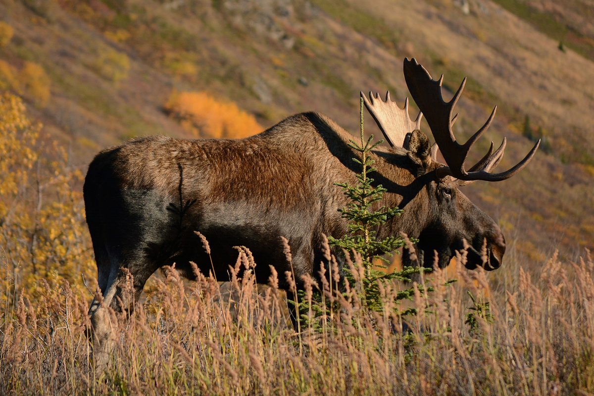
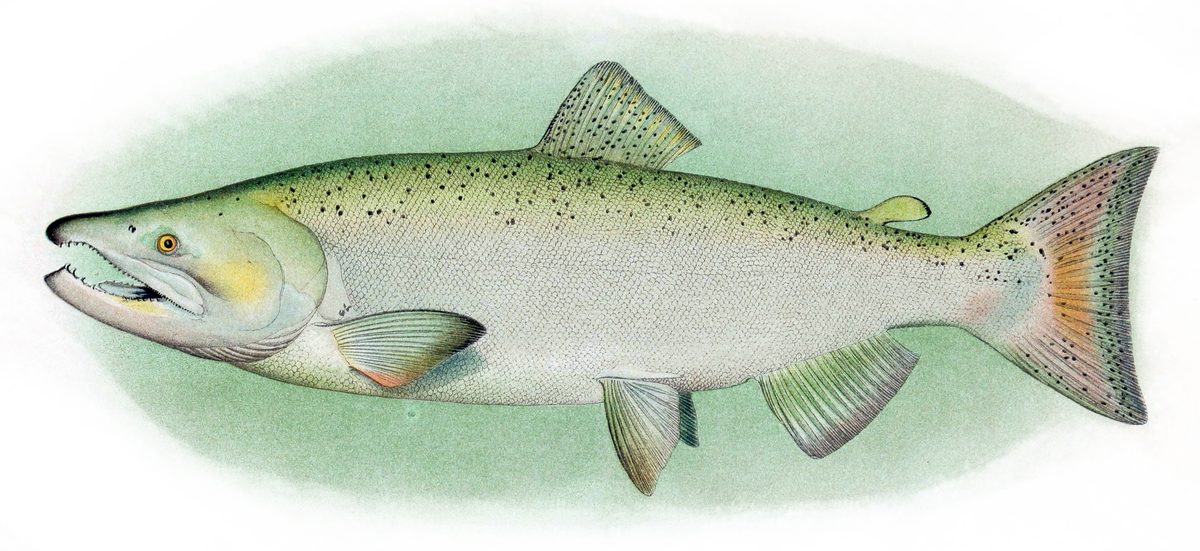
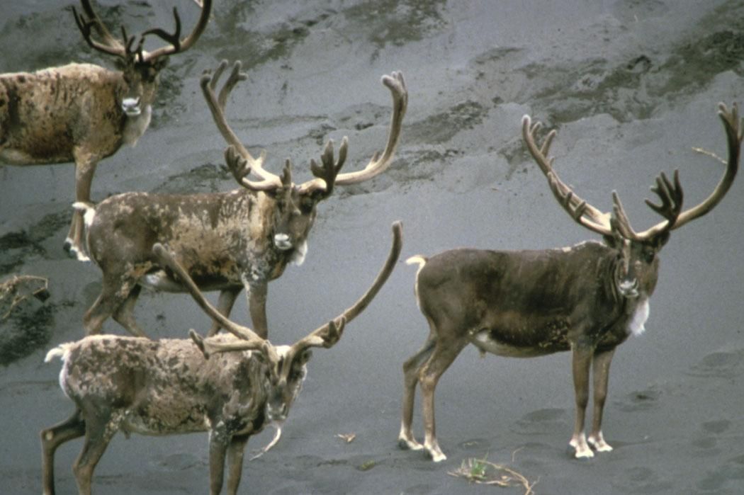
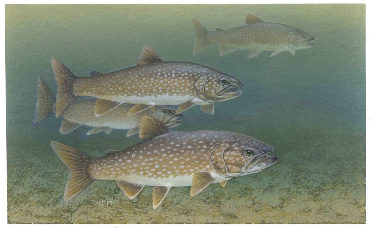
Kobuk Valley protects habitat shared by Arctic and boreal wildlife, including caribou, moose, wolves, black bears, brown bears, and Dall’s sheep. The Western Arctic Caribou Herd depends on the valley’s undeveloped character and natural resources for its migratory movement. Give animals room to travel and feed, keep food secure, and avoid arranging an itinerary around a promised wildlife encounter. The rivers support salmon, Arctic grayling, Arctic char, and other fish, adding to the importance of intact aquatic habitat. This is also a cultural landscape with evidence of human use and adaptation spanning thousands of years. Customary and traditional subsistence uses by local rural Alaska residents remain part of the park’s purpose. Leave archaeological material undisturbed and respect people carrying out traditional activities rather than treating the valley as an unoccupied landscape.
Where on earth
Satellite imagery flying in from a world view to Kobuk Valley Wilderness, United States. Use the + / − buttons, or click the map to zoom with your scroll wheel; drag to pan and pinch to zoom on touch.
Coordinates
- Decimal degrees
- 67.0431, -158.8713
- Latitude (DMS)
- 67° 2′ 35.1″ N
- Longitude (DMS)
- 158° 52′ 16.7″ W
Coordinates are an access-point reference for Kobuk Valley Wilderness, not a route. Carry a paper map and confirm trailhead or put-in access with the managing agency before you go.
Topic summary
Here in Kobuk Valley National Park, 26 miles north of the Arctic Circle and enclosed by the Baird and Waring Mountains, the climate has changed little (or not at all) since the late Pleistocene era. Remnant...
Key takeaways
- Region: AK, USA
- Country: United States
- Good for: hiking
- Coordinates: 67.043, -158.871
Intended uses
hiking
Keep planning
Popular pursuits at Kobuk Valley Wilderness
- Fishing
Resident gamefish, seasons, and the water that holds them.
- Hunting
Seasons, tags, and the units that hold animals.
- Mountaineering
Glacier and high-route objectives with real consequence.
- Hiking
Day miles on marked trail, with route notes and trail links below.
- Wildlife Viewing
Best light, best season, and where animals move.
- Backpacking
Multi-day travel with everything on your back — see the packing blocks below.
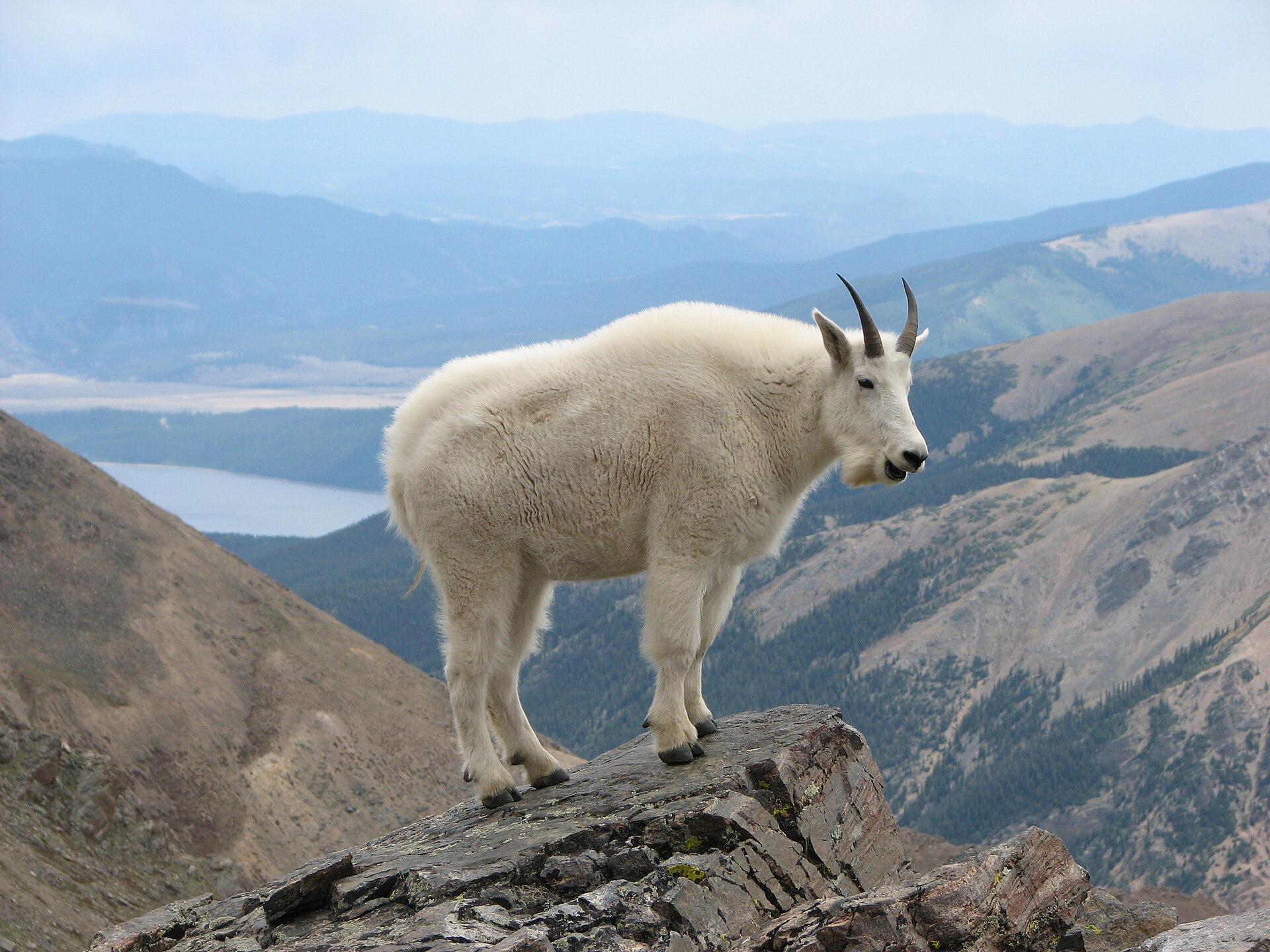
Animals around Kobuk Valley Wilderness



A designated wilderness within a larger Arctic park
Kobuk Valley Wilderness is a designated portion of Kobuk Valley National Park in northwest Alaska, not another name for the entire park. The wilderness inventory lists 176,000 acres, while the park encompasses 1.7 million acres of land that is either eligible for or designated as wilderness. That distinction matters when choosing a destination: a feature within the park is not necessarily inside the designated wilderness boundary. The broader valley lies north of the Arctic Circle, enclosed by the Baird and Waring Mountains near the western end of the Brooks Range. Boreal forest gives way to open tundra, while rivers and sandy plains add markedly different terrain. Plan around a specific landscape and verified access arrangement rather than treating this large area as a single trail-based destination.
Sand dunes, rivers, and Arctic conditions
The Great Kobuk Sand Dunes are among the broader park’s most distinctive features: crescent-shaped dunes covering 25 square miles and shifting in Arctic winds. They sit within a landscape that also supports boreal forest, open tundra, and mountain ecosystems. The Kobuk River watershed connects these environments and is central to the park’s conservation purpose. Despite the Arctic setting, summer temperatures can exceed 100 degrees Fahrenheit, making heat preparation relevant alongside protection from wind and changing weather. For walking on exposed sand, carry water and allow a conservative margin for effort rather than assuming cool conditions or easy footing. River-focused travel calls for a separate assessment of conditions and equipment. Neither a dune outing nor a river journey should be treated as a confirmed route into designated wilderness without checking its location.
Wildlife and a living cultural landscape
Kobuk Valley protects habitat shared by Arctic and boreal wildlife, including caribou, moose, wolves, black bears, brown bears, and Dall’s sheep. The Western Arctic Caribou Herd depends on the valley’s undeveloped character and natural resources for its migratory movement. Give animals room to travel and feed, keep food secure, and avoid arranging an itinerary around a promised wildlife encounter. The rivers support salmon, Arctic grayling, Arctic char, and other fish, adding to the importance of intact aquatic habitat. This is also a cultural landscape with evidence of human use and adaptation spanning thousands of years. Customary and traditional subsistence uses by local rural Alaska residents remain part of the park’s purpose. Leave archaeological material undisturbed and respect people carrying out traditional activities rather than treating the valley as an unoccupied landscape.
Route options
- Great Kobuk Sand Dunes exploration
A landscape-based outing concept rather than a documented trail itinerary. Focus on the shifting dunes, with water, sun protection, and wind protection suited to exposed sand and potentially hot summer conditions. Confirm access and whether the intended area lies within designated wilderness.
- Kobuk River corridor journey
A planning concept centered on the river and the valley’s riverine and boreal environments, not a verified paddling itinerary. Establish suitable start and finish locations, current conditions, transportation, and wilderness boundaries with the National Park Service before selecting a route.
Sample itineraries
- Wilderness landscape overnight · 2 days
Plan an overnight focused on the transition between boreal forest and open tundra. Confirm the designated wilderness boundary and a suitable route with the National Park Service before arranging access. Keep daily objectives modest and leave time for navigation and weather changes.
- Kobuk Valley landscape study · 3 days
Build a park-wide trip around the Kobuk River watershed, forest-tundra transition, and Great Kobuk Sand Dunes. These are planning objectives, not a verified connecting route. Confirm access and which portions lie within designated wilderness; allow time for wildlife observation without approaching animals.
Seasonal conditions
Spring
Spring transition
Treat this Arctic setting as a conditions-dependent destination. Confirm snow, river, and ground conditions before selecting travel methods or committing to a route.
Summer
Summer
Arctic latitude does not guarantee cool travel: summer temperatures may exceed 100 degrees Fahrenheit. Exposed sand travel calls for sun protection, adequate water, and flexible walking plans.
Fall
Fall transition
Prepare for changing Arctic weather and colder travel conditions. Verify current river and ground conditions rather than assuming summer travel plans remain suitable.
Winter
Winter
Plan conservatively for Arctic cold in a vast, undeveloped landscape. Winter travel requires cold-weather shelter, dependable navigation, and an emergency plan suited to remote conditions.
| Season | Window | Conditions |
|---|---|---|
| Spring | Spring transition | Treat this Arctic setting as a conditions-dependent destination. Confirm snow, river, and ground conditions before selecting travel methods or committing to a route. |
| Summer | Summer | Arctic latitude does not guarantee cool travel: summer temperatures may exceed 100 degrees Fahrenheit. Exposed sand travel calls for sun protection, adequate water, and flexible walking plans. |
| Fall | Fall transition | Prepare for changing Arctic weather and colder travel conditions. Verify current river and ground conditions rather than assuming summer travel plans remain suitable. |
| Winter | Winter | Plan conservatively for Arctic cold in a vast, undeveloped landscape. Winter travel requires cold-weather shelter, dependable navigation, and an emergency plan suited to remote conditions. |
Permits, fees & closures
Confirm current permit requirements, access rules, and trip-specific restrictions with the National Park Service before arranging travel.
Official source: [PDF] Kobuk Valley National Park Foundation Statement · Verified November 8, 2026
Hazards & regulations
- Summer heat can exceed 100 degrees Fahrenheit. Carry adequate water and reduce exertion when exposed sand becomes hot.
- Arctic winds shift the Great Kobuk Sand Dunes. Protect eyes and equipment from blowing sand and maintain reliable navigation.
- Black and brown bears inhabit the area. Keep food secured, remain alert, and give wildlife ample space.
- The vast, undeveloped landscape demands self-reliance. Carry emergency communication and leave a trip plan with a responsible contact.
- River travel requires current local information and appropriate equipment. Do not assume a mapped river provides a suitable crossing or travel route.
What to pack for Kobuk Valley Wilderness
- Topographic maps showing designated wilderness boundaries
- Compass and navigation device
- Satellite communicator
- First-aid kit and repair supplies
- Windproof and waterproof outer layers
- Insulating layers appropriate to the season
- Shelter suitable for exposed conditions
- Season-appropriate sleeping system
- Sun protection and protective eyewear
- Water containers and treatment equipment
- Food storage suitable for bear country
- Binoculars for distant wildlife observation
Kobuk Valley Wilderness FAQ
- Is Kobuk Valley Wilderness the same as the entire national park?
- No. The mapped designated wilderness covers approximately 176,000 acres. Kobuk Valley National Park encompasses 1.7 million acres, all eligible for or designated as wilderness. Check boundaries rather than treating every park destination as part of the designated wilderness.
- What defines the landscape?
- Kobuk Valley lies north of the Arctic Circle, between the Baird and Waring Mountains. Its landscape combines the Kobuk River watershed, boreal forest, open tundra, and Arctic sand dunes.
- Are the Great Kobuk Sand Dunes a confirmed wilderness access point?
- No confirmed access point or connecting route is established here. The dunes are a named feature of the national park. Confirm their relationship to your wilderness route and arrange appropriate access with current local guidance.
- Can inventory coordinates be used as a trailhead?
- No. The wilderness inventory map point marks a location inside the boundary, not a trailhead, campsite, or access point. Use verified access information rather than navigating to an inventory marker.
- What should visitors know about cultural resources and subsistence?
- The park protects archaeological resources and evidence of Alaska Native cultural use spanning thousands of years. It also supports customary and traditional subsistence uses by local rural Alaska residents. Leave cultural materials undisturbed and avoid interfering with subsistence activities.
- Can aircraft or motorboats be assumed to be allowed or prohibited?
- Neither assumption is a sound basis for planning. Alaska park management includes special access and traditional-use mandates. Ask the National Park Service which rules apply to your proposed travel method and location.