



- Region
- AK, USA
- Country
- United States
- Best for
- hiking
- Best season
- Spring, Summer
- Permits
- Confirm current permit, access and reserva…
- Managed by
- U.S. Fish and Wildlife Service — Arctic National Wildlife Refuge
Plan with verified data
Mollie Beattie Wilderness trip tools
Tools for a trip here
Picked for how, when and where you're going. Free, no signup.
Photos of Mollie Beattie Wilderness
How to get there
Contact Arctic National Wildlife Refuge for access guidance specific to the intended itinerary. Do not use an interior wilderness map point as a trailhead or arrival location.
Sources: fws.gov · University of Montana / federal agency partners · Wilderness Connect / federal wilderness boundary inventory · Wikipedia. Confirm road and trailhead conditions with the managing agency before you leave.
AK, USA · United States
- Fishing
- Hunting
- Climbing
- Mountaineering
- Sea Kayaking
- Beachcombing
- Hiking
- Backpacking
An eight-million-acre Arctic wilderness
Mollie Beattie Wilderness occupies the northeastern section of Arctic National Wildlife Refuge in Alaska. At approximately eight million acres, it covers more than 40 percent of the refuge and is the second-largest designated wilderness in the United States. Its landscape centers on the Brooks Range, where arctic, subarctic, and alpine ecosystems meet. Elevations run from sea level in the north to peaks approaching 9,000 feet. That range matters for trip planning: coastal tundra, high mountain terrain, and wooded southern valleys present very different travel conditions. Treat the wilderness as a large region requiring a carefully chosen itinerary, not as a single hiking destination. It is named for Mollie Beattie, the first woman to lead the U.S. Fish and Wildlife Service.
Terrain and travel expectations
The Brooks Range provides the mountain backbone of the wilderness. Northward, rolling tundra is cut by winding rivers and dotted with freshwater lakes; farther north are Arctic Ocean barrier islands and saltwater lagoons. Southward, treeless mountains give way to broad valleys containing spruce, birch, and aspen. Hiking and backpacking are activities here, with mountain terrain that can be steep, rocky, and icy in places. Choose an itinerary around the group's footing, navigation, and mountain-travel skills rather than assuming uniform conditions across the landscape. Carry navigation tools, protective layers, and footwear suited to rough ground. No specific trailhead or established route is identified here, so obtain current access and route guidance from Arctic National Wildlife Refuge before committing to a travel plan.
Weather, wildlife, and preparation
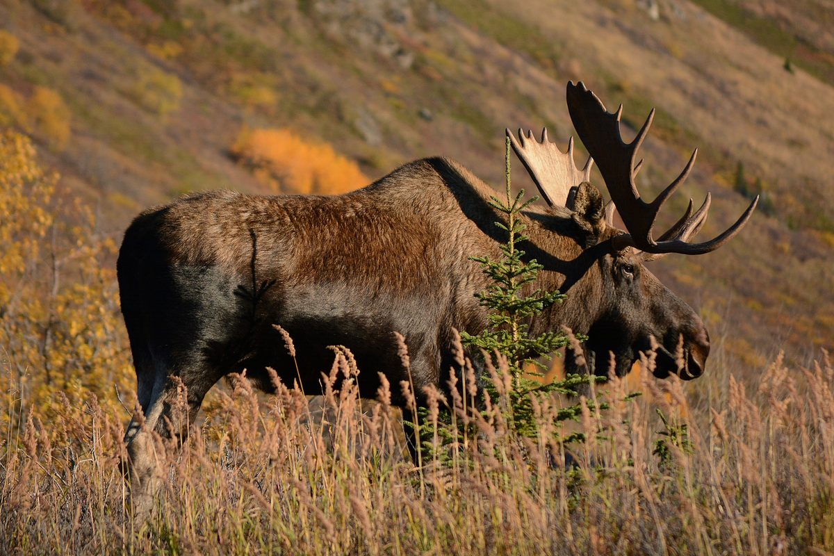
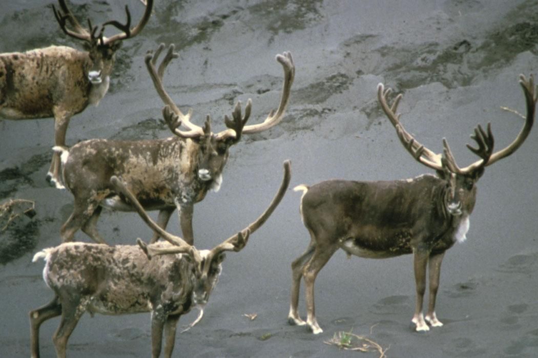
July is the warmest month, with average temperatures reported between 48 and 73 degrees Fahrenheit; January averages range from minus 24 to minus 8. Annual precipitation is about 12.2 inches, but that modest total is not a reason to leave weather protection behind, especially in exposed mountain terrain. Wildlife varies with habitat. Brown bears, moose, wolves, wolverines, and caribou inhabit the wider landscape; Dall sheep and marmots occur in the high mountains, while musk oxen and arctic foxes use the northern slopes. Polar bears occur on the offshore ice pack. Plan food storage and wildlife encounters conservatively, keep ample distance from animals, and avoid approaching them for photographs. Confirm current conditions, applicable requirements, and wildlife-safety guidance with the refuge before departure.
Where on earth
Satellite imagery flying in from a world view to Mollie Beattie Wilderness, United States. Use the + / − buttons, or click the map to zoom with your scroll wheel; drag to pan and pinch to zoom on touch.
Coordinates
- Decimal degrees
- 68.9171, -143.1182
- Latitude (DMS)
- 68° 55′ 1.7″ N
- Longitude (DMS)
- 143° 7′ 5.6″ W
Coordinates are an access-point reference for Mollie Beattie Wilderness, not a route. Carry a paper map and confirm trailhead or put-in access with the managing agency before you go.
Topic summary
Possibly no other region of America has seen less human impact than the northeastern corner of Alaska. Here the Brooks Range bulges up near the Arctic Ocean to create a unique combination of habitats...
Key takeaways
- Region: AK, USA
- Country: United States
- Good for: hiking
- Coordinates: 68.917, -143.118
Intended uses
hiking
Keep planning
Popular pursuits at Mollie Beattie Wilderness
- Fishing
Resident gamefish, seasons, and the water that holds them.
- Hunting
Seasons, tags, and the units that hold animals.
- Climbing
Rock and alpine lines with approach beta.
- Mountaineering
Glacier and high-route objectives with real consequence.
- Sea Kayaking
Coastal crossings, tides, and protected camps.
- Beachcombing
Tide-line walking between camps.
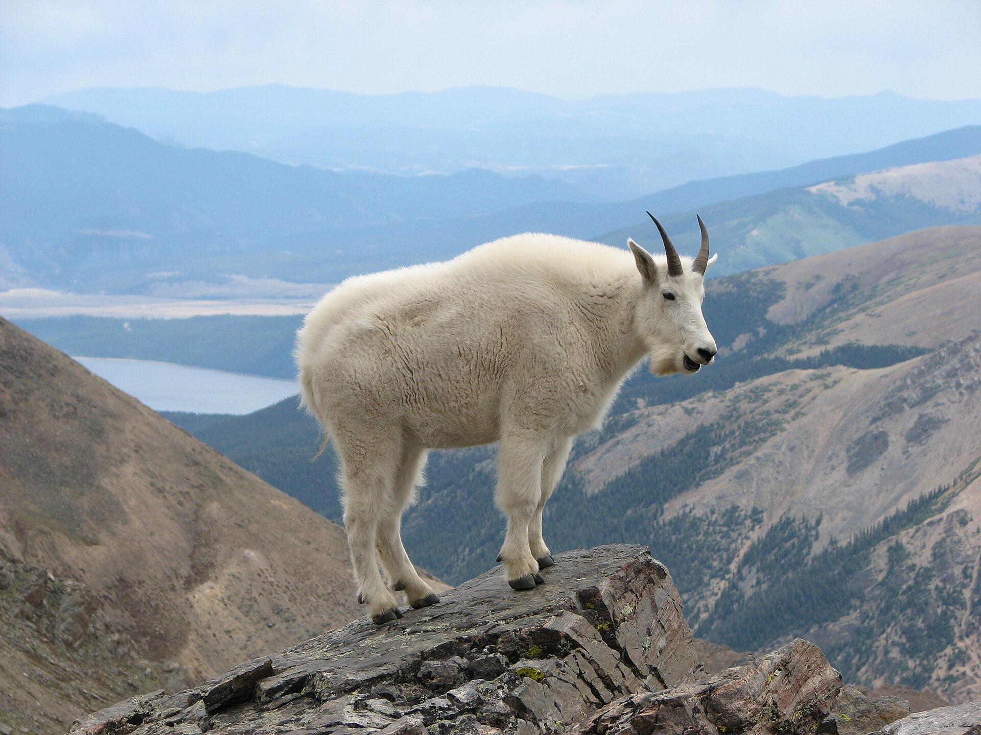
Animals around Mollie Beattie Wilderness



An eight-million-acre Arctic wilderness
Mollie Beattie Wilderness occupies the northeastern section of Arctic National Wildlife Refuge in Alaska. At approximately eight million acres, it covers more than 40 percent of the refuge and is the second-largest designated wilderness in the United States. Its landscape centers on the Brooks Range, where arctic, subarctic, and alpine ecosystems meet. Elevations run from sea level in the north to peaks approaching 9,000 feet. That range matters for trip planning: coastal tundra, high mountain terrain, and wooded southern valleys present very different travel conditions. Treat the wilderness as a large region requiring a carefully chosen itinerary, not as a single hiking destination. It is named for Mollie Beattie, the first woman to lead the U.S. Fish and Wildlife Service.
Terrain and travel expectations
The Brooks Range provides the mountain backbone of the wilderness. Northward, rolling tundra is cut by winding rivers and dotted with freshwater lakes; farther north are Arctic Ocean barrier islands and saltwater lagoons. Southward, treeless mountains give way to broad valleys containing spruce, birch, and aspen. Hiking and backpacking are activities here, with mountain terrain that can be steep, rocky, and icy in places. Choose an itinerary around the group's footing, navigation, and mountain-travel skills rather than assuming uniform conditions across the landscape. Carry navigation tools, protective layers, and footwear suited to rough ground. No specific trailhead or established route is identified here, so obtain current access and route guidance from Arctic National Wildlife Refuge before committing to a travel plan.
Weather, wildlife, and preparation
July is the warmest month, with average temperatures reported between 48 and 73 degrees Fahrenheit; January averages range from minus 24 to minus 8. Annual precipitation is about 12.2 inches, but that modest total is not a reason to leave weather protection behind, especially in exposed mountain terrain. Wildlife varies with habitat. Brown bears, moose, wolves, wolverines, and caribou inhabit the wider landscape; Dall sheep and marmots occur in the high mountains, while musk oxen and arctic foxes use the northern slopes. Polar bears occur on the offshore ice pack. Plan food storage and wildlife encounters conservatively, keep ample distance from animals, and avoid approaching them for photographs. Confirm current conditions, applicable requirements, and wildlife-safety guidance with the refuge before departure.
Route options
- Hiking
Hiking is an activity in Mollie Beattie Wilderness, including mountain terrain that can be steep, rocky, and icy. This is an activity option rather than a defined trail; select a specific itinerary with current refuge guidance.
- Backpacking
Backpacking offers a way to travel within the wilderness's mountain landscape. No named backpacking circuit or fixed itinerary is identified here; establish the route and access arrangements before departure.
Sample itineraries
- Mountain hiking planning outline · 2 days
Allow one day for a conservative hike in the Mollie Beattie Wilderness mountain terrain and a second for another outing or weather flexibility. This is a planning outline, not an established route; confirm access and suitable terrain with Arctic National Wildlife Refuge before committing.
- Brooks Range backpacking planning outline · 5 days
Build a backpacking plan around the wilderness’s Brooks Range terrain. Use the opening days to assess footing and pace, keep the middle flexible, and leave time for the return. Confirm access and route feasibility first; steep, rocky and sometimes icy ground can limit progress.
Seasonal conditions
Spring
Transition toward summer; timing varies by elevation
The wilderness spans coastal lowlands and high alpine terrain. Do not assume conditions change uniformly across that range. Check snow, ice and footing conditions for the intended route before choosing hiking objectives.
Summer
July is the warmest month
July temperatures average between 48°F and 73°F. Mountain terrain can still include icy footing. Pack layers and weather protection rather than treating the warmest month as a guarantee of mild conditions.
Fall
Transition toward winter; timing varies by elevation
Plan conservatively as conditions move toward the severe winter cold. Arctic, subarctic and alpine settings require different preparations; confirm current conditions instead of relying on a single seasonal expectation for the entire wilderness.
Winter
January is the coldest month
January temperatures average between -24°F and -8°F. Travel requires cold-weather expertise and equipment suited to severe cold. Porcupine caribou use the southern portion of the wilderness in winter.
| Season | Window | Conditions |
|---|---|---|
| Spring | Transition toward summer; timing varies by elevation | The wilderness spans coastal lowlands and high alpine terrain. Do not assume conditions change uniformly across that range. Check snow, ice and footing conditions for the intended route before choosing hiking objectives. |
| Summer | July is the warmest month | July temperatures average between 48°F and 73°F. Mountain terrain can still include icy footing. Pack layers and weather protection rather than treating the warmest month as a guarantee of mild conditions. |
| Fall | Transition toward winter; timing varies by elevation | Plan conservatively as conditions move toward the severe winter cold. Arctic, subarctic and alpine settings require different preparations; confirm current conditions instead of relying on a single seasonal expectation for the entire wilderness. |
| Winter | January is the coldest month | January temperatures average between -24°F and -8°F. Travel requires cold-weather expertise and equipment suited to severe cold. Porcupine caribou use the southern portion of the wilderness in winter. |
Permits, fees & closures
Confirm current permit, access and reservation requirements with the U.S. Fish and Wildlife Service at Arctic National Wildlife Refuge.
Official source: Mollie Beattie Wilderness at Arctic National Wildlife Refuge | FWS.gov · Verified November 2, 2026
Hazards & regulations
- Steep, rocky mountain terrain demands careful footing and conservative route choices.
- Icy sections can make hiking terrain substantially harder; turn back when conditions exceed skills or equipment.
- Severe winter cold requires specialized clothing, shelter and cold-weather travel skills.
- Brown bears occur in the wilderness, black bears inhabit forestland, and polar bears occur offshore on the ice pack. Plan food storage and wildlife precautions for the habitat visited.
What to pack for Mollie Beattie Wilderness
- Sturdy hiking footwear for rocky ground
- Trekking poles
- Map and compass
- Navigation device with backup power
- Traction appropriate to confirmed icy conditions
- Layered insulation
- Windproof and waterproof outerwear
- Gloves and warm headwear
- Shelter and sleep system matched to expected temperatures
- Water treatment
- First-aid and repair supplies
- Emergency communication device
- Wildlife-resistant food storage appropriate to agency guidance
- Binoculars for observing animals from a distance
Mollie Beattie Wilderness FAQ
- Where is Mollie Beattie Wilderness?
- It occupies approximately eight million acres in the northeastern section of Arctic National Wildlife Refuge in Alaska. Its terrain centers on part of the Brooks Range and includes arctic, subarctic and alpine ecosystems.
- What terrain should hikers expect?
- Elevations extend from sea level to peaks nearly 9,000 feet high. Landscapes include rolling tundra, rivers, freshwater lakes, treeless mountains and forested southern valleys. Mountain hiking can involve steep, rocky and sometimes icy ground.
- Is the mapped inventory point an access location?
- No. The inventory point lies inside the wilderness boundary but is not a trailhead, campsite or access point. Confirm a practical access plan with Arctic National Wildlife Refuge before building a trip around any map marker.
- When is the weather warmest?
- July is the warmest month, with temperatures averaging between 48°F and 73°F. That range does not establish safe conditions for every elevation or route. Check conditions for the specific terrain planned.
- Are the suggested itineraries established routes?
- No. They are trip-planning outlines for hiking and backpacking, not verified routes or access instructions. Confirm access, terrain, current conditions and applicable requirements with the refuge before selecting a route.
- Who was Mollie Beattie?
- Mollie Beattie was the first woman to direct the U.S. Fish and Wildlife Service. She advocated for the Arctic National Wildlife Refuge, endangered species protection and ecosystem-based conservation.