


Where on earth
Satellite imagery flying in from a world view to Superior Hiking Trail: Temperance River to Carlton Peak Section Strategy, United States. Use the + / − buttons, or click the map to zoom with your scroll wheel; drag to pan and pinch to zoom on touch.
- Region
- Minnesota
- Country
- United States
- Trip length
- 9.4 miles point-to-point
- Backpacking
- Hiking
- Mountaineering
- Sea Kayaking
- Beachcombing
- Surfing
- Wildlife Viewing
- Canoeing
Key takeaways
- Trip length: 9.4 miles point-to-point
- Top activity: backpacking
Topic summary
A rugged traverse across dynamic river gorges and resistant anorthosite bedrock.
Intended uses
backpacking
Verification notes
Last verified October 16, 2026.
Tools for a trip here
Picked for how, when and where you're going. Free, no signup.
- Sleep System Temp CalculatorCold nights: check your bag and pad add up to a safe sleep.
- Bear Country Food StorageBear country: canister, Ursack or hang, and the local rules.
- Base Weight CalculatorEvery ounce is carried — total your kit and find your base weight.
- Pack Volume SizerSize the pack for your trip length and season.
- Water Purification MatrixTreat water from streams and lakes on trail.
Plan with verified data
Superior Hiking Trail: Temperance River to Carlton Peak Section Strategy trip tools
How to get there
Temperance River State Park is at 7620 Highway 61, Schroeder, Minnesota. For the Carlton Peak approach and the river-gorge hikes, use the Highway 61 parking lot on the northeast side of the Temperance River. The park office can provide vehicle permits and park information.
- Highway 61 parking lot, northeast side of the Temperance River
Primary starting point for the Carlton Peak Trail via the Superior Hiking Trail, the Temperance River Gorge Trail and the west-side Upper Falls route. The gorge approach begins on pavement toward the Hidden Falls viewing deck.
- Park office
Vehicle permits are available here. A nearby Gitchi-Gami State Trail spur crosses Highway 61 and meets the main paved trail; turn left there to reach the bridge over the Temperance River.
Sources: files.dnr.state.mn.us · Wikipedia · Wikivoyage. Confirm road and trailhead conditions with the managing agency before you leave.
Popular pursuits at Superior Hiking Trail: Temperance River to Carlton Peak Section Strategy
- Backpacking
Multi-day travel with everything on your back — see the packing blocks below.
- Hiking
Day miles on marked trail, with route notes and trail links below.
- Mountaineering
Glacier and high-route objectives with real consequence.
- Sea Kayaking
Coastal crossings, tides, and protected camps.
- Beachcombing
Tide-line walking between camps.
- Surfing
Swell windows and access from camp.
Animals around Superior Hiking Trail: Temperance River to Carlton Peak Section Strategy







Maps, GPS & compass for this trip
Carry a waterproof paper map and a compass you can steer by, and treat the GPS as the backup — not the other way round. Buying links go to Amazon; Wild10 earns a commission at no cost to you.
Waterproof topo maps
- Waterproof topographic map — Superior Hiking Trail: Temperance River to Carlton Peak Section StrategyAmazon search for waterproof, tear-resistant topo maps covering this area.
- National Geographic Trails IllustratedThe waterproof Trails Illustrated series — check for a sheet covering this area.
- Waterproof map case & compass lanyardKeep a paper map readable in rain, spray and a swamped boat.
Fishing at Superior Hiking Trail: Temperance River to Carlton Peak Section Strategy
Planning to fish Superior Hiking Trail: Temperance River to Carlton Peak Section Strategy, Minnesota? Fishing licenses, open seasons and catch limits in Minnesota are set by the local wildlife authority and change every year — check the official source before you cast a line.
Do I need a fishing license at Superior Hiking Trail: Temperance River to Carlton Peak Section Strategy?
- A Minnesota fishing license is normally required for anyone over the local youth age.
- Read the current Minnesota fishing regulations for special waters, barbless-hook or catch-and-release rules.
- Clean, drain and dry boats and gear between waters to stop invasive species.
Hunting near Superior Hiking Trail: Temperance River to Carlton Peak Section Strategy
Thinking about hunting Superior Hiking Trail: Temperance River to Carlton Peak Section Strategy, Minnesota? Hunting seasons, tags and draws in Minnesota are set by the wildlife authority each year. Confirm the rules for your species and unit before you go.
Is hunting allowed at Superior Hiking Trail: Temperance River to Carlton Peak Section Strategy?
- Confirm the land around Superior Hiking Trail: Temperance River to Carlton Peak Section Strategy is open to hunting and which management unit it falls in.
What do I need to hunt in Minnesota?
- A Minnesota hunting license — most jurisdictions also require hunter education certification.
- Species tags or draw results for big game such as deer, elk, moose or bear where they occur.
- Knowledge of firearm and bow transport rules, which differ by land type and border crossing.
Section character: river gorge to rock dome
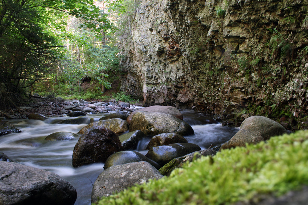
The Temperance River approach to Carlton Peak combines a close look into a rocky river gorge with a climb through forest to an exposed rock dome. Start from the Highway 61 parking lot on the northeast side of the river and follow the Superior Hiking Trail along the gorge, then through rolling, forested terrain toward the peak. The Carlton Peak Trail is listed at 3 miles one-way, with steep terrain, bare rock and packed dirt. Carlton Peak stands over 1,000 feet above Lake Superior; that describes its position above the lake, not the climb’s cumulative elevation gain. The payoff is a panoramic view of the surrounding wilderness. Treat this as a rugged hiking outing rather than an extended roadside stroll: the river overlooks come early, while reaching the peak requires continuing beyond the gorge.
Choose a turnaround before adding side trips
For a peak-focused day, use the Highway 61 northeast-side parking lot as the starting point and make Carlton Peak the main objective. An out-and-back keeps the return tied to the same access point without relying on a second trailhead or shuttle. For a shorter outing, the Temperance River Gorge Trail follows the gorge for 0.25 miles one-way, beginning with a paved approach to a deck overlooking Hidden Falls before changing to gravel and rock stairs. Upper Falls on the west side offers another option, listed at 1 mile one-way and reached by crossing the river on the Gitchi-Gami Trail bridge. Choose between these river walks and the peak climb according to available daylight and comfort on steep, rocky ground. Do not treat the separate trail distances as consecutive legs of one route.
Footing, river safety and overnight planning
The main concerns here are rugged footing and exposure along the Temperance River Gorge. Wear good hiking shoes, take care on bare rock and stairs, and keep small children close beside the gorge. Do not swim in the Temperance River: its currents are dangerous and unpredictable. Cell service may be spotty, so carry a map rather than depending on a live connection for navigation. Park hours are 8 a.m. to 10 p.m. daily, and vehicle permits are required and available at the park office. For an overnight base, the park has drive-in campsites near Lake Superior and cart-in campsites; all park campsites are reservable. Superior Hiking Trail backpack campsites are managed by the SHT Association, so confirm arrangements with that organization rather than assuming park campground procedures apply. Keep pets attended and on a 6-foot leash; they are not allowed at beaches or in buildings.
Route options
- Carlton Peak Trail via the Superior Hiking Trail3 miles one-waySteep terrain with bare rock and packed dirt
Start at the Highway 61 parking lot northeast of the river. Follow the Superior Hiking Trail along the gorge and through rolling forest to Carlton Peak’s rock dome and wilderness views. Return by the same route for an out-and-back.
- Temperance River Gorge Trail0.25 miles one-wayHilly, with bare rock, packed dirt and stairs
Follow the paved trail from the northeast-side Highway 61 parking lot to the Hidden Falls viewing deck, then continue on gravel and rock stairs to clifftop overlooks along the gorge.
- Upper Falls (West Side)1 mile one-wayHilly, with bare rock, packed dirt and stairs
From the northeast-side Highway 61 parking lot, head upstream past Hidden Falls. Turn left at the paved Gitchi-Gami Trail, cross the bridge, then turn right and continue upstream to Upper Falls.
- Gitchi-Gami State Trail bridge approach0.4 miles one-wayPaved, with some hills
Find the paved spur near the park office, cross Highway 61 and turn left at the main trail intersection to reach the Temperance River bridge and gorge views.
Sample itineraries
- Temperance River to Carlton Peak Day Hike · 1 day
Start at the Highway 61 parking lot northeast of the river. Follow the Superior Hiking Trail along the gorge and through rolling forest to Carlton Peak, 3 miles one-way. Plan to return the same way. Allow extra time for steep terrain, bare rock and gorge overlooks.
- Camp-Based Gorge and Peak Weekend · 2 days
Reserve a Temperance River State Park campsite. On day one, explore Hidden Falls and the Upper Falls west-side route, listed as 1 mile one-way. On day two, hike the Superior Hiking Trail from Highway 61 to Carlton Peak. This approach keeps overnight gear at camp rather than carrying it up the peak.
Seasonal conditions
Spring
Spring; check current trail conditions before departure.
Assess footing on bare rock, packed dirt and stairs before committing to the peak. Wet surfaces call for slower travel near the gorge. Never enter the Temperance River: its currents are dangerous and unpredictable.
Summer
Summer; choose a hiking day suited to the forecast.
The Carlton Peak route combines rolling forest with a steep rock-dome finish. Carry water and sun protection, and pace the climb for the day's temperatures. Lake access does not make the Temperance River safe for swimming.
Fall
Fall; confirm weather and hunting activity before visiting.
Pack layers for time on the exposed rock dome and beside Lake Superior. Check hunting information when planning beyond the main route: hunting is permitted on mapped Superior National Forest land, and hunting and trapping are allowed in the park's Cross River Unit.
Winter
Winter; confirm conditions and suitable routes with park staff.
The park offers skiing and snowshoeing, with snowmobiling on the North Shore State Trail. Do not assume the steep Carlton Peak hiking route is suitable for those activities. Snow or ice on rock and stairs requires a conservative route choice.
| Season | Window | Conditions |
|---|---|---|
| Spring | Spring; check current trail conditions before departure. | Assess footing on bare rock, packed dirt and stairs before committing to the peak. Wet surfaces call for slower travel near the gorge. Never enter the Temperance River: its currents are dangerous and unpredictable. |
| Summer | Summer; choose a hiking day suited to the forecast. | The Carlton Peak route combines rolling forest with a steep rock-dome finish. Carry water and sun protection, and pace the climb for the day's temperatures. Lake access does not make the Temperance River safe for swimming. |
| Fall | Fall; confirm weather and hunting activity before visiting. | Pack layers for time on the exposed rock dome and beside Lake Superior. Check hunting information when planning beyond the main route: hunting is permitted on mapped Superior National Forest land, and hunting and trapping are allowed in the park's Cross River Unit. |
| Winter | Winter; confirm conditions and suitable routes with park staff. | The park offers skiing and snowshoeing, with snowmobiling on the North Shore State Trail. Do not assume the steep Carlton Peak hiking route is suitable for those activities. Snow or ice on rock and stairs requires a conservative route choice. |
Permits, fees & closures
Vehicle permits are required at Temperance River State Park and can be purchased at the park office. Confirm any separate Superior Hiking Trail overnight requirements with the managing organization.
Reservations: All park campsites are reservable at mndnr.gov/reservations or by calling 866-857-2757. The mapped Superior Hiking Trail backpack campsite is managed by the SHT Association; confirm its arrangements separately.
Official source: [PDF] Map of Temperance River State Park Trails and Facilities - files · Verified October 19, 2026
Hazards & regulations
- Do not swim in the Temperance River. Its currents are dangerous and unpredictable.
- Trails follow clifftops above the Temperance River Gorge. Watch footing and keep small children close.
- Carlton Peak involves steep terrain, bare rock and packed dirt. Gorge routes also include rock stairs; wear good hiking shoes.
- Cell service may be spotty. Carry navigation that works offline; call 911 in an emergency.
- Hunting occurs on mapped Superior National Forest land. Hunting and trapping are allowed in the Cross River Unit; check the location of planned side trips.
What to pack for Superior Hiking Trail: Temperance River to Carlton Peak Section Strategy
- Good hiking shoes with dependable grip
- Rain shell and insulating layer
- Sun protection
- Traction appropriate to current conditions
- Drinking water
- Food for the climb and return
- Offline trail map
- Headlamp
- First-aid kit
- Tent and weather-appropriate sleep system
- Camp cooking equipment
- Firewood purchased at the park or from a vendor selling wood approved for this park; do not gather wood
Superior Hiking Trail: Temperance River to Carlton Peak Section Strategy FAQ
- Where does the Carlton Peak hike start?
- Use the Highway 61 parking lot on the northeast side of the Temperance River. Follow the Superior Hiking Trail along the gorge and through rolling forest. Carlton Peak Trail is listed as 3 miles one-way, with steep terrain and bare rock.
- Is there a shorter option than Carlton Peak?
- Yes. The Temperance River Gorge Trail is 0.25 miles one-way. From the same Highway 61 parking lot, a paved trail reaches a Hidden Falls viewing deck before transitioning to gravel, rock stairs and clifftop overlooks.
- What is the Upper Falls west-side route?
- Start northeast of the river at Highway 61 and hike upstream past Hidden Falls. Turn left onto the paved Gitchi-Gami Trail, then right after the bridge. Continue upstream to Upper Falls. The route is 1 mile one-way and includes hills, bare rock and stairs.
- Can this section work as a camping trip?
- Yes. The park has electric and non-electric drive-in campsites near Lake Superior, plus cart-in options. A camp-based trip lets hikers visit the gorge and peak separately. The map also identifies a backpack campsite managed by the SHT Association.
- Are dogs allowed?
- Pets are welcome in the park but must remain on a 6-foot leash, be attended at all times and be cleaned up after. They are not allowed in buildings or at beaches.
- What should hikers know about park hours and communication?
- The park is open daily from 8 a.m. to 10 p.m. Cell service may be spotty, so save navigation before arriving and share the day's plan with someone. In an emergency, call 911.