



Where on earth
Satellite imagery flying in from a world view to Beaverkill River, Worldwide. Use the + / − buttons, or click the map to zoom with your scroll wheel; drag to pan and pinch to zoom on touch.
- Region
- New York, USA
- Country
- Worldwide
- Biome
- Catskills (400 m)
- Best season
- April – October
- Difficulty
- moderate
- Backpacking
- Hiking
- Fishing
Key takeaways
- Biome: Catskills (400 m)
- Best season: April – October
- Difficulty: moderate
- Top activity: backpacking
Photos of Beaverkill River
Topic summary
Birthplace of American fly fishing — Catskills' most iconic trout stream.
Key takeaways
- Difficulty: moderate
- Best season: April – October
Intended uses
backpacking
Climate suitability
Catskills (400 m)
Tools for a trip here
Picked for how, when and where you're going. Free, no signup.
- Sleep System Temp CalculatorCold nights: check your bag and pad add up to a safe sleep.
- Base Weight CalculatorEvery ounce is carried — total your kit and find your base weight.
- Pack Volume SizerSize the pack for your trip length and season.
- Water Purification MatrixTreat water from streams and lakes on trail.
- Layering CalculatorCold-season miles: layer for climbs and camp.
Plan with verified data
Beaverkill River trip tools
How to get there
Locate Beaverkill Bridge, also known as Conklin Bridge, north of Roscoe in the Town of Rockland, New York. Conklin Road crosses the Beaver Kill on the bridge within Beaverkill State Campground. Confirm current road and campground access before traveling.
- Beaverkill Bridge / Conklin Bridge
The wooden covered bridge carries Conklin Road over the Beaver Kill. Use it as a geographic anchor for a bridge-focused visit; confirm permitted stopping and pedestrian access rather than assuming roadside parking or shoreline entry.
- Beaverkill State Campground
Conklin Road passes through this campground at Beaverkill Bridge. Confirm campground access and any arrangements for a visit directly before relying on it as a starting point.
Sources: Wikipedia · Wikivoyage. Confirm road and trailhead conditions with the managing agency before you leave.
Popular pursuits at Beaverkill River
- Backpacking
Multi-day travel with everything on your back — see the packing blocks below.
- Hiking
Day miles on marked trail, with route notes and trail links below.
- Fishing
Resident gamefish, seasons, and the water that holds them.
Animals around Beaverkill River
 Wildlife guideBlack bearUrsus americanus
 Big gameWhitetail DeerOdocoileus virginianus
 GamefishBrook TroutSalvelinus fontinalis
 Wildlife guideNorth American beaverCastor canadensis
 Big gameBlack BearUrsus americanus
 GamefishSmallmouth BassMicropterus dolomieu
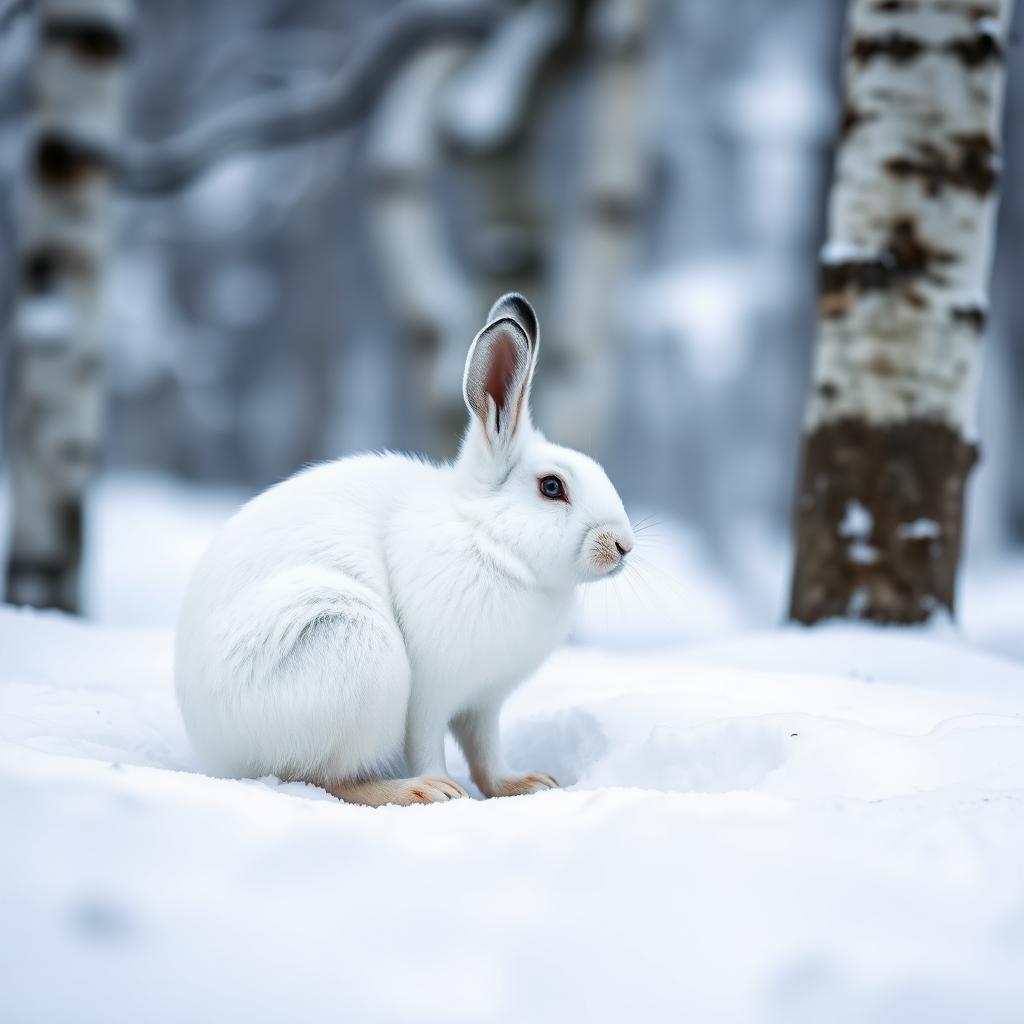 Wildlife guideSnowshoe hareLepus americanus
 Big gameWild HogSus scrofa
Maps, GPS & compass for this trip
Carry a waterproof paper map and a compass you can steer by, and treat the GPS as the backup — not the other way round. Buying links go to Amazon; Wild10 earns a commission at no cost to you.
Waterproof topo maps
- Waterproof topographic map — Beaverkill RiverAmazon search for waterproof, tear-resistant topo maps covering this area.
- National Geographic Trails IllustratedThe waterproof Trails Illustrated series — check for a sheet covering this area.
- Waterproof map case & compass lanyardKeep a paper map readable in rain, spray and a swamped boat.
Fishing at Beaverkill River
Planning to fish Beaverkill River, New York? Fishing licenses, open seasons and catch limits in New York are set by the local wildlife authority and change every year — check the official source before you cast a line.
Do I need a fishing license at Beaverkill River?
- A New York fishing license is normally required for anyone over the local youth age.
- Read the current New York fishing regulations for special waters, barbless-hook or catch-and-release rules.
- Clean, drain and dry boats and gear between waters to stop invasive species.
Hunting near Beaverkill River
Thinking about hunting Beaverkill River, New York? Hunting seasons, tags and draws in New York are set by the wildlife authority each year. Confirm the rules for your species and unit before you go.
Is hunting allowed at Beaverkill River?
- Confirm the land around Beaverkill River is open to hunting and which management unit it falls in.
What do I need to hunt in New York?
- A New York hunting license — most jurisdictions also require hunter education certification.
- Species tags or draw results for big game such as deer, elk, moose or bear where they occur.
- Knowledge of firearm and bow transport rules, which differ by land type and border crossing.
A Bridge-Centered Visit to the Beaver Kill
The Beaver Kill runs beneath Beaverkill Bridge, a wooden covered crossing north of Roscoe in the Town of Rockland, New York. Also called Conklin Bridge, it carries Conklin Road through Beaverkill State Campground. This gives a visit a specific geographic focus: the river crossing and its campground setting in the Catskill Mountains. Plan around that named location rather than treating the river as a single, interchangeable access point. A road crossing identifies where to find the river, but does not by itself establish public shoreline access, parking, or a place to launch a boat. For a bridge-focused outing, confirm current access before leaving and keep any riverbank exploration within areas where public use is clearly allowed.
The Covered Bridge and Its History
Built in 1865, Beaverkill Bridge was among the first bridges over the river when this part of the Catskill Mountains was still largely unsettled. Its wooden structure uses an unusual modification of the lattice truss design developed earlier in the nineteenth century by Ithiel Town. The identity of its builder remains disputed: three men have been credited, and all three likely played some role. The bridge is one of New York State's 29 historic covered bridges. Following repairs during the late twentieth century, it was added to the National Register of Historic Places in 2007. That history makes the crossing itself a useful focus for a visit, with attention to its construction as well as its relationship to the river.
Planning Around a Working Crossing
Beaverkill Bridge is both a historic structure and a crossing that carries Conklin Road through Beaverkill State Campground. Treat those functions together when planning a stop: viewing the bridge should not interfere with road traffic or campground use. Repair and maintenance efforts continue, so check the current condition of the crossing and any access instructions before making it the centerpiece of a trip. The bridge's location within the campground does not establish camping availability or unrestricted use of the surrounding riverbanks. Confirm those arrangements separately with the campground or responsible agency. Keep the itinerary flexible enough to accommodate posted directions, and choose viewing locations only where stopping and pedestrian access are allowed. A bridge visit need not involve entering the water.
Route options
- Conklin Road Bridge Approach
Make the Conklin Road crossing within Beaverkill State Campground the destination for a road-based visit. Check current access instructions and stop only where allowed. This is a location-based approach, not a documented hiking route.
- Beaverkill Bridge Historic-Structure Visit
Focus a short visit on the covered bridge and its modified lattice-truss construction, using only locations where pedestrian viewing is permitted. Confirm access on arrival; this option does not imply a riverbank trail or a through-route.
Sample itineraries
- Beaverkill Covered Bridge Visit · 1 day
Focus a short visit on Beaverkill Bridge, also called Conklin Bridge, north of Roscoe. Conklin Road crosses the Beaver Kill here through Beaverkill State Campground. The wooden bridge dates to 1865 and features an unusual modified lattice truss. Check current access before traveling.
- Campground and Bridge Overnight · 2 days
Plan an overnight at Beaverkill State Campground only after confirming camping availability with the managing agency. Make the historic bridge the main sightseeing stop, with time to appreciate its Catskill Mountains setting. Follow posted guidance for river access and bridge use.
Seasonal conditions
Spring
Confirm spring access before departure
Check the local weather forecast and campground operating status. For a riverside visit, assess conditions on arrival rather than assuming the bank or water is safe to enter.
Summer
Confirm summer camping availability
If planning an overnight, verify campground availability and facilities before packing. Bring drinking water and sun protection for time outdoors; do not assume river access means swimming is appropriate.
Fall
Confirm fall campground operations
Check forecast temperatures and pack adaptable layers for the Catskill Mountains setting. Confirm that campground access suits the intended visit, especially before committing to an overnight.
Winter
Confirm winter road and site access
Check weather and road conditions before approaching on Conklin Road. Do not assume the campground operates in winter. Choose footwear and insulation for the forecast, and reconsider the visit if footing or travel conditions are unsafe.
| Season | Window | Conditions |
|---|---|---|
| Spring | Confirm spring access before departure | Check the local weather forecast and campground operating status. For a riverside visit, assess conditions on arrival rather than assuming the bank or water is safe to enter. |
| Summer | Confirm summer camping availability | If planning an overnight, verify campground availability and facilities before packing. Bring drinking water and sun protection for time outdoors; do not assume river access means swimming is appropriate. |
| Fall | Confirm fall campground operations | Check forecast temperatures and pack adaptable layers for the Catskill Mountains setting. Confirm that campground access suits the intended visit, especially before committing to an overnight. |
| Winter | Confirm winter road and site access | Check weather and road conditions before approaching on Conklin Road. Do not assume the campground operates in winter. Choose footwear and insulation for the forecast, and reconsider the visit if footing or travel conditions are unsafe. |
Permits, fees & closures
Confirm permit requirements, campground rules, and current access with the managing agency.
Confirm current permits, fees, and closures with the managing agency before you go.
Hazards & regulations
- Beaverkill Bridge carries Conklin Road. Stay alert for vehicles and do not treat the bridge as a pedestrian-only structure.
- The bridge crosses a river. Assess bank footing and water conditions before approaching; do not assume safe wading or swimming.
- Bridge repair and maintenance efforts continue. Check current access and obey any posted work-area restrictions.
What to pack for Beaverkill River
- Sturdy footwear
- Drinking water
- Weather-appropriate layers
- Rain protection
- Sun protection
- Tent and sleeping pad
- Sleeping bag suited to forecast temperatures
- Headlamp
- Food and appropriate storage
- Waste bags
Beaverkill River FAQ
- Where is Beaverkill Bridge?
- It crosses the Beaver Kill north of Roscoe, in the Town of Rockland, New York. Conklin Road passes over the bridge through Beaverkill State Campground.
- Are Beaverkill Bridge and Conklin Bridge the same place?
- Yes. Conklin Bridge is another name for the wooden covered bridge carrying Conklin Road over the Beaver Kill.
- What makes the bridge historically notable?
- Built in 1865, it was among the area's early river crossings. Its design uses an unusual modification of Ithiel Town's lattice truss. It was listed on the National Register of Historic Places in 2007.
- Can this be an overnight trip?
- Beaverkill State Campground is the relevant campground for a bridge-centered visit. Confirm its operating status, camping availability, facilities, and rules with the managing agency before planning to stay.
- Is the covered bridge pedestrian-only?
- No. It carries Conklin Road. Check posted guidance, remain alert for vehicles, and confirm current access because repair and maintenance efforts continue.