



Where on earth
Satellite imagery flying in from a world view to Dolly Sods Wilderness, Worldwide. Use the + / − buttons, or click the map to zoom with your scroll wheel; drag to pan and pinch to zoom on touch.
- Region
- West Virginia, USA
- Country
- Worldwide
- Biome
- Boreal plateau (900–1,200 m)
- Best season
- May – October
- Difficulty
- moderate
- Backpacking
- Hiking
- Wildlife Viewing
Key takeaways
- Biome: Boreal plateau (900–1,200 m)
- Best season: May – October
- Difficulty: moderate
- Top activity: backpacking
Photos of Dolly Sods Wilderness
Topic summary
A boreal plateau of bogs, red spruce, and heath — displaced Canadian ecosystem in West Virginia.
Key takeaways
- Difficulty: moderate
- Best season: May – October
Intended uses
backpacking
Climate suitability
Boreal plateau (900–1,200 m)
Tools for a trip here
Picked for how, when and where you're going. Free, no signup.
- Sleep System Temp CalculatorCold nights: check your bag and pad add up to a safe sleep.
- Base Weight CalculatorEvery ounce is carried — total your kit and find your base weight.
- Pack Volume SizerSize the pack for your trip length and season.
- Water Purification MatrixTreat water from streams and lakes on trail.
- Layering CalculatorCold-season miles: layer for climbs and camp.
Plan with verified data
Dolly Sods Wilderness trip tools
How to get there
Dolly Sods Wilderness is in West Virginia, USA, Worldwide. Its center point is 39.0500, -79.3500. Use these links for live turn-by-turn directions from where you are, then confirm road, trailhead and access conditions with the managing agency before you leave.
Popular pursuits at Dolly Sods Wilderness
- Backpacking
Multi-day travel with everything on your back — see the packing blocks below.
- Hiking
Day miles on marked trail, with route notes and trail links below.
- Wildlife Viewing
Best light, best season, and where animals move.
Animals around Dolly Sods Wilderness
 Wildlife guideBlack bearUrsus americanus
 Big gameWhitetail DeerOdocoileus virginianus
 GamefishBrook TroutSalvelinus fontinalis
 Wildlife guideNorth American beaverCastor canadensis
 Big gameBlack BearUrsus americanus
 GamefishSmallmouth BassMicropterus dolomieu
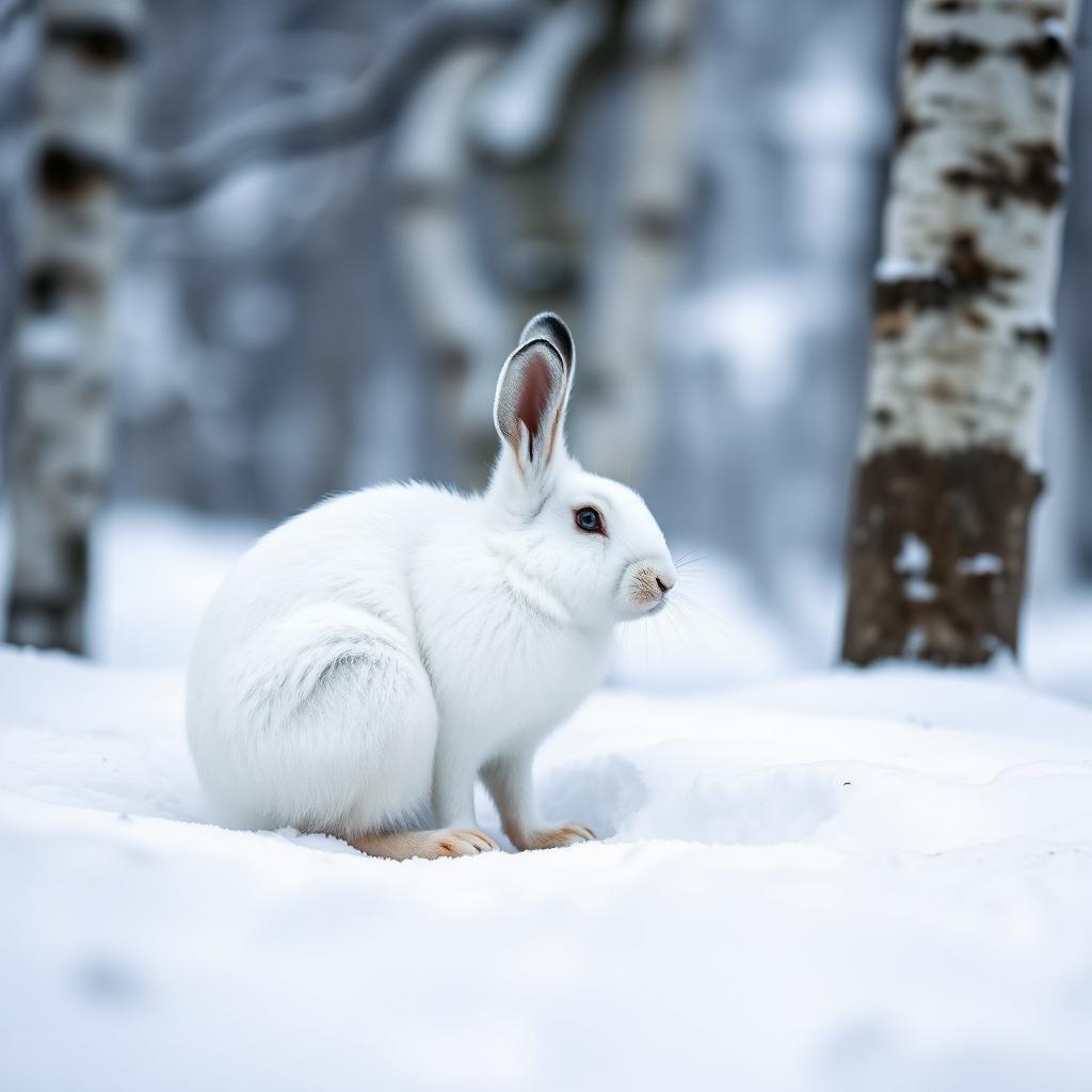 Wildlife guideSnowshoe hareLepus americanus
 Big gameWild HogSus scrofa
Maps, GPS & compass for this trip
Carry a waterproof paper map and a compass you can steer by, and treat the GPS as the backup — not the other way round. Buying links go to Amazon; Wild10 earns a commission at no cost to you.
Waterproof topo maps
- Waterproof topographic map — Dolly Sods WildernessAmazon search for waterproof, tear-resistant topo maps covering this area.
- National Geographic Trails IllustratedThe waterproof Trails Illustrated series — check for a sheet covering this area.
- Waterproof map case & compass lanyardKeep a paper map readable in rain, spray and a swamped boat.
Fishing at Dolly Sods Wilderness
Planning to fish Dolly Sods Wilderness, Virginia? Fishing licenses, open seasons and catch limits in Virginia are set by the local wildlife authority and change every year — check the official source before you cast a line.
Do I need a fishing license at Dolly Sods Wilderness?
- A Virginia fishing license is normally required for anyone over the local youth age.
- Read the current Virginia fishing regulations for special waters, barbless-hook or catch-and-release rules.
- Clean, drain and dry boats and gear between waters to stop invasive species.
- Dolly Sods Wilderness may add its own fishing rules on top of Virginia law — check the managing agency too.
Hunting near Dolly Sods Wilderness
Thinking about hunting Dolly Sods Wilderness, Virginia? Hunting seasons, tags and draws in Virginia are set by the wildlife authority each year. Confirm the rules for your species and unit before you go.
Is hunting allowed at Dolly Sods Wilderness?
- Hunting is prohibited or heavily restricted in many national parks, wilderness and protected areas — confirm with the Dolly Sods Wilderness land manager before planning a hunt, and look to surrounding public land.
What do I need to hunt in Virginia?
- A Virginia hunting license — most jurisdictions also require hunter education certification.
- Species tags or draw results for big game such as deer, elk, moose or bear where they occur.
- Knowledge of firearm and bow transport rules, which differ by land type and border crossing.
Dolly Sods in its West Virginia setting
Dolly Sods Wilderness is the destination for this West Virginia trip, but a useful plan needs to distinguish statewide context from details specific to the wilderness. West Virginia lies entirely within the Appalachian mountain range and has the highest mean elevation of any eastern state. Forested mountains and hills, with small cities and towns between them, define the broader travel setting. That context supports planning for a mountain outing; it does not establish the terrain, trail conditions, or access arrangements at Dolly Sods. Before choosing an itinerary, confirm the wilderness boundary and obtain a current map that identifies its actual trails and entry points. Treat regional descriptions as background rather than as directions to the destination.
Keep nearby wilderness areas distinct
Roaring Plains West Wilderness provides another example of protected mountain country in eastern West Virginia, but it should not be treated as another name for Dolly Sods. Roaring Plains West is in the Allegheny Mountains, belongs to the Monongahela National Forest, and includes Mount Porte Crayon. Those details describe Roaring Plains West specifically; they do not establish Dolly Sods access, management, or route options. The same distinction matters when encountering the names Flatrock Plains, Roaring Plains North, and Roaring Plains East. A regional trip can involve several named landscapes without their boundaries or rules being interchangeable. Check that any map, driving directions, or trail description being used actually identifies Dolly Sods Wilderness before building the day's plan around it.
Confirm the essentials before choosing a route
A specific Dolly Sods itinerary needs confirmed access points, trail connections, and current guidance from the managing agency. No particular trailhead, road approach, walking distance, or difficulty rating is established here, so none is recommended. Begin with an agency map, then select a route whose length and terrain match the group's experience and available daylight. Confirm any permit requirements directly with the managing agency rather than applying rules from another wilderness area. For a mountain trip, check the weather before departure and carry clothing, water, food, and navigation suitable for the chosen outing. These are general planning steps, not a substitute for destination-specific information. Keep the itinerary provisional until the approach and route have both been checked.
Sample itineraries
- Dolly Sods day-hike plan · 1 day
Plan a single day hike after confirming a suitable trail and access point with the managing agency. Choose the outing around current conditions, daylight and group ability. This is a planning outline, not a verified route.
- Two-day hiking visit · 2 days
Use the first day for a short introductory hike on a confirmed route. Adjust the second day's outing to weather and footing. Arrange lodging separately; do not assume overnight wilderness camping or a particular campsite is available.
Seasonal conditions
Spring
Spring
For a mountain outing, prepare for changing temperatures and wet conditions. Confirm Dolly Sods trail and road status before departure; no reliable seasonal access schedule is established here.
Summer
Summer
Carry drinking water and weather protection for hiking in West Virginia's mountains. Set distance and pace around the forecast rather than assuming summer guarantees comfortable conditions.
Fall
Fall
Plan around available daylight and carry layers for temperature changes. Confirm local conditions before selecting a route; no destination-specific foliage timing or access schedule is established here.
Winter
Winter
Treat cold-weather mountain travel conservatively. Verify road access and trail conditions before committing, and choose an outing suited to the group's equipment and experience.
| Season | Window | Conditions |
|---|---|---|
| Spring | Spring | For a mountain outing, prepare for changing temperatures and wet conditions. Confirm Dolly Sods trail and road status before departure; no reliable seasonal access schedule is established here. |
| Summer | Summer | Carry drinking water and weather protection for hiking in West Virginia's mountains. Set distance and pace around the forecast rather than assuming summer guarantees comfortable conditions. |
| Fall | Fall | Plan around available daylight and carry layers for temperature changes. Confirm local conditions before selecting a route; no destination-specific foliage timing or access schedule is established here. |
| Winter | Winter | Treat cold-weather mountain travel conservatively. Verify road access and trail conditions before committing, and choose an outing suited to the group's equipment and experience. |
Permits, fees & closures
Confirm current permits, camping rules and access requirements for Dolly Sods Wilderness with the managing agency.
Confirm current permits, fees, and closures with the managing agency before you go.
Hazards & regulations
- Changing mountain weather can make an outing colder or wetter than expected; carry layers and rain protection.
- Mountain terrain can demand more time and energy than anticipated; choose a conservative turnaround point.
- Unverified road or trail access can disrupt a trip; confirm the approach before departure.
What to pack for Dolly Sods Wilderness
- Current trail map
- Offline navigation
- Confirmed access information
- Written trip plan shared with a contact
- Rain shell
- Insulating layer
- Season-appropriate footwear
- Drinking water
- Food
- Headlamp
- First-aid kit
Dolly Sods Wilderness FAQ
- Where is Dolly Sods Wilderness?
- Dolly Sods Wilderness is in West Virginia, USA. West Virginia lies entirely within the Appalachian mountain region.
- Which trailhead or route should be used?
- No specific Dolly Sods trailhead or route is verified here. Obtain a current map and confirm access with the managing agency before choosing an itinerary.
- Can a wilderness overnight be planned?
- Confirm camping rules and suitable overnight options with the managing agency first. The two-day outline does not establish campsite availability or camping authorization.
- What is the best season to visit?
- A destination-specific best season is not established here. Choose dates based on current access, the local forecast and the group's readiness for mountain conditions.
- Is Roaring Plains West the same destination?
- No. Roaring Plains West is a separately named wilderness in the Monongahela National Forest. Its Mount Porte Crayon information should not be treated as Dolly Sods route guidance.