



- Region
- AK, USA
- Country
- United States
- Best for
- hiking
- Best season
- Spring, Summer
- Permits
- Confirm wilderness trip requirements and a…
- Managed by
- U.S. Fish and Wildlife Service, Kenai National Wildlife Refuge
Plan with verified data
Kenai Wilderness trip tools
Tools for a trip here
Picked for how, when and where you're going. Free, no signup.
Photos of Kenai Wilderness
How to get there
Kenai Wilderness lies within Kenai National Wildlife Refuge on Alaska’s Kenai Peninsula, near Anchorage. The refuge is administered from offices in Soldotna. Choose a specific trail, canoe route, or refuge facility before arranging access; the wilderness covers a large and varied landscape.
- Jim's Landing
A boat ramp on the Upper Kenai River within the broader refuge recreation network. Confirm how the intended river trip relates to wilderness boundaries and applicable boating rules.
- Hidden Lake Campground
A developed camping option in Kenai National Wildlife Refuge. Use it as a refuge overnight base rather than assuming it is a wilderness trailhead; confirm current camping arrangements before arrival.
- Upper Skilak Campground
A refuge campground with drive-in and walk-in campsites. Confirm current site arrangements and access details with the refuge.
Sources: fws.gov · University of Montana / federal agency partners · Wilderness Connect / federal wilderness boundary inventory · Wikipedia. Confirm road and trailhead conditions with the managing agency before you leave.
AK, USA · United States
- Canoeing
- Kayaking
- Fishing
- Hunting
- Mountaineering
- Birdwatching
- Hiking
- Wildlife Viewing
Mountains, river systems, and lowland forest
Kenai Wilderness protects 1,354,247 acres within Kenai National Wildlife Refuge on Alaska’s Kenai Peninsula. Designated in 1980, it occupies well over half of the refuge, but the wilderness and the broader refuge are not interchangeable when planning access or activities. The landscape includes the western slopes of the Kenai Mountains, ancient glaciers, nine river systems, and spruce-birch lowlands extending toward Cook Inlet. Elevations range from sea level in the northern portion to 6,612 feet in the south. Many rivers originate in the Harding Ice Field. This variety makes the first planning decision straightforward: choose between mountain travel, forest hiking, and lake-based paddling rather than treating Kenai as a single kind of trip. The refuge’s origins as the Kenai National Moose Range also explain its continuing emphasis on wildlife habitat.
Choosing a hiking or paddling trip
More than 200 miles of established trails provide access to much of the backcountry, while canoe trails connect hundreds of small lakes. The Swanson River Canoe Trail is a named option for exploring that lake country. Fishing is another major draw, with some visitors using fly-in access to more remote lakes. Those opportunities span a refuge with designated wilderness, so confirm the rules for the exact waters and landing locations before arranging transport. Do not assume that access practices on a larger lake apply to a canoe trail or that a refuge campground lies inside wilderness. Hidden Lake Campground, Upper Skilak Campground, and public use cabins offer overnight options within the broader refuge. Confirm current campground arrangements, cabin availability, and any applicable permits or charges with the U.S. Fish and Wildlife Service before committing to an itinerary.
Weather, insects, and wildlife preparation
Kenai’s warmest month is July, with average temperatures ranging from 46 to 68 degrees Fahrenheit; January averages range from 9 to 25 degrees. Annual precipitation is approximately 22 inches. Even a summer trip calls for rain protection and layers suited to cool conditions, especially when paddling or stopping for long periods. Insects deserve deliberate preparation: carry repellent and clothing that covers exposed skin. Forest vegetation includes alder, devil’s club, ferns, and numerous berry-producing plants; do not treat an unfamiliar berry as food. Brown bears occur here, and food storage matters in both campgrounds and the backcountry. Use provided bear-resistant waste facilities appropriately and confirm suitable food-storage practices for the intended trip. Moose, wolves, and many bird species also inhabit the area; give wildlife space rather than approaching for a closer view.
Where on earth
Satellite imagery flying in from a world view to Kenai Wilderness, United States. Use the + / − buttons, or click the map to zoom with your scroll wheel; drag to pan and pinch to zoom on touch.
Coordinates
- Decimal degrees
- 60.0756, -150.6204
- Latitude (DMS)
- 60° 4′ 32.3″ N
- Longitude (DMS)
- 150° 37′ 13.4″ W
Coordinates are an access-point reference for Kenai Wilderness, not a route. Carry a paper map and confirm trailhead or put-in access with the managing agency before you go.
Topic summary
For almost 100 years, the Kenai Peninsula has attracted hunters of moose, Dall sheep, and other wild game. In 1941 President Roosevelt designated more than 1.7 million acres as the Kenai National Moose...
Key takeaways
- Region: AK, USA
- Country: United States
- Good for: hiking
- Coordinates: 60.076, -150.620
Intended uses
hiking
Keep planning
Popular pursuits at Kenai Wilderness
- Canoeing
Paddle routes, portages, and put-ins.
- Kayaking
Sheltered and open-water paddling lines.
- Fishing
Resident gamefish, seasons, and the water that holds them.
- Hunting
Seasons, tags, and the units that hold animals.
- Mountaineering
Glacier and high-route objectives with real consequence.
- Birdwatching
Migration windows and the habitat that concentrates birds.
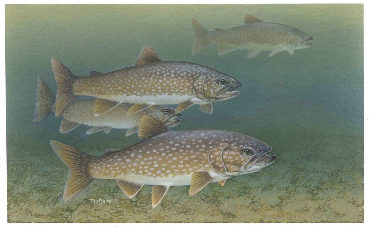
Animals around Kenai Wilderness







Mountains, river systems, and lowland forest
Kenai Wilderness protects 1,354,247 acres within Kenai National Wildlife Refuge on Alaska’s Kenai Peninsula. Designated in 1980, it occupies well over half of the refuge, but the wilderness and the broader refuge are not interchangeable when planning access or activities. The landscape includes the western slopes of the Kenai Mountains, ancient glaciers, nine river systems, and spruce-birch lowlands extending toward Cook Inlet. Elevations range from sea level in the northern portion to 6,612 feet in the south. Many rivers originate in the Harding Ice Field. This variety makes the first planning decision straightforward: choose between mountain travel, forest hiking, and lake-based paddling rather than treating Kenai as a single kind of trip. The refuge’s origins as the Kenai National Moose Range also explain its continuing emphasis on wildlife habitat.
Choosing a hiking or paddling trip
More than 200 miles of established trails provide access to much of the backcountry, while canoe trails connect hundreds of small lakes. The Swanson River Canoe Trail is a named option for exploring that lake country. Fishing is another major draw, with some visitors using fly-in access to more remote lakes. Those opportunities span a refuge with designated wilderness, so confirm the rules for the exact waters and landing locations before arranging transport. Do not assume that access practices on a larger lake apply to a canoe trail or that a refuge campground lies inside wilderness. Hidden Lake Campground, Upper Skilak Campground, and public use cabins offer overnight options within the broader refuge. Confirm current campground arrangements, cabin availability, and any applicable permits or charges with the U.S. Fish and Wildlife Service before committing to an itinerary.
Weather, insects, and wildlife preparation
Kenai’s warmest month is July, with average temperatures ranging from 46 to 68 degrees Fahrenheit; January averages range from 9 to 25 degrees. Annual precipitation is approximately 22 inches. Even a summer trip calls for rain protection and layers suited to cool conditions, especially when paddling or stopping for long periods. Insects deserve deliberate preparation: carry repellent and clothing that covers exposed skin. Forest vegetation includes alder, devil’s club, ferns, and numerous berry-producing plants; do not treat an unfamiliar berry as food. Brown bears occur here, and food storage matters in both campgrounds and the backcountry. Use provided bear-resistant waste facilities appropriately and confirm suitable food-storage practices for the intended trip. Moose, wolves, and many bird species also inhabit the area; give wildlife space rather than approaching for a closer view.
Route options
- Swanson River Canoe Trail
A canoe-trail option in Kenai’s small-lake country. Obtain route-specific access information and confirm current regulations before choosing an itinerary.
- Skilak Lookout Trail
A named hiking trail in the refuge recreation network. Confirm the trailhead, current conditions, and relationship to the wilderness boundary before setting out.
- Kenai River boating
A river-based outing in the broader refuge, where fishing and boating are established activities. Jim's Landing provides a named boat ramp on the Upper Kenai River; confirm suitable launch and takeout arrangements rather than assuming a complete itinerary.
Sample itineraries
- Swanson River Canoe Trail sampler · 2 days
Plan an out-and-back paddle on the Swanson River Canoe Trail, part of Kenai's network linking hundreds of small lakes. Keep the turnaround flexible rather than committing to a fixed mileage. Confirm access, camping rules, and conditions with refuge staff before choosing an overnight stop.
- Kenai backcountry hiking introduction · 3 days
Choose an established backcountry trail with refuge staff, using the first day for a short approach, the second for exploration, and the third for return. Kenai has more than 200 miles of established trails across lowland forest and mountain terrain; select a route suited to the group's experience.
Seasonal conditions
Spring
Spring transition
Kenai spans lowland forest and glaciated mountains, so do not assume conditions at access points reflect higher terrain. Confirm snow, trail, and lake conditions before committing to a hiking or canoe itinerary.
Summer
July is the warmest month
July temperatures average between 46°F and 68°F. Pack warm layers and rain protection even for summer trips. Insects can be troublesome, especially when camping or traveling among the lowland lakes.
Fall
Fall transition
Prepare for colder conditions as the season moves toward winter. Keep hiking and paddling plans flexible, and confirm conditions locally. Kenai's abundant wild berries are a reason to remain alert around wildlife rather than assume a berry patch is empty.
Winter
January is the coldest month
January temperatures average between 9°F and 25°F. Cold-weather insulation, shelter, and conservative travel plans are essential. Do not treat freezing air temperatures as proof that lake or river ice is safe.
| Season | Window | Conditions |
|---|---|---|
| Spring | Spring transition | Kenai spans lowland forest and glaciated mountains, so do not assume conditions at access points reflect higher terrain. Confirm snow, trail, and lake conditions before committing to a hiking or canoe itinerary. |
| Summer | July is the warmest month | July temperatures average between 46°F and 68°F. Pack warm layers and rain protection even for summer trips. Insects can be troublesome, especially when camping or traveling among the lowland lakes. |
| Fall | Fall transition | Prepare for colder conditions as the season moves toward winter. Keep hiking and paddling plans flexible, and confirm conditions locally. Kenai's abundant wild berries are a reason to remain alert around wildlife rather than assume a berry patch is empty. |
| Winter | January is the coldest month | January temperatures average between 9°F and 25°F. Cold-weather insulation, shelter, and conservative travel plans are essential. Do not treat freezing air temperatures as proof that lake or river ice is safe. |
Permits, fees & closures
Confirm wilderness trip requirements and activity-specific rules with Kenai National Wildlife Refuge before departure.
Fees: Kenai National Wildlife Refuge does not charge an entrance fee. Confirm current campground and public use cabin rates directly with the refuge.
Reservations: Confirm current campground and cabin booking arrangements with the refuge. Proposed reservation changes for Hidden Lake Campground should not be treated as confirmed current policy.
Official source: Kenai Recreation Fees | U.S. Fish & Wildlife Service · Verified November 1, 2026
Hazards & regulations
- Brown bears inhabit Kenai, including less-visited areas. Store food and scented items securely, keep a clean camp, and give bears room.
- Insects can make lake travel and camping uncomfortable. Carry repellent and a head net.
- Cold exposure remains possible during summer, when July averages extend down to 46°F. Carry insulation and rain protection.
- Lake and river travel carries immersion risk. Wear a personal flotation device and avoid paddling conditions beyond the group's ability.
- Mountain terrain includes ancient glaciers. Do not extend a hiking itinerary onto glacial terrain without appropriate skills and equipment.
What to pack for Kenai Wilderness
- Waterproof jacket and rain pants
- Insulating layers appropriate to the season
- Insect repellent
- Head net
- Map and navigation tools
- First-aid kit
- Emergency shelter
- Water treatment
- Bear-resistant food storage appropriate to refuge rules
- Personal flotation device
- Dry bags
- Spare paddle
- Dry clothing kept separate from paddling gear
Kenai Wilderness FAQ
- How does Kenai Wilderness relate to the refuge?
- Kenai Wilderness protects 1,354,247 acres within Kenai National Wildlife Refuge, making up well over half of the refuge. The refuge is administered from Soldotna.
- What terrain should a trip plan account for?
- The wilderness includes the western slopes of the Kenai Mountains, glaciers, nine river systems, and spruce-birch lowland forest extending toward Cook Inlet. Many rivers originate from the Harding Ice Field. A lake itinerary and a mountain itinerary require different preparation.
- Is canoe travel a practical way to explore?
- Yes. A system of canoe trails provides access to hundreds of small lakes, including the Swanson River Canoe Trail. Choose the route and overnight arrangements after checking access and conditions with refuge staff.
- Can motorboats use the canoe trails?
- Motorized boats are not allowed on the canoe trails. Larger lakes have different allowances; confirm the rules for the specific lake and wilderness area before bringing a motorboat.
- Are campgrounds and cabins necessarily inside the wilderness?
- Do not assume refuge facilities lie within designated wilderness. Hidden Lake Campground, Upper Skilak Campground, and refuge public use cabins are accommodation options to investigate separately. Confirm their locations and suitability for the intended wilderness route.
- What fishing opportunities are available?
- Fishing draws visitors to Kenai's lakes and rivers, including fly-in trips to remote lakes. Confirm fishing requirements and access rules with the managing agencies before planning a trip, especially where travel intersects designated wilderness.