


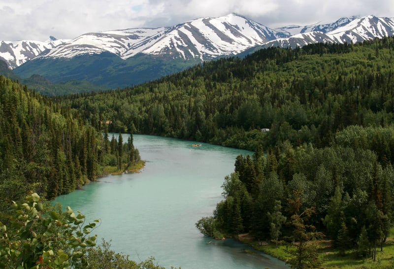
Where on earth
Satellite imagery flying in from a world view to Kenai Peninsula, United States. Use the + / − buttons, or click the map to zoom with your scroll wheel; drag to pan and pinch to zoom on touch.
- Region
- Alaska, USA
- Country
- United States
- Biome
- Salmon rivers, boreal forest and coastal fjords
- Best season
- Summer, Autumn
- Trip length
- 3–7 days
- Difficulty
- moderate
- Canoeing
- Kayaking
- Fishing
- Hunting
- Mountaineering
- Winter Camping
- Skiing
- Sea Kayaking
Key takeaways
- Biome: Salmon rivers, boreal forest and coastal fjords
- Best season: Summer, Autumn
- Trip length: 3–7 days
- Difficulty: moderate
- Top activity: fishing
Photos of Kenai Peninsula
Topic summary
Salmon rivers, glacier trails and two distinct coasts—plan by species, season and current fishing rules.
Key takeaways
- Difficulty: moderate
- Trip length: 3–7 days
- Best season: Summer, Autumn
Intended uses
- fishing
- hiking
- canoeing
- camping
Climate suitability
Salmon rivers, boreal forest and coastal fjords
Verification notes
Last verified October 9, 2026.
Tools for a trip here
Picked for how, when and where you're going. Free, no signup.
- Water Purification MatrixLake water needs treating — compare filters, chemicals and boiling.
- Layering CalculatorCold water: dress for immersion, not just the air temperature.
- Sleep System Temp CalculatorCold nights: check your bag and pad add up to a safe sleep.
- Bear Country Food StorageBear country: canister, Ursack or hang, and the local rules.
- The 10 EssentialsBackcountry safety basics, printable.
Plan with verified data
Kenai Peninsula trip tools
How to get there
Fly to Anchorage (ANC), then follow the Seward Highway south. At the Sterling Highway junction, AK-1 heads west toward Cooper Landing, Soldotna, Kenai, Kasilof and Homer; AK-9 continues toward Seward. NPS lists Seward 126 road miles south of Anchorage. Kenai is reached from Soldotna via the Kenai Spur Highway; Homer remains on the Sterling Highway. Do not assume the Cooper Landing bypass is open: the MP 45–60 project is phased and construction continues. Check Alaska 511 and DOT project notices for delays before departure and allow a buffer before a guide meeting or flight. Summer rail service connects Anchorage and Seward, but it does not substitute for a car or arranged transfers to the river fisheries. No fixed driving time is promised.
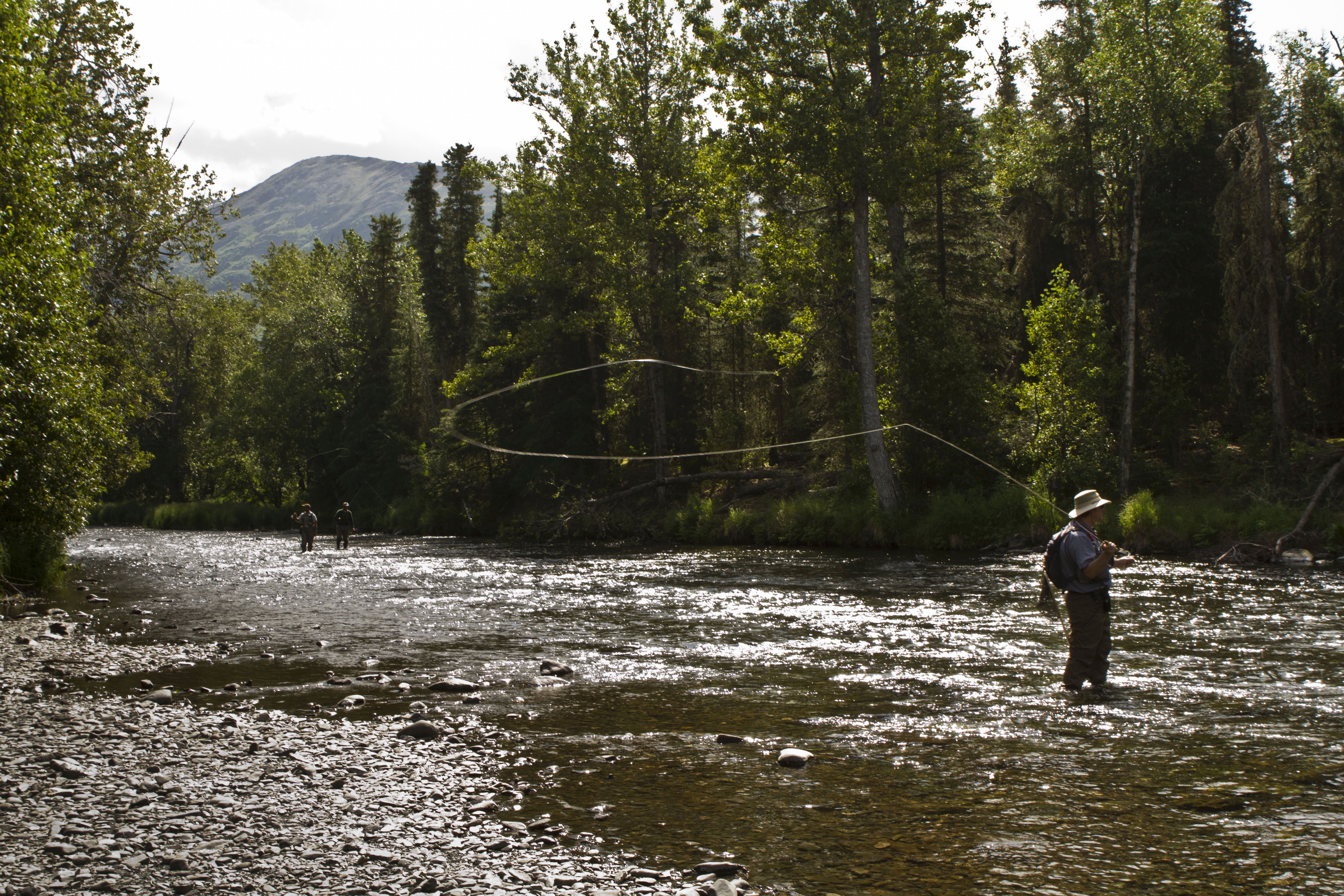
Photo: Berkley Bedell/USFWS — Public domain Cooper Landing / Russian RiverUse the Sterling Highway for the Cooper Landing area. Choose official campground walking access or the Russian River ferry where operating; consult the ADF&G Russian River access map and current facility notices. This photo shows fishing on the Russian River, not a parking lot or an exact launch.
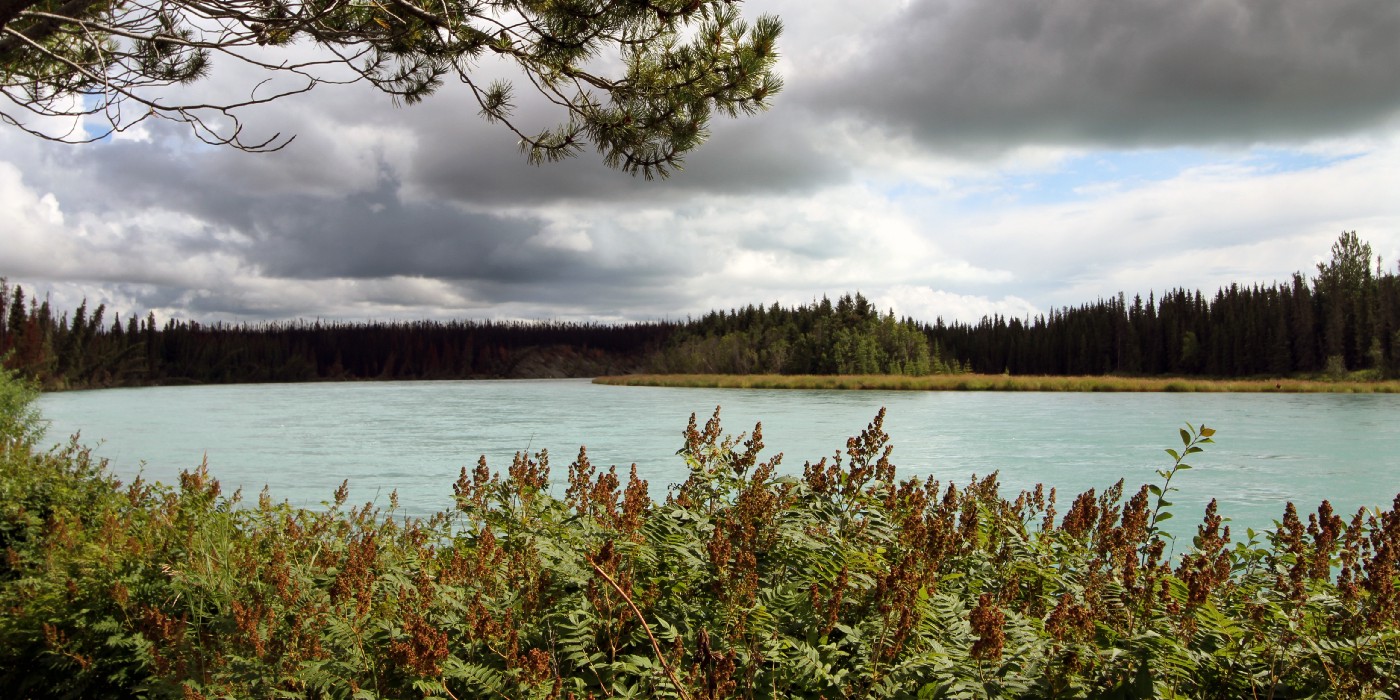
Photo: Katrina Liebich/USFWS — Public domain Soldotna / lower Kenai RiverSoldotna is on the Sterling Highway. Confirm a designated public fishing-access site or your guide’s actual launch and landing. The photograph shows the Kenai River between Soldotna and its mouth, not a verified entry point.
- Kasilof and Anchor Point
Continue southwest along the Sterling Highway from Soldotna for these distinct river bases. Use the exact public-access map for the intended river and verify current closures; do not use a general river-mouth pin as permission to park, cross private land or launch.
- Seward / Kenai Fjords Visitor Center
Stay on AK-9 at the Sterling junction for Seward. NPS locates its waterfront visitor center at 1212 Fourth Avenue. Charter boarding is operator-specific and must be confirmed separately.
- Exit Glacier Nature Center
From the Seward Highway, turn onto Herman Leirer Road (Exit Glacier Road) and continue to the nature-center parking lot. NPS pages describe about 8.4–8.6 miles; follow current road signage. Vehicle access commonly closes in late October and may remain closed into May. This coordinate is from the NPS Exit Glacier page.
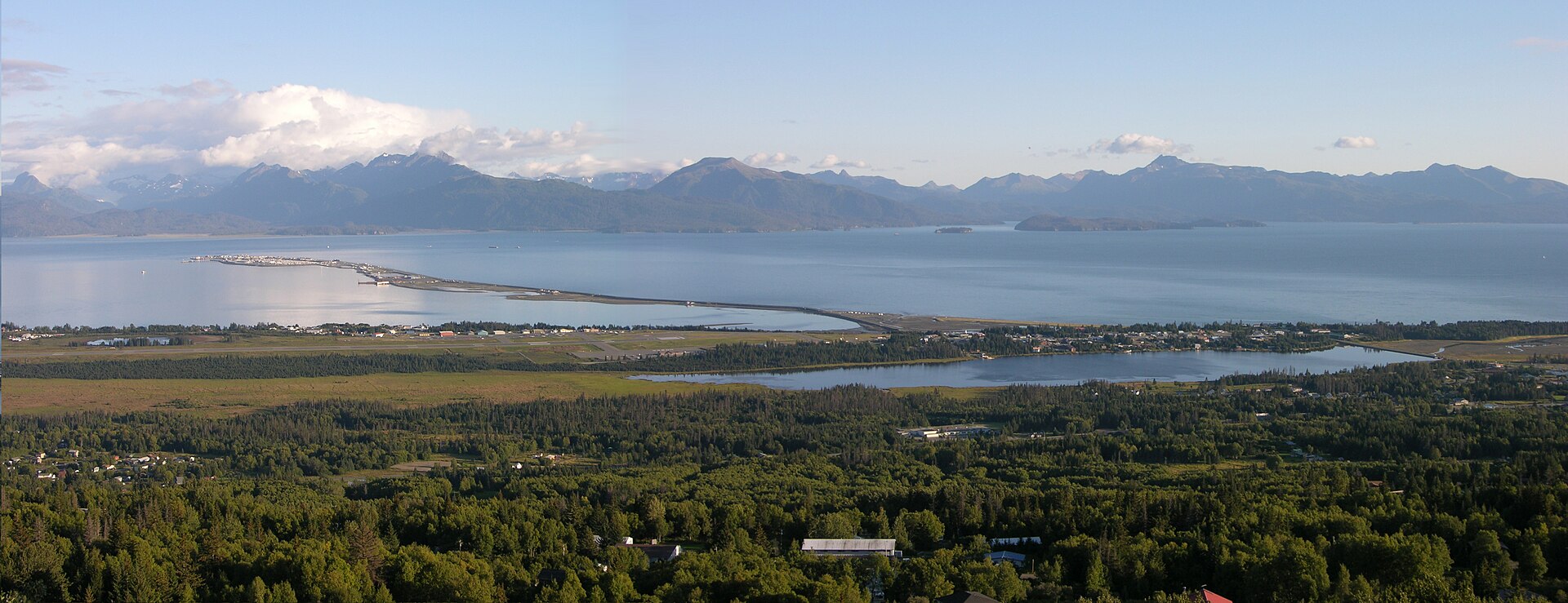
Photo: Derek Ramsey — CC BY-SA 2.5 Homer SpitFollow the Sterling Highway to Homer and the signed Spit road for marine services. Confirm the charter’s harbor, slip and meeting time; the panorama is an orientation view of Homer Spit, not a named boat launch.
Sources: National Park Service · Alaska DOT&PF · Alaska DOT&PF · Alaska Department of Fish and Game. Confirm road and trailhead conditions with the managing agency before you leave.
Popular pursuits at Kenai Peninsula
- Canoeing
Paddle routes, portages, and put-ins.
- Kayaking
Sheltered and open-water paddling lines.
- Fishing
Resident gamefish, seasons, and the water that holds them.
- Hunting
Seasons, tags, and the units that hold animals.
- Mountaineering
Glacier and high-route objectives with real consequence.
- Winter Camping
Cold-season travel and camp craft; layering matters more than mileage.
Animals around Kenai Peninsula







Recommended gear
Maps, GPS & compass for this trip
Carry a waterproof paper map and a compass you can steer by, and treat the GPS as the backup — not the other way round. Buying links go to Amazon; Wild10 earns a commission at no cost to you.
Waterproof topo maps
- Waterproof topographic map — Kenai PeninsulaAmazon search for waterproof, tear-resistant topo maps covering this area.
- National Geographic Trails IllustratedThe waterproof Trails Illustrated series — check for a sheet covering this area.
- Waterproof map case & compass lanyardKeep a paper map readable in rain, spray and a swamped boat.
Fishing at Kenai Peninsula
Planning to fish Kenai Peninsula, Alaska? Fishing licenses, open seasons and catch limits in Alaska are set by the local wildlife authority and change every year — check the official source before you cast a line.
Do I need a fishing license at Kenai Peninsula?
- A Alaska fishing license is normally required for anyone over the local youth age.
- Read the current Alaska fishing regulations for special waters, barbless-hook or catch-and-release rules.
- Clean, drain and dry boats and gear between waters to stop invasive species.
Hunting near Kenai Peninsula
Thinking about hunting Kenai Peninsula, Alaska? Hunting seasons, tags and draws in Alaska are set by the wildlife authority each year. Confirm the rules for your species and unit before you go.
Is hunting allowed at Kenai Peninsula?
- Confirm the land around Kenai Peninsula is open to hunting and which management unit it falls in.
What do I need to hunt in Alaska?
- A Alaska hunting license — most jurisdictions also require hunter education certification.
- Species tags or draw results for big game such as deer, elk, moose or bear where they occur.
- Knowledge of firearm and bow transport rules, which differ by land type and border crossing.
Featured in these Top 10 lists
- Top 10 Kenai Peninsula Salmon Fishing Trips — ranked #1
- Top 10 Kenai Peninsula Salmon Fishing Trips — ranked #2
- Top 10 Kenai Peninsula Salmon Fishing Trips — ranked #3
- Top 10 Kenai Peninsula Salmon Fishing Trips — ranked #4
- Top 10 Kenai Peninsula Salmon Fishing Trips — ranked #5
- Top 10 Kenai Peninsula Salmon Fishing Trips — ranked #6
- Top 10 Kenai Peninsula Salmon Fishing Trips — ranked #7
- Top 10 Kenai Peninsula Salmon Fishing Trips — ranked #8
- Top 10 Kenai Peninsula Salmon Fishing Trips — ranked #9
- Top 10 Kenai Peninsula Salmon Fishing Trips — ranked #10
Browse every destination we cover in the Destination Hub.
Kenai Peninsula: choose a coast, then choose your salmon run
The Kenai Peninsula is not one fishing hole. Cooper Landing and the Russian River sit in the mountain headwaters; Soldotna and Kenai serve the lower river; Kasilof and Anchor Point face Cook Inlet; Seward faces Resurrection Bay; Homer opens onto Kachemak Bay. Those bases have different weather, access, salmon timing and fishing rules. Pick a target species and a practical base before reserving boats or accommodation. A week split between two bases is more resilient than a checklist that crosses the peninsula every morning. The refuge lies in Dena’ina country, known as Yaghanen, “the good land.” Respect cultural places, private land and habitat protections.
This is a researched planning guide, not a claim of firsthand fishing success. Compare our [Top 10 Kenai salmon fishing trips](/top-ten/kenai-salmon-fishing-trips) with the [Fishing Guide](/fishing) and [Trip Planner](/trip-planner). The ranking spans the annual run cycle; it does not imply that every fishery is open today.
Sockeye, coho and kings are different trips
ADF&G’s run chart places Kenai sockeye mainly in mid-July through mid-August, Russian River sockeye in an early mid-June–mid-July run and a later mid-July–mid-August window, and Kasilof sockeye broadly in June–August. Kenai coho generally arrive from late July into mid-October; smaller southern streams have shorter August–September windows. These are historical biological windows, not fishing authorizations or guaranteed catches. [Run timing](https://www.adfg.alaska.gov/static-sf/Region2/pdfpubs/kenrun.pdf) explains when fish may be present; the regulations and emergency orders determine whether you may target or retain them.
Do not plan a Kenai River king trip from historical June/July publicity. The 2026 rules close Kenai River king fishing, including catch-and-release, and restrict most other peninsula freshwater king fisheries. Kasilof and Ninilchik exceptions are narrow and emergency-order dependent. Homer saltwater feeder kings are a separate fishery under different rules. Check the precise water and date rather than assuming “salmon season” opens all species.
Build a trip around access, not an invented route
Roadside fishing, a licensed guide’s drift boat and a saltwater charter are three different logistics problems. At the Russian River, official information describes campground walking access and a ferry connection; confirm their current operating status. Around Soldotna, choose designated public access instead of stepping through yards or eroding riverbanks. For a boat day, have the operator specify the legal fishing reach, meeting point, launch, landing and shuttle. A region-wide map is orientation only: it is not a channel chart, a verified launch inventory or a safe drift route.
In Seward and Homer, allow a weather-buffer day. Marine forecasts, tides and sea state—not a booking calendar—decide whether a boat should leave. Confirm what the charter supplies, what species it will actually target and how any retained fish will be chilled and transported.
Beyond the salmon bank
Kenai National Wildlife Refuge offers hiking, wildlife viewing, canoe-country exploration, roadside campgrounds and reservable public-use cabins. Kenai Fjords National Park adds the road-accessible Exit Glacier area and boat-accessed coastline. Keep glacier walks on designated trails; the Exit Glacier canyon has an outburst-flood safety closure. The Harding Icefield Trail is a separate strenuous mountain objective, not a casual add-on after a full fishing day. [NPS current conditions](https://www.nps.gov/kefj/planyourvisit/conditions.htm) should decide whether it belongs in the itinerary.
Fishing and wildlife observation share the same habitat. Bears, moose and eagles may be present; neither wildlife sightings nor solitude is guaranteed. Store food, fish and scented gear securely, use established paths and give animals space. Choosing a shorter legal fishing day is better than crowding a bear or pushing a cold-water crossing.
Route options
- Russian River bank-fishing dayCrowded bank access; wading and bear awareness required
A walk-in salmon outing from an operating public-access facility, using the official fishery map to identify open water and special tackle zones. Match the early or late sockeye run to your dates. This is an activity outline, not a mapped bank route.
- Kenai River guided drift or boat dayGuide-led cold-water river outing
Choose a reach and species with a licensed operator. Confirm legal tackle, launch and landing, shuttle, life jackets and weather policy. The upper-river canyon is not an unguided beginner float.
- Homer or Seward saltwater salmon dayMarine weather and cold-water exposure
A weather-dependent charter from the appropriate harbor. Seward coho and Homer feeder kings have different timing and regulations. Confirm the intended fishing area, tide, sea forecast and current restrictions.
- Exit Glacier designated trailsTrail-dependent; icefield hike is strenuous
Use the NPS trail map and current-condition notices for a land-based rest day. Do not enter the closed glacier canyon or treat the glacier margin as a maintained trail.
Sample itineraries
- 3-day sockeye base in Soldotna or Cooper Landing · 3 days
Day 1: arrive, buy the required license and inspect legal public access. Day 2: fish the selected run with a guide or from an open designated bank. Day 3: keep a weather/run buffer and take a refuge visitor-center or designated-trail outing. Choose either lower Kenai July/August or Russian early/late-run timing, not a guaranteed opening.
- 6-day river-and-coast salmon sampler · 6 days
Days 1–3: base near Soldotna or Cooper Landing for a legally open sockeye or coho fishery. Day 4: transfer to Seward or Homer, not both. Day 5: take a suitable legal salmon charter if marine conditions permit. Day 6: reserve a backup/rest day before returning. Confirm current runs, season, travel delays and fish transport before booking.
- 3-day October fallback · 3 days
Sockeye runs are normally over, and Russian River salmon fishing is closed after September. Plan only a currently legal Kenai coho reach or a separately authorized Homer feeder-king saltwater trip. Check fresh emergency orders and operator availability, and retain a land-based backup for weather. Do not book the summer list as an October itinerary.
Seasonal conditions
Spring
March–May
Mountain snow and cold rivers constrain access; the Exit Glacier road often stays closed into May. Feeder-king saltwater opportunities are separate from freshwater runs. Do not rely on historical spring king openings.
Early summer
June–mid-July
Russian River early-run sockeye and Kasilof sockeye are seasonal options if open. Roads and popular facilities become busy. 2026 freshwater king restrictions override historical run timing.
Peak sockeye
Mid-July–mid-August
Kenai and Russian late-run sockeye are the main planning targets. Expect crowding and reserve accommodation early. Consult fish counts, current tackle rules and emergency orders; abundance and retention limits change.
Coho season
Late July–September; some Kenai runs into mid-October
Kenai coho usually have the longer window; Russian River, Kasilof and southern streams taper earlier. Seward saltwater coho are generally a mid/late-summer plan. Run timing does not extend a legal season.
Late autumn and winter
October–February
Daylight shortens and road, river and marine conditions become more consequential. In October 2026, Russian salmon fishing is closed; use only a confirmed legal Kenai coho reach or Homer saltwater option. Snow commonly ends Exit Glacier car access in late October. Many seasonal guides and facilities may be unavailable.
| Season | Window | Conditions |
|---|---|---|
| Spring | March–May | Mountain snow and cold rivers constrain access; the Exit Glacier road often stays closed into May. Feeder-king saltwater opportunities are separate from freshwater runs. Do not rely on historical spring king openings. |
| Early summer | June–mid-July | Russian River early-run sockeye and Kasilof sockeye are seasonal options if open. Roads and popular facilities become busy. 2026 freshwater king restrictions override historical run timing. |
| Peak sockeye | Mid-July–mid-August | Kenai and Russian late-run sockeye are the main planning targets. Expect crowding and reserve accommodation early. Consult fish counts, current tackle rules and emergency orders; abundance and retention limits change. |
| Coho season | Late July–September; some Kenai runs into mid-October | Kenai coho usually have the longer window; Russian River, Kasilof and southern streams taper earlier. Seward saltwater coho are generally a mid/late-summer plan. Run timing does not extend a legal season. |
| Late autumn and winter | October–February | Daylight shortens and road, river and marine conditions become more consequential. In October 2026, Russian salmon fishing is closed; use only a confirmed legal Kenai coho reach or Homer saltwater option. Snow commonly ends Exit Glacier car access in late October. Many seasonal guides and facilities may be unavailable. |
Permits, fees & closures
Use a valid Alaska sport-fishing license where required. Check species-, reach-, tackle- and date-specific rules plus emergency orders before every fishing day. A king salmon stamp may be required when legally targeting kings; buying one does not authorize a closed fishery. Kenai River king fishing is closed in 2026, including catch-and-release. Alaska personal-use Kenai/Kasilof dipnetting is residents-only and requires the applicable household permit; it is not a nonresident sport-fishing option. Different land managers govern camps, cabins, boats and trails.
Fees: Check current agency license and facility schedules; no fixed prices are quoted here.
Reservations: Most refuge campsites are first-come, first-served; Hidden Lake Skyview Loop and the refuge’s 14 public-use cabins use Recreation.gov. Charters and accommodation need separate bookings.
Official source: Kenai National Wildlife Refuge visitor information · Verified October 9, 2026
Hazards & regulations
- Cold, powerful rivers: wear a properly fitted life jacket on boats; use a wading belt and avoid deep or swift wading. Do not let a hooked fish pull you into unsafe water.
- Brown and black bears: carry accessible bear spray, travel attentively, give bears room and follow posted food/fish-storage instructions. Never keep fishing when a bear is crowding the bank.
- Marine weather, tide and wind: use current forecasts and an appropriate operator. A road map does not provide navigation soundings or safe small-boat channels.
- Exit Glacier canyon: NPS has an outburst-flood safety closure; remain on designated trails. Outwash water may rise suddenly regardless of local weather.
- Construction, darkness and wildlife on roads: check Alaska 511 before departure. Allow travel buffers and avoid a rushed night drive after fishing.
- Regulation risk: read the rules for the precise reach; freshwater snagging is not permitted, and king closures apply even to intended catch-and-release.
What to pack for Kenai Peninsula
- Species-appropriate rod, reel and tackle permitted for the exact reach
- Waders with wading belt and secure nonslip footwear
- Rain shell and insulating layers
- Polarized glasses, sun protection and pliers
- Landing net and tackle-disposal bag
- Accessible bear spray and training in its use
- Properly fitted PFD for boating
- First-aid kit, headlamp and spare warm layers
- Downloaded official access maps and offline navigation
- Satellite communication for remote outings where cell service is absent
- Confirm charter-provided gear and life jackets before packing
- Seasickness preparation appropriate to personal medical advice
- Cooler and operator-confirmed chilling/processing plan for legal harvest
- Dry bags for electronics and spare layers
- Current license, required stamps and any harvest-record documents
- Weather-rated shelter and sleeping system
- Agency-approved food/fish storage appropriate to the site
- Stove and current fire-restriction information
- Reservation confirmation where required
- Waste bags and Leave No Trace plan
Wildlife you may see
- Brown and black bears share salmon streams; avoid approaching or displacing feeding animals.
- Moose occur in forest and road corridors; give them space, especially cows with calves.
- Bald eagles and waterfowl are common regional wildlife, not guaranteed sightings.
- Coastal boat trips may encounter sea otters, sea lions or whales; keep legal wildlife distances.
Kenai Peninsula FAQ
- When should I go for Kenai salmon?
- Start with the species. Kenai sockeye generally run mid-July–mid-August; Russian early-run sockeye are a June/July plan. Kenai coho generally arrive late July into autumn. Those are biological windows, not guarantees or legal seasons; read current regulations and emergency orders.
- Can I fish for king salmon on the Kenai River?
- Not under the verified 2026 rules: Kenai River king salmon fishing is closed, including catch-and-release. Do not use historic run dates as an opening. Check the current-year emergency orders; Kasilof/Ninilchik exceptions and Homer saltwater rules are separate.
- Can visitors dipnet for salmon?
- Alaska personal-use Kenai/Kasilof dipnetting is for eligible residents with the required license/permit, not nonresident tourists. Nonresidents cannot use someone else’s permit to fish or assist in the fishery. Use a legally open sport-fishing option instead.
- Where can I camp?
- Kenai Refuge lists roadside campgrounds including Hidden Lake and Upper Skilak, plus 14 reservable cabins. Most campsites are first-come, first-served; Hidden Lake Skyview Loop can be reserved. Refuge backcountry camping requires at least a quarter mile from the specified major roads. Confirm site-specific rules; this does not authorize camping on every peninsula shore.
- Does the map show a safe boat route?
- No. The destination map is regional orientation. Verify the operator’s launch, landing and shuttle, use official river/marine information and do not navigate rapids or saltwater from a general map pin.
- Can I visit Exit Glacier during a fishing trip?
- Yes when road and trail conditions allow. NPS provides road access from Seward; vehicle access commonly closes in late October and can stay closed into May. Stay on designated trails and out of the closed canyon. Pets are not allowed on park trails.
- What is actually possible in October?
- Sockeye runs are over and Russian River salmon fishing is closed after September. Kenai coho reach-specific seasons and current emergency orders must be checked. Homer feeder kings are a separate saltwater possibility, subject to rules, operator availability and marine weather.