



Where on earth
Satellite imagery flying in from a world view to Redstreak (Kootenay), Worldwide. Use the + / − buttons, or click the map to zoom with your scroll wheel; drag to pan and pinch to zoom on touch.
- Region
- British Columbia, Canada
- Country
- Worldwide
- Biome
- Sub-alpine (1,000 m)
- Best season
- May – September
- Difficulty
- moderate
- Backpacking
- Hiking
- Climbing
- Mountaineering
- Hot Springs
Key takeaways
- Biome: Sub-alpine (1,000 m)
- Best season: May – September
- Difficulty: moderate
- Top activity: backpacking
Photos of Redstreak (Kootenay)
Topic summary
Rocky Mountain camping steps from Radium Hot Springs.
Key takeaways
- Difficulty: moderate
- Best season: May – September
Intended uses
backpacking
Climate suitability
Sub-alpine (1,000 m)
Tools for a trip here
Picked for how, when and where you're going. Free, no signup.
- Sleep System Temp CalculatorCold nights: check your bag and pad add up to a safe sleep.
- Base Weight CalculatorEvery ounce is carried — total your kit and find your base weight.
- Pack Volume SizerSize the pack for your trip length and season.
- Water Purification MatrixTreat water from streams and lakes on trail.
- Layering CalculatorCold-season miles: layer for climbs and camp.
Plan with verified data
Redstreak (Kootenay) trip tools
How to get there
The Banff–Windermere Highway is the main named travel corridor through Kootenay National Park in southeastern British Columbia. Confirm the Redstreak-specific approach and final turnoff with the park before travelling.
- Southwestern park entrance
A park-level entry point at 918 metres elevation. Confirm onward directions to Redstreak before using it as the starting point for a local visit.
- Banff–Windermere Highway
The highway corridor around which Kootenay National Park was established. Use it for broader park travel; confirm individual stop locations and Redstreak access separately.
Sources: Wikipedia · Wikivoyage. Confirm road and trailhead conditions with the managing agency before you leave.
Popular pursuits at Redstreak (Kootenay)
- Backpacking
Multi-day travel with everything on your back — see the packing blocks below.
- Hiking
Day miles on marked trail, with route notes and trail links below.
- Climbing
Rock and alpine lines with approach beta.
- Mountaineering
Glacier and high-route objectives with real consequence.
- Hot Springs
Soakable water and the etiquette that keeps it open.
Animals around Redstreak (Kootenay)
 Wildlife guideTimber wolfCanis lupus
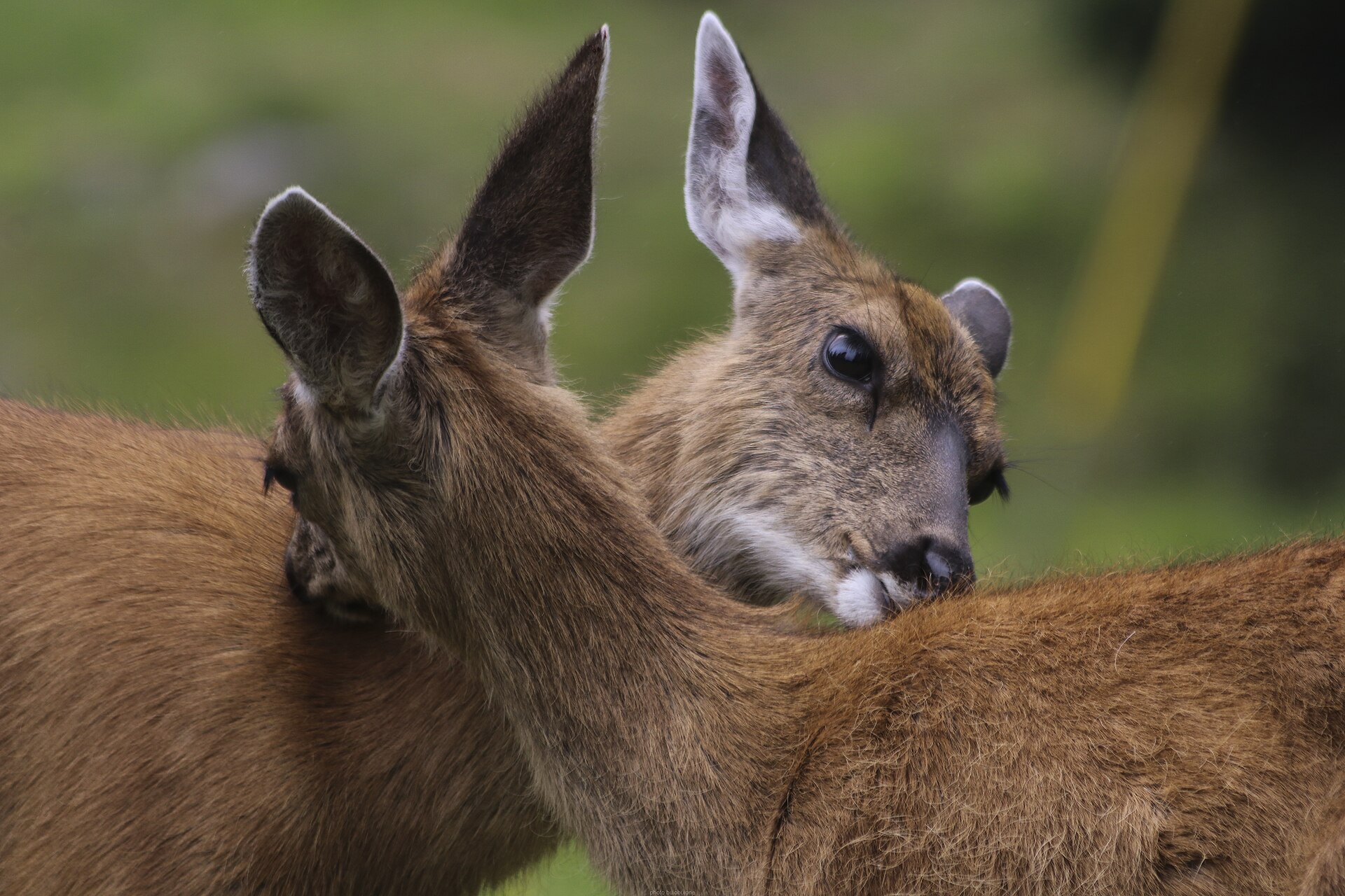 Big gameBlacktail DeerOdocoileus hemionus columbianus
 GamefishPacific SalmonOncorhynchus spp.
 Wildlife guideCanada lynxLynx canadensis
 Big gameElkCervus canadensis
 GamefishRainbow TroutOncorhynchus mykiss
 Wildlife guideBlack bearUrsus americanus
 Big gameBlack BearUrsus americanus
Maps, GPS & compass for this trip
Carry a waterproof paper map and a compass you can steer by, and treat the GPS as the backup — not the other way round. Buying links go to Amazon; Wild10 earns a commission at no cost to you.
Waterproof topo maps
- Waterproof topographic map — Redstreak (Kootenay)Amazon search for waterproof, tear-resistant topo maps covering this area.
- National Geographic Trails IllustratedThe waterproof Trails Illustrated series — check for a sheet covering this area.
- Waterproof map case & compass lanyardKeep a paper map readable in rain, spray and a swamped boat.
Fishing at Redstreak (Kootenay)
Planning to fish Redstreak (Kootenay), British Columbia? Fishing licences, open seasons and catch limits in British Columbia are set by the local wildlife authority and change every year — check the official source before you cast a line.
Do I need a fishing licence at Redstreak (Kootenay)?
- A British Columbia fishing licence is normally required for anyone over the local youth age.
- Read the current British Columbia fishing regulations for special waters, barbless-hook or catch-and-release rules.
- Clean, drain and dry boats and gear between waters to stop invasive species.
Hunting near Redstreak (Kootenay)
Thinking about hunting Redstreak (Kootenay), British Columbia? Hunting seasons, tags and draws in British Columbia are set by the wildlife authority each year. Confirm the rules for your species and unit before you go.
Is hunting allowed at Redstreak (Kootenay)?
- Confirm the land around Redstreak (Kootenay) is open to hunting and which management unit it falls in.
What do I need to hunt in British Columbia?
- A British Columbia hunting licence — most jurisdictions also require hunter education certification.
- Species tags or draw results for big game such as deer, elk, moose or bear where they occur.
- Knowledge of firearm and bow transport rules, which differ by land type and border crossing.
Redstreak and the wider Kootenay landscape
For a Redstreak trip, the broader setting is Kootenay National Park in southeastern British Columbia, within the Canadian Rockies. The park covers 1,406 square kilometres and includes parts of the Kootenay and Park mountain ranges. Its landscape spans river valleys and high mountain terrain, rising from 918 metres at the southwestern park entrance to 3,424 metres at Deltaform Mountain. Those are park-wide elevations, not a description of a Redstreak walking route. Keep that distinction in mind when choosing outings: a local stay and a journey through the wider park involve different planning. Confirm Redstreak’s exact access, facilities and available walks with the park before committing to an itinerary, rather than treating general Kootenay information as site-specific guidance.
A park shaped by a highway and two rivers
The Banff–Windermere Highway is central to Kootenay’s geography and history. The park was created in 1920 through an agreement between British Columbia and the federal government to build a highway, with land approximately eight kilometres on either side of the 94-kilometre route set aside for park purposes. Two rivers help explain the surrounding terrain. The Vermilion River lies entirely within the park, while the Kootenay River begins just outside its boundary, passes through the park and continues into the Rocky Mountain Trench before eventually joining the Columbia River. For trip planning, use the highway as the broad travel corridor, not as proof of access to every riverbank or mountain. Choose stops and walking routes only after confirming their actual access.
Timing and practical planning
Kootenay is open year-round, with its main visitor season running from June through September. That park-wide season does not establish Redstreak’s operating dates or the availability of any particular facility. Confirm local opening information and any booking, permit or entry requirements with the managing agency before departure. The park’s substantial elevation range also makes it important to plan for the terrain of each outing rather than a single forecast or valley temperature. Carry layers, weather protection, drinking water and navigation appropriate to the day. Keep a highway outing separate from mountain walking in the itinerary, and check conditions before moving between them. For a Redstreak-focused visit, settle the local access details first, then add wider park exploration as time and conditions allow.
Route options
- Banff–Windermere Highway through-journey
A road-based option following the highway corridor through the park. Plan confirmed stopping places in advance rather than assuming that rivers and mountain terrain are directly accessible from the road.
- Banff–Windermere Highway shorter return drive
For a less extensive road outing, choose a confirmed destination along the highway and return along the same corridor. Set the turnaround point after checking current access and available time; this is an itinerary option, not a named hiking route.
Sample itineraries
- One-day Kootenay orientation · 1 day
Plan a daytime visit along the Banff–Windermere Highway through Kootenay National Park. Keep activities flexible and confirm suitable stopping places with park staff. For a Redstreak-focused visit, verify its access and facilities before departure.
- Two-day mountain visit · 2 days
Use the first day to explore the park along the Banff–Windermere Highway. Reserve the second for an outdoor outing selected with current park guidance. Arrange accommodation separately; do not assume Redstreak camping is available.
Seasonal conditions
Spring
Spring; most park campgrounds open from early May
The park is open year-round, but campground availability is seasonal. Its large elevation range means conditions at the southwestern entrance should not be treated as a guide to higher terrain. Confirm Redstreak operations separately.
Summer
June through September is the main visitor season
This is the park's main travel period. Plan clothing and outings for a mountain setting with substantial elevation differences. Confirm local access and campground arrangements before committing to a Redstreak stay.
Fall
Most park campgrounds operate until late September
Do not assume camping continues throughout fall. Check Redstreak's operating status and prepare for colder mountain conditions as the season progresses.
Winter
Winter
The park remains open, but limited winter camping is available only at Dolly Varden campground. Plan conservatively for winter mountain travel rather than relying on summer camping arrangements.
| Season | Window | Conditions |
|---|---|---|
| Spring | Spring; most park campgrounds open from early May | The park is open year-round, but campground availability is seasonal. Its large elevation range means conditions at the southwestern entrance should not be treated as a guide to higher terrain. Confirm Redstreak operations separately. |
| Summer | June through September is the main visitor season | This is the park's main travel period. Plan clothing and outings for a mountain setting with substantial elevation differences. Confirm local access and campground arrangements before committing to a Redstreak stay. |
| Fall | Most park campgrounds operate until late September | Do not assume camping continues throughout fall. Check Redstreak's operating status and prepare for colder mountain conditions as the season progresses. |
| Winter | Winter | The park remains open, but limited winter camping is available only at Dolly Varden campground. Plan conservatively for winter mountain travel rather than relying on summer camping arrangements. |
Permits, fees & closures
Confirm current entry and camping requirements for Redstreak with the managing park agency.
Confirm current permits, fees, and closures with the managing agency before you go.
Hazards & regulations
- Mountain exposure: the park spans elevations from 918 m to 3,424 m. Match clothing and plans to the elevation of the outing.
- River safety: keep a safe distance from the Kootenay and Vermilion rivers, and do not assume water is safe to enter or cross.
- Seasonal camping availability: do not rely on a campground being open outside its confirmed operating season.
What to pack for Redstreak (Kootenay)
- Insulating layers
- Waterproof outer layer
- Warm hat and gloves
- Footwear suited to the planned terrain
- Drinking water
- Food for the outing
- Navigation tools
- First-aid kit
- Headlamp
- Shelter
- Sleeping bag suited to expected temperatures
- Insulated sleeping pad
- Food storage suited to park requirements
Redstreak (Kootenay) FAQ
- Where is Kootenay National Park?
- It is in southeastern British Columbia, in the Canadian Rockies. The park includes parts of the Kootenay and Park mountain ranges and borders Banff and Yoho national parks.
- When is the main visiting season?
- June through September is the main visitor season. Most park campgrounds operate from early May to late September; confirm Redstreak's schedule separately.
- Can Redstreak be used as a winter camping base?
- Do not plan on it without checking with park staff. Limited winter camping in Kootenay National Park is available only at Dolly Varden campground.
- What should be confirmed before a Redstreak stay?
- Verify the exact access, operating status, available facilities, camping requirements and reservation arrangements with the managing park agency before departure.
- Which road provides a park touring option?
- The Banff–Windermere Highway runs through the park. Confirm Redstreak directions and suitable stopping places separately rather than assuming highway access establishes campground access.
- Why plan for different conditions within the park?
- Elevations range from 918 m at the southwestern entrance to 3,424 m at Deltaform Mountain. Conditions at lower elevations may not reflect those on higher mountain outings.