



Where on earth
Satellite imagery flying in from a world view to Upper Delaware Scenic River, Worldwide. Use the + / − buttons, or click the map to zoom with your scroll wheel; drag to pan and pinch to zoom on touch.
- Region
- NY/PA, USA
- Country
- Worldwide
- Biome
- Northern hardwood (200 m)
- Best season
- May – October
- Difficulty
- moderate
- Backpacking
- Hiking
- Canoeing
- Fishing
Key takeaways
- Biome: Northern hardwood (200 m)
- Best season: May – October
- Difficulty: moderate
- Top activity: backpacking
Photos of Upper Delaware Scenic River
Topic summary
A 73-mile wild river along the NY/PA border — smallmouth bass and eagles.
Key takeaways
- Difficulty: moderate
- Best season: May – October
Intended uses
backpacking
Climate suitability
Northern hardwood (200 m)
Tools for a trip here
Picked for how, when and where you're going. Free, no signup.
- Sleep System Temp CalculatorCold nights: check your bag and pad add up to a safe sleep.
- Base Weight CalculatorEvery ounce is carried — total your kit and find your base weight.
- Pack Volume SizerSize the pack for your trip length and season.
- Water Purification MatrixTreat water from streams and lakes on trail.
- Layering CalculatorCold-season miles: layer for climbs and camp.
Plan with verified data
Upper Delaware Scenic River trip tools
How to get there
US 209 is a regional orientation route in Pennsylvania and New York. In New York, part of it follows the former Delaware and Hudson Canal corridor between Port Jervis and Kingston. In Pennsylvania, it traverses Delaware Water Gap National Recreation Area. Neither description establishes a direct approach to an Upper Delaware access point; confirm the final approach to the chosen site separately.
- Port Jervis
Regional orientation point at one end of the former Delaware and Hudson Canal corridor toward Kingston. No specific Upper Delaware launch or trail access is established here.
- Kingston
Regional road-network orientation point, not a confirmed river access. US 209 ends at US 9W north of Kingston and continues east as NY 199.
Sources: Wikipedia · Wikivoyage. Confirm road and trailhead conditions with the managing agency before you leave.
Popular pursuits at Upper Delaware Scenic River
- Backpacking
Multi-day travel with everything on your back — see the packing blocks below.
- Hiking
Day miles on marked trail, with route notes and trail links below.
- Canoeing
Paddle routes, portages, and put-ins.
- Fishing
Resident gamefish, seasons, and the water that holds them.
Animals around Upper Delaware Scenic River
 Wildlife guideBlack bearUrsus americanus
 Big gameWhitetail DeerOdocoileus virginianus
 GamefishBrook TroutSalvelinus fontinalis
 Wildlife guideNorth American beaverCastor canadensis
 Big gameBlack BearUrsus americanus
 GamefishSmallmouth BassMicropterus dolomieu
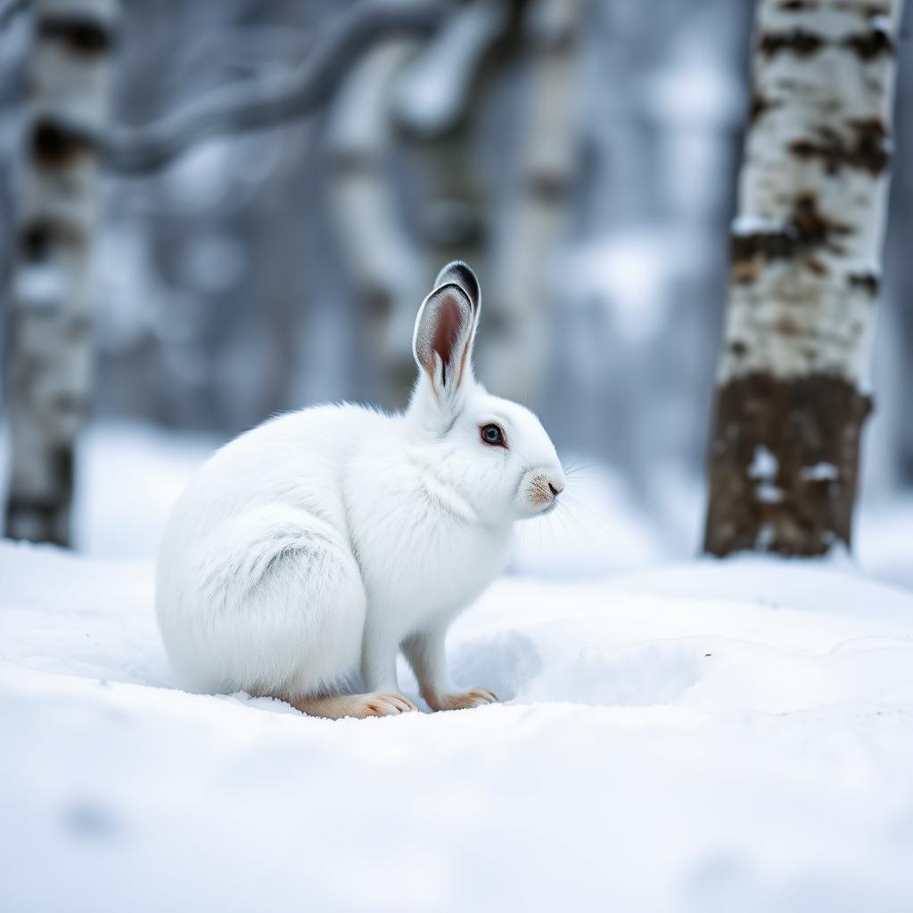 Wildlife guideSnowshoe hareLepus americanus
 Big gameWild HogSus scrofa
Maps, GPS & compass for this trip
Carry a waterproof paper map and a compass you can steer by, and treat the GPS as the backup — not the other way round. Buying links go to Amazon; Wild10 earns a commission at no cost to you.
Waterproof topo maps
- Waterproof topographic map — Upper Delaware Scenic RiverAmazon search for waterproof, tear-resistant topo maps covering this area.
- National Geographic Trails IllustratedThe waterproof Trails Illustrated series — check for a sheet covering this area.
- Waterproof map case & compass lanyardKeep a paper map readable in rain, spray and a swamped boat.
Fishing at Upper Delaware Scenic River
Planning to fish Upper Delaware Scenic River? Fishing licenses, open seasons and catch limits in Delaware are set by the local wildlife authority and change every year — check the official source before you cast a line.
Do I need a fishing license at Upper Delaware Scenic River?
- A Delaware fishing license is normally required for anyone over the local youth age.
- Read the current Delaware fishing regulations for special waters, barbless-hook or catch-and-release rules.
- Clean, drain and dry boats and gear between waters to stop invasive species.
Hunting near Upper Delaware Scenic River
Thinking about hunting Upper Delaware Scenic River? Hunting seasons, tags and draws in Delaware are set by the wildlife authority each year. Confirm the rules for your species and unit before you go.
Is hunting allowed at Upper Delaware Scenic River?
- Confirm the land around Upper Delaware Scenic River is open to hunting and which management unit it falls in.
What do I need to hunt in Delaware?
- A Delaware hunting license — most jurisdictions also require hunter education certification.
- Species tags or draw results for big game such as deer, elk, moose or bear where they occur.
- Knowledge of firearm and bow transport rules, which differ by land type and border crossing.
Planning for the Upper Delaware
The Upper Delaware Scenic River is the destination for this New York–Pennsylvania trip, but regional road geography should not be mistaken for a river-access plan. Port Jervis, the Delaware and Hudson Canal corridor, and US 209 provide useful orientation in the surrounding region. They do not, by themselves, identify a public launch, a trailhead, or a suitable river outing. Build the trip around a confirmed destination access point before choosing the final approach. For a water-based visit, confirm where entry and exit are allowed and whether the intended stretch suits the group. Keep the Upper Delaware distinct from the Delaware Water Gap National Recreation Area: a road description for the latter is not an access guide to the former.
The New York Road and Canal Corridor
US 209 offers a concrete way to understand the broader New York road network. North of Port Jervis, part of its alignment follows the defunct Delaware and Hudson Canal corridor toward Kingston. That canal connected the anthracite coal fields of northeastern Pennsylvania with industries and heating customers in New York City. The road therefore adds an industrial-history thread to a regional trip, rather than establishing a river itinerary. At its northern end, US 209 reaches US 9W north of Kingston, where the road continues east as NY 199. Use those connections for regional orientation only. A drive along the canal corridor should remain a separate option from any Upper Delaware outing until the actual river access and connecting roads have been confirmed.
Separating Regional Drives from River Outings
On the Pennsylvania side of the wider region, US 209 travels through the length of Delaware Water Gap National Recreation Area and along the southern part of the Poconos in Monroe and Carbon counties. Its broader course also includes Jim Thorpe and portions of the historic Lehigh Canal and Lehigh Valley Railroad corridors. These are useful distinctions when reading a road map: the highway links several landscapes and historic corridors, not one continuous Upper Delaware visitor route. Choose a regional drive for its own geography rather than assuming it follows the destination river section. Before committing to an outdoor itinerary, confirm the specific site, legal access, current conditions, and any applicable requirements with the agency responsible for that site.
Route options
- US 209: Port Jervis–Kingston corridor
Regional road option following parts of the former Delaware and Hudson Canal corridor. This is a road-and-history option, not a confirmed Upper Delaware river itinerary.
- US 209 through Delaware Water Gap National Recreation Area
Separate regional driving option through the recreation area. Do not treat this road corridor as an Upper Delaware access route or paddling itinerary.
Sample itineraries
- Upper Delaware day-trip framework · 1 day
Plan a single-day visit only after confirming public access and suitable activities with the managing agency. Choose a verified starting point and return plan; do not assume that a nearby highway provides river access.
- Two-day river and regional history framework · 2 days
Reserve one day for an agency-confirmed Upper Delaware visit. Use the second for a separately planned regional history outing: US 209 follows parts of the former Delaware and Hudson Canal corridor between Port Jervis and Kingston. Confirm stopping places independently; this is not a verified river-access route.
Seasonal conditions
Spring
Confirm locally before choosing dates
Check current weather, river conditions, and public access before committing to an outing. A destination-specific spring activity window is not established here.
Summer
Confirm locally before choosing dates
Confirm conditions for the intended activity rather than treating summer as assurance of suitable river conditions. Carry drinking water and weather-appropriate protection.
Fall
Confirm locally before choosing dates
Check the forecast and available daylight when setting a return time. Confirm access and services directly; no fall operating schedule is established here.
Winter
Confirm locally before choosing dates
Ask the managing agency whether the intended access points and activities are suitable for current conditions. Do not assume year-round access or services.
| Season | Window | Conditions |
|---|---|---|
| Spring | Confirm locally before choosing dates | Check current weather, river conditions, and public access before committing to an outing. A destination-specific spring activity window is not established here. |
| Summer | Confirm locally before choosing dates | Confirm conditions for the intended activity rather than treating summer as assurance of suitable river conditions. Carry drinking water and weather-appropriate protection. |
| Fall | Confirm locally before choosing dates | Check the forecast and available daylight when setting a return time. Confirm access and services directly; no fall operating schedule is established here. |
| Winter | Confirm locally before choosing dates | Ask the managing agency whether the intended access points and activities are suitable for current conditions. Do not assume year-round access or services. |
Permits, fees & closures
Confirm permit requirements, access rules, and any booking requirements with the managing agency before travel.
Confirm current permits, fees, and closures with the managing agency before you go.
Hazards & regulations
- Unverified river conditions: obtain a current assessment before planning any on-water activity.
- Weather exposure: check the forecast and carry protection appropriate to the conditions.
- Access mistakes: a road following a waterway or historic canal does not establish a public launch, trailhead, or safe stopping place.
What to pack for Upper Delaware Scenic River
- Map showing agency-confirmed public access
- Saved managing-agency contact details
- Written outing and return plan
- Drinking water
- Food
- Weather-appropriate layers
- Rain protection
- First-aid kit
- Properly fitted life jacket
- Waterproof storage for essential belongings
- Equipment appropriate to agency-confirmed river conditions
Upper Delaware Scenic River FAQ
- Does US 209 provide confirmed Upper Delaware river access?
- No Upper Delaware access point is established here. US 209 travels through Delaware Water Gap National Recreation Area in Pennsylvania, but that description does not establish access to this destination.
- Is Delaware Water Gap National Recreation Area an Upper Delaware itinerary stop?
- Do not treat it as an interchangeable destination. Confirm the boundaries and access points for Upper Delaware Scenic River before building an itinerary.
- What regional history could complement a visit?
- Parts of US 209 in New York run alongside the former Delaware and Hudson Canal, which extended from Port Jervis to Kingston. Plan this as a separate regional outing, with stopping places checked in advance.
- Are there verified paddling routes or trip distances?
- No specific launch, takeout, paddling route, or river-trip distance is established here. Obtain those details from the managing agency before arranging equipment or transportation.
- When is the best time to go?
- A reliable destination-specific season cannot be established here. Choose dates after checking current weather, river conditions, access, and the requirements of the intended activity.