



Where on earth
Satellite imagery flying in from a world view to White Mountains — AMC Hut Traverse, United States. Use the + / − buttons, or click the map to zoom with your scroll wheel; drag to pan and pinch to zoom on touch.
- Region
- New Hampshire, USA
- Country
- United States
- Biome
- Alpine krummholz (500–1,900 m)
- Best season
- June – September
- Difficulty
- moderate
- Backpacking
- Hiking
- Climbing
- Winter Camping
- Wildlife Viewing
Key takeaways
- Biome: Alpine krummholz (500–1,900 m)
- Best season: June – September
- Difficulty: moderate
- Top activity: backpacking
Photos of White Mountains — AMC Hut Traverse
Topic summary
The classic 7-hut traverse across the White Mountains — a full week of alpine hospitality.
Key takeaways
- Difficulty: moderate
- Best season: June – September
Intended uses
backpacking
Climate suitability
Alpine krummholz (500–1,900 m)
Tools for a trip here
Picked for how, when and where you're going. Free, no signup.
- Sleep System Temp CalculatorCold nights: check your bag and pad add up to a safe sleep.
- Bear Country Food StorageBear country: canister, Ursack or hang, and the local rules.
- Base Weight CalculatorEvery ounce is carried — total your kit and find your base weight.
- Pack Volume SizerSize the pack for your trip length and season.
- Water Purification MatrixTreat water from streams and lakes on trail.
Plan with verified data
White Mountains — AMC Hut Traverse trip tools
How to get there
White Mountains — AMC Hut Traverse is in New Hampshire, USA, United States. Its center point is 44.2706, -71.3033. Use these links for live turn-by-turn directions from where you are, then confirm road, trailhead and access conditions with the managing agency before you leave.
Popular pursuits at White Mountains — AMC Hut Traverse
- Backpacking
Multi-day travel with everything on your back — see the packing blocks below.
- Hiking
Day miles on marked trail, with route notes and trail links below.
- Climbing
Rock and alpine lines with approach beta.
- Winter Camping
Cold-season travel and camp craft; layering matters more than mileage.
- Wildlife Viewing
Best light, best season, and where animals move.
Animals around White Mountains — AMC Hut Traverse
 Wildlife guideBlack bearUrsus americanus
 Big gameWhitetail DeerOdocoileus virginianus
 GamefishBrook TroutSalvelinus fontinalis
 Wildlife guideNorth American beaverCastor canadensis
 Big gameBlack BearUrsus americanus
 GamefishSmallmouth BassMicropterus dolomieu
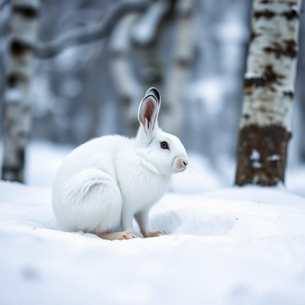 Wildlife guideSnowshoe hareLepus americanus
 Big gameWild HogSus scrofa
Maps, GPS & compass for this trip
Carry a waterproof paper map and a compass you can steer by, and treat the GPS as the backup — not the other way round. Buying links go to Amazon; Wild10 earns a commission at no cost to you.
Waterproof topo maps
- Waterproof topographic map — White Mountains — AMC Hut TraverseAmazon search for waterproof, tear-resistant topo maps covering this area.
- National Geographic Trails IllustratedThe waterproof Trails Illustrated series — check for a sheet covering this area.
- Waterproof map case & compass lanyardKeep a paper map readable in rain, spray and a swamped boat.
Fishing at White Mountains — AMC Hut Traverse
Planning to fish White Mountains — AMC Hut Traverse, New Hampshire? Fishing licenses, open seasons and catch limits in New Hampshire are set by the local wildlife authority and change every year — check the official source before you cast a line.
Do I need a fishing license at White Mountains — AMC Hut Traverse?
- A New Hampshire fishing license is normally required for anyone over the local youth age.
- Read the current New Hampshire fishing regulations for special waters, barbless-hook or catch-and-release rules.
- Clean, drain and dry boats and gear between waters to stop invasive species.
Hunting near White Mountains — AMC Hut Traverse
Thinking about hunting White Mountains — AMC Hut Traverse, New Hampshire? Hunting seasons, tags and draws in New Hampshire are set by the wildlife authority each year. Confirm the rules for your species and unit before you go.
Is hunting allowed at White Mountains — AMC Hut Traverse?
- Confirm the land around White Mountains — AMC Hut Traverse is open to hunting and which management unit it falls in.
What do I need to hunt in New Hampshire?
- A New Hampshire hunting license — most jurisdictions also require hunter education certification.
- Species tags or draw results for big game such as deer, elk, moose or bear where they occur.
- Knowledge of firearm and bow transport rules, which differ by land type and border crossing.
New England's Interior
The White Mountains are nestled in the inland portion of New England, a region characterized by its bewitching colonial villages, sublime fall foliage, and breathtaking mountain vistas. Unlike the densely populated coastal areas, inland New England offers a different kind of experience, often providing shelter from crowds and fostering a deep affinity with nature. This landlocked setting means that many recreational opportunities can be open year-round, catering to those seeking a connection with the natural world rather than the bustling seaside. While coastal areas see peak tourism from Memorial Day through Labor Day, inland destinations like the White Mountains have developed their own specific niche for travelers seeking outdoor adventures across four distinct seasons. Understanding these regional differences is key to planning a successful trip to this part of the United States, allowing visitors to appreciate the unique character of New England's interior landscapes and the opportunities they present for exploration and outdoor activity.
The Willey Range
Mount Willey is a prominent feature within the White Mountains, specifically as part of the Willey Range. This range, where Mount Willey is the southernmost and second highest peak, forms a significant portion of the western wall of Crawford Notch. The mountain itself is named after Samuel Willey, Jr. and his family, who experienced a tragic landslide in 1826 near their home in Crawford Notch. The higher elevations of Mount Willey support a spruce-fir forest ecosystem, which is typical of the natural life found throughout the White Mountains region. This area is characterized by its rugged terrain and dense forests, providing a challenging and rewarding environment for outdoor enthusiasts. The presence of such distinct geographical features and historical context adds depth to the experience of exploring this part of New New Hampshire, inviting a deeper appreciation for both its natural beauty and its past.
Hydrology and Watersheds
The White Mountains region, particularly around Mount Willey, plays a significant role in the hydrology of New England. The mountain's north and east faces drain directly into the Saco River, which then flows eastward to the Gulf of Maine at Saco, Maine. In contrast, the south and west sides of Mount Willey contribute to a different watershed. These slopes drain into the North Fork of the Pemigewasset River. This fork then joins the East Branch, subsequently flowing into the main Stem of the Pemigewasset River. From there, the waters continue into the Merrimack River, eventually reaching the Gulf of Maine at Newburyport, Massachusetts. This bifurcation of drainage patterns highlights the complex geological and geographical structure of the White Mountains, showcasing how precipitation on a single mountain can contribute to two distinct river systems that ultimately feed into the Atlantic Ocean. Understanding these watershed dynamics can enhance appreciation for the interconnectedness of the region's natural systems.
Crawford Notch and Pemigewasset Wilderness
The White Mountains offer diverse landscapes, including critical natural areas like Crawford Notch State Park and the Pemigewasset Wilderness. While Mount Willey's summit is just outside Crawford Notch State Park, it is located at the northeast corner of the Pemigewasset Wilderness. These areas represent significant conservation efforts within the White Mountains, preserving vast tracts of natural forest and mountainous terrain. The juxtaposition of a state park and a wilderness area provides varied levels of protection and access, catering to different outdoor recreation preferences. Crawford Notch itself is a historic and scenic pass through the mountains, providing dramatic views and serving as a gateway to many trails. The Pemigewasset Wilderness, known for its remote and untamed character, offers a more primitive backcountry experience. Together, these areas define the essence of the White Mountains, providing crucial habitat for wildlife and offering extensive opportunities for outdoor pursuits.
Route options
- Appalachian Trail Section
A portion of the Appalachian Trail spans through the Mount Willey area, offering a long-distance hiking experience through the spruce-fir forests of the White Mountains. This segment connects to a broader network of trails.
Seasonal conditions
Spring
Varies
New England experiences four distinct seasons. Spring brings thawing and new growth to the inland mountains.
Summer
Varies
New England experiences four distinct seasons. Inland locations like the White Mountains are often busy with visitors seeking outdoor recreation.
Fall
Varies
New England experiences four distinct seasons. Fall brings sublime foliage to the mountain vistas.
Winter
Varies
New England experiences four distinct seasons. Inland locations can remain open year-round, catering to specific types of travelers.
| Season | Window | Conditions |
|---|---|---|
| Spring | Varies | New England experiences four distinct seasons. Spring brings thawing and new growth to the inland mountains. |
| Summer | Varies | New England experiences four distinct seasons. Inland locations like the White Mountains are often busy with visitors seeking outdoor recreation. |
| Fall | Varies | New England experiences four distinct seasons. Fall brings sublime foliage to the mountain vistas. |
| Winter | Varies | New England experiences four distinct seasons. Inland locations can remain open year-round, catering to specific types of travelers. |
Permits, fees & closures
Confirm permit requirements with the managing agency.
Confirm current permits, fees, and closures with the managing agency before you go.
Hazards & regulations
- Landslides
- Extreme weather
- Getting lost
What to pack for White Mountains — AMC Hut Traverse
- Map
- Compass
- Appropriate clothing for four distinct seasons
White Mountains — AMC Hut Traverse FAQ
- What kind of forest can be found in the higher elevations of Mount Willey?
- Higher elevations of Mount Willey classify as a spruce-fir forest, which hosts natural life commonly found in the White Mountains region.
- Where does the water from Mount Willey's north and east faces drain?
- The north and east faces of Mount Willey drain directly into the Saco River, and then into the Gulf of Maine at Saco, Maine.
- Where does the water from Mount Willey's south and west sides drain?
- The south and west sides of Mount Willey drain into the North Fork of the Pemigewasset River, then into the East Branch, the Pemigewasset River, Merrimack River, and finally into the Gulf of Maine at Newburyport, Massachusetts.
- Is Mount Willey part of a wilderness area or state park?
- The summit of Mount Willey is just outside Crawford Notch State Park and is at the northeast corner of the Pemigewasset Wilderness.
- What is Mount Willey named after?
- Mount Willey is named after Samuel Willey, Jr. and his family, who were killed in a landslide in 1826 in Crawford Notch.