



Where on earth
Satellite imagery flying in from a world view to Buffalo National River, United States. Use the + / − buttons, or click the map to zoom with your scroll wheel; drag to pan and pinch to zoom on touch.
- Region
- Arkansas, USA
- Country
- United States
- Biome
- Ozark plateau river (100–300 m)
- Best season
- March – May
- Trip length
- 2 – 7 days (three river sections)
- Difficulty
- moderate
- Backpacking
- Hiking
- Rafting
- Hunting
- Desert Hiking
- Canyoneering
- Wildlife Viewing
- Canoeing
Key takeaways
- Biome: Ozark plateau river (100–300 m)
- Best season: March – May
- Trip length: 2 – 7 days (three river sections)
- Difficulty: moderate
- Top activity: backpacking
Photos of Buffalo National River
Topic summary
The first US National River — 135 miles of undammed Ozark water below 500-ft limestone bluffs.
Key takeaways
- Difficulty: moderate
- Best season: March – May
Intended uses
backpacking
Climate suitability
Ozark plateau river (100–300 m)
Tools for a trip here
Picked for how, when and where you're going. Free, no signup.
- Sleep System Temp CalculatorCold nights: check your bag and pad add up to a safe sleep.
- Base Weight CalculatorEvery ounce is carried — total your kit and find your base weight.
- Pack Volume SizerSize the pack for your trip length and season.
- Water Purification MatrixTreat water from streams and lakes on trail.
- Layering CalculatorCold-season miles: layer for climbs and camp.
Plan with verified data
Buffalo National River trip tools
How to get there
Buffalo National River is in Arkansas, USA, United States. Its center point is 36.0500, -92.7000. Use these links for live turn-by-turn directions from where you are, then confirm road, trailhead and access conditions with the managing agency before you leave.
- Fitton Cave
Also known as Beauty Cave, this cave near Buffalo National River is gated, with access closely monitored by the National Park Service. It is not an unrestricted entry point; confirm access directly before planning a visit.
- Buffalo River cliffs
The cliffs harbor 340 known caves, many supporting endangered bats. This is a landscape feature rather than a verified trailhead or river launch; establish a public access location before planning an approach.
Popular pursuits at Buffalo National River
- Backpacking
Multi-day travel with everything on your back — see the packing blocks below.
- Hiking
Day miles on marked trail, with route notes and trail links below.
- Rafting
Whitewater sections and the flows that make them run.
- Hunting
Seasons, tags, and the units that hold animals.
- Desert Hiking
Water carries and heat management drive the plan.
- Canyoneering
Narrows, downclimbs, and flash-flood timing.
Animals around Buffalo National River
 Wildlife guideBlack bearUrsus americanus
 Big gameWhitetail DeerOdocoileus virginianus
 GamefishLargemouth BassMicropterus nigricans
 Wildlife guideWild turkeyMeleagris gallopavo
 Big gameWild HogSus scrofa
 GamefishRed DrumSciaenops ocellatus
 Big gameBlack BearUrsus americanus
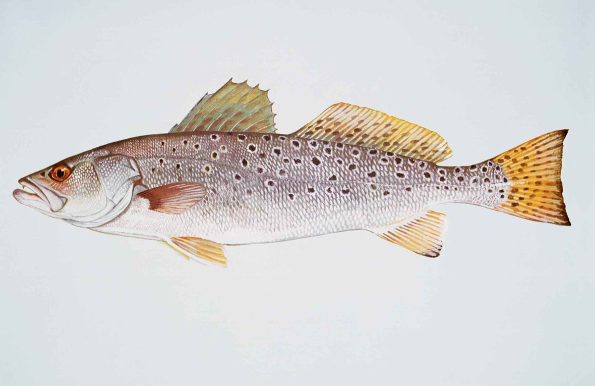 GamefishSpotted SeatroutCynoscion nebulosus
Maps, GPS & compass for this trip
Carry a waterproof paper map and a compass you can steer by, and treat the GPS as the backup — not the other way round. Buying links go to Amazon; Wild10 earns a commission at no cost to you.
Waterproof topo maps
- Waterproof topographic map — Buffalo National RiverAmazon search for waterproof, tear-resistant topo maps covering this area.
- National Geographic Trails IllustratedThe waterproof Trails Illustrated series — check for a sheet covering this area.
- Waterproof map case & compass lanyardKeep a paper map readable in rain, spray and a swamped boat.
Fishing at Buffalo National River
Planning to fish Buffalo National River, Arkansas? Fishing licenses, open seasons and catch limits in Arkansas are set by the local wildlife authority and change every year — check the official source before you cast a line.
Do I need a fishing license at Buffalo National River?
- A Arkansas fishing license is normally required for anyone over the local youth age.
- Read the current Arkansas fishing regulations for special waters, barbless-hook or catch-and-release rules.
- Clean, drain and dry boats and gear between waters to stop invasive species.
Hunting near Buffalo National River
Thinking about hunting Buffalo National River, Arkansas? Hunting seasons, tags and draws in Arkansas are set by the wildlife authority each year. Confirm the rules for your species and unit before you go.
Is hunting allowed at Buffalo National River?
- Confirm the land around Buffalo National River is open to hunting and which management unit it falls in.
What do I need to hunt in Arkansas?
- A Arkansas hunting license — most jurisdictions also require hunter education certification.
- Species tags or draw results for big game such as deer, elk, moose or bear where they occur.
- Knowledge of firearm and bow transport rules, which differ by land type and border crossing.
A river landscape with extensive caves
Buffalo National River lies in Arkansas, where the cliffs along the Buffalo River harbor 340 known caves. That underground landscape is an important part of the destination, but a known cave is not necessarily a visitor access point. Many of these caves provide habitat for endangered bats, making wildlife protection a central consideration for any cave-related outing. Plan around the distinction between seeing the river’s cliff country and entering its caves: the latter requires specific confirmation of access conditions. For an aboveground visit, establish a suitable public starting point before setting out rather than assuming that a cliff or cave location provides an approach. Keep any exploration from disturbing cave entrances or the animals that depend on them.
Fitton Cave and the scale of the underground landscape
Fitton Cave, also called Beauty Cave, is located near Buffalo National River. With 17.5 miles of mapped passage as of 2024, it is the longest known cave in Arkansas. That measurement describes a mapped cave system, not a visitor route, walking distance, or promise of accessible passage. The cave is gated, and the National Park Service closely monitors access because of white-nose syndrome, a fungal disease affecting bats. Treat Fitton as a protected underground site rather than an ordinary stop to add spontaneously to a river trip. Before making plans centered on entering it, ask the National Park Service whether access is possible and what current conservation requirements apply. Do not interpret its alternate name, Beauty Cave, as a separate destination or entrance.
Plan around habitat protection and verified access
Bat conservation should shape decisions about exploring the Buffalo River’s caves. Many of the 340 known caves in its cliffs are home to endangered bats, and white-nose syndrome is specifically associated with the close monitoring of access at Fitton Cave. A responsible plan starts with confirming which locations can be visited, not with searching for a way around a gate or finding an unverified entrance. Ask the National Park Service about current access and wildlife-protection guidance for Fitton before committing to an underground outing. Keep the aboveground portion of a trip separate from any proposed cave entry so that uncertain cave access does not determine the whole day. Leave caves and their entrances undisturbed when authorization or appropriate access information is unclear.
Route options
- Buffalo River cliffs — aboveground planning option
Consider an aboveground outing focused on the river’s cliff landscape, with a public starting point and route confirmed separately. No specific trail, launch, or connected itinerary is established here, and cave locations should not be treated as open access.
- Fitton Cave — conditional underground option
An underground visit depends on confirmation from the National Park Service, which closely monitors access to this gated cave because of white-nose syndrome. Its mapped passage length is not a visitor itinerary; confirm whether an outing is possible before planning a route.
Sample itineraries
- Buffalo River Cliff Country · 1 day
Plan a daylight visit focused on the Buffalo River and its cave-bearing cliffs. Confirm suitable public access with the National Park Service before choosing stops. Keep cave entrances undisturbed; many caves shelter endangered bats.
- River Landscape and Cave Conservation · 2 days
Spend one day exploring the river landscape from confirmed public access areas. Use the second for additional cliff viewing and learning about the area's cave ecology. Do not build the trip around entering Fitton Cave: it is gated, and the National Park Service closely monitors access.
Seasonal conditions
Spring
Check conditions before choosing spring dates.
Confirm weather and river conditions before planning outdoor time. A spring visit does not establish cave access; check with the National Park Service before approaching a gated cave.
Summer
Check conditions before choosing summer dates.
Match time outdoors, water supplies, and clothing to the forecast. Keep river and cliff plans separate from any proposed cave visit, which requires checking current access guidance.
Fall
Check conditions before choosing fall dates.
Check the forecast and available daylight when planning stops around the river landscape. Avoid disturbing bats or entering caves without confirming access guidance.
Winter
Check conditions before choosing winter dates.
Choose clothing and outing length for the forecast and daylight. Do not assume Fitton Cave is accessible in winter; its gate and closely monitored access require advance confirmation.
| Season | Window | Conditions |
|---|---|---|
| Spring | Check conditions before choosing spring dates. | Confirm weather and river conditions before planning outdoor time. A spring visit does not establish cave access; check with the National Park Service before approaching a gated cave. |
| Summer | Check conditions before choosing summer dates. | Match time outdoors, water supplies, and clothing to the forecast. Keep river and cliff plans separate from any proposed cave visit, which requires checking current access guidance. |
| Fall | Check conditions before choosing fall dates. | Check the forecast and available daylight when planning stops around the river landscape. Avoid disturbing bats or entering caves without confirming access guidance. |
| Winter | Check conditions before choosing winter dates. | Choose clothing and outing length for the forecast and daylight. Do not assume Fitton Cave is accessible in winter; its gate and closely monitored access require advance confirmation. |
Permits, fees & closures
Confirm current permit requirements and cave-access rules with the National Park Service before visiting.
Confirm current permits, fees, and closures with the managing agency before you go.
Hazards & regulations
- Cliff terrain calls for careful footing and distance from edges; do not approach an edge for a better view of a cave entrance.
- Check river conditions before approaching or entering the water, and stay within personal abilities.
- White-nose syndrome is a fungal disease affecting bats. Follow National Park Service guidance on cave access and disease prevention.
- Fitton Cave is gated and closely monitored. Do not bypass its gate or treat other cave entrances as unrestricted access.
What to pack for Buffalo National River
- Footwear with reliable traction
- Drinking water
- Weather-appropriate layers
- Sun protection
- Map for the chosen public access area
- Charged phone
- Binoculars for viewing cliffs without approaching edges
- Basic first-aid kit
Wildlife you may see
- Endangered bats inhabit many caves in the Buffalo River cliffs. Leave cave entrances undisturbed and follow cave-access guidance.
- White-nose syndrome threatens bats and is a reason access to Fitton Cave is closely monitored.
Buffalo National River FAQ
- What makes the Buffalo River cliffs distinctive?
- The cliffs harbor 340 known caves, many providing habitat for endangered bats. Cave conservation is an important part of planning a visit.
- What is Fitton Cave?
- Fitton Cave, also called Beauty Cave, lies near the Buffalo National River in Arkansas. It is Arkansas's longest known cave, with 17.5 miles of mapped passage as of 2024.
- Can a visit include entering Fitton Cave?
- Do not assume entry is available. Fitton Cave is gated, and the National Park Service closely monitors access because of white-nose syndrome. Confirm current access requirements directly before making plans.
- Is the mapped cave length a visitor route?
- No. The 17.5-mile figure describes mapped passage, not a designated visitor itinerary. It does not establish public access or a suitable route.
- How can visitors protect the area's bats?
- Avoid disturbing bats and cave entrances, respect gates, and follow National Park Service instructions on access and white-nose syndrome prevention.