



Where on earth
Satellite imagery flying in from a world view to Pharaoh Lake Wilderness, United States. Use the + / − buttons, or click the map to zoom with your scroll wheel; drag to pan and pinch to zoom on touch.
- Region
- New York, USA
- Country
- United States
- Biome
- Boreal hardwood (200–600 m)
- Best season
- May – October
- Difficulty
- moderate
- Backpacking
- Hiking
- Mountaineering
Key takeaways
- Biome: Boreal hardwood (200–600 m)
- Best season: May – October
- Difficulty: moderate
- Top activity: backpacking
Photos of Pharaoh Lake Wilderness
Topic summary
A quieter east-side Adirondack wilderness — a network of glacial lakes and ridge trails.
Key takeaways
- Difficulty: moderate
- Best season: May – October
Intended uses
backpacking
Climate suitability
Boreal hardwood (200–600 m)
Tools for a trip here
Picked for how, when and where you're going. Free, no signup.
- Sleep System Temp CalculatorCold nights: check your bag and pad add up to a safe sleep.
- Base Weight CalculatorEvery ounce is carried — total your kit and find your base weight.
- Pack Volume SizerSize the pack for your trip length and season.
- Water Purification MatrixTreat water from streams and lakes on trail.
- Layering CalculatorCold-season miles: layer for climbs and camp.
Plan with verified data
Pharaoh Lake Wilderness trip tools
How to get there
Pharaoh Lake Wilderness is in New York, USA, United States. Its center point is 43.8083, -73.5972. Use these links for live turn-by-turn directions from where you are, then confirm road, trailhead and access conditions with the managing agency before you leave.
- Adirondack Trailhead
Starting point for the Sucker Brook Trail.
- Pharaoh Lake Road Trailhead
Access point for the Pharaoh Lake Trail and Crab Pond Trail.
- New Hague Road Trailhead
Access point for the Springhill Ponds Trail and Berrymill Pond Trail.
- Putnam Pond Campground Trailhead South
Access point for the Berrymill Pond Trail and Grizzle Ocean Trail. A day use fee is required to park a vehicle here when the campground is open.
Popular pursuits at Pharaoh Lake Wilderness
- Backpacking
Multi-day travel with everything on your back — see the packing blocks below.
- Hiking
Day miles on marked trail, with route notes and trail links below.
- Mountaineering
Glacier and high-route objectives with real consequence.
Animals around Pharaoh Lake Wilderness
 Wildlife guideBlack bearUrsus americanus
 Big gameWhitetail DeerOdocoileus virginianus
 GamefishBrook TroutSalvelinus fontinalis
 Wildlife guideNorth American beaverCastor canadensis
 Big gameBlack BearUrsus americanus
 GamefishSmallmouth BassMicropterus dolomieu
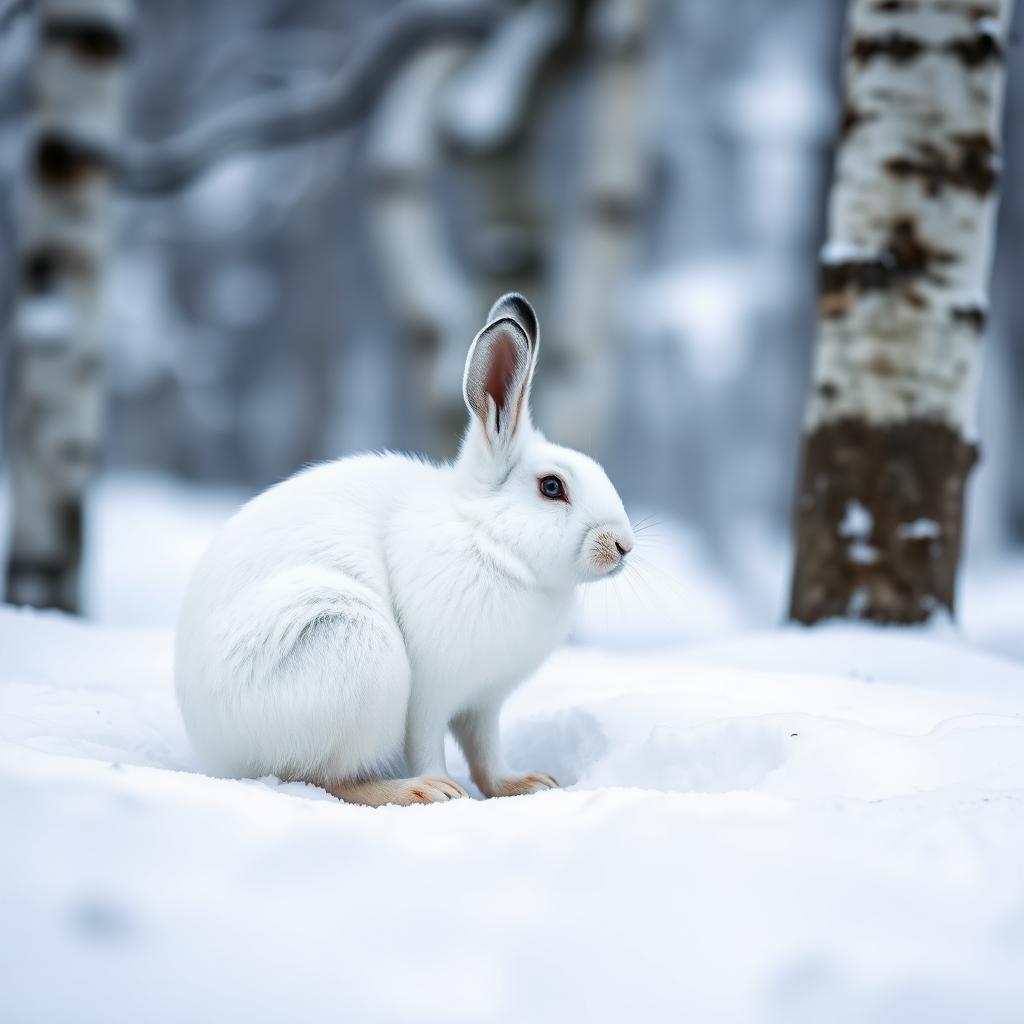 Wildlife guideSnowshoe hareLepus americanus
 Big gameWild HogSus scrofa
Maps, GPS & compass for this trip
Carry a waterproof paper map and a compass you can steer by, and treat the GPS as the backup — not the other way round. Buying links go to Amazon; Wild10 earns a commission at no cost to you.
Waterproof topo maps
- Waterproof topographic map — Pharaoh Lake WildernessAmazon search for waterproof, tear-resistant topo maps covering this area.
- National Geographic Trails IllustratedThe waterproof Trails Illustrated series — check for a sheet covering this area.
- Waterproof map case & compass lanyardKeep a paper map readable in rain, spray and a swamped boat.
Fishing at Pharaoh Lake Wilderness
Planning to fish Pharaoh Lake Wilderness, New York? Fishing licenses, open seasons and catch limits in New York are set by the local wildlife authority and change every year — check the official source before you cast a line.
Do I need a fishing license at Pharaoh Lake Wilderness?
- A New York fishing license is normally required for anyone over the local youth age.
- Read the current New York fishing regulations for special waters, barbless-hook or catch-and-release rules.
- Clean, drain and dry boats and gear between waters to stop invasive species.
- Pharaoh Lake Wilderness may add its own fishing rules on top of New York law — check the managing agency too.
Hunting near Pharaoh Lake Wilderness
Thinking about hunting Pharaoh Lake Wilderness, New York? Hunting seasons, tags and draws in New York are set by the wildlife authority each year. Confirm the rules for your species and unit before you go.
Is hunting allowed at Pharaoh Lake Wilderness?
- Hunting is prohibited or heavily restricted in many national parks, wilderness and protected areas — confirm with the Pharaoh Lake Wilderness land manager before planning a hunt, and look to surrounding public land.
What do I need to hunt in New York?
- A New York hunting license — most jurisdictions also require hunter education certification.
- Species tags or draw results for big game such as deer, elk, moose or bear where they occur.
- Knowledge of firearm and bow transport rules, which differ by land type and border crossing.
Introduction to Pharaoh Lake Wilderness
The Pharaoh Lake Wilderness encompasses 46,283 acres within the Adirondack Forest Preserve in New York. It straddles the Essex County-Warren County line, touching the towns of Schroon, Ticonderoga, Hague, and Horicon. The area is characterized by numerous lakes and ponds, particularly in its northern reaches. Pharaoh Lake itself spans 441 acres, making it one of the largest lakes in the Adirondacks completely surrounded by Forest Preserve lands. Other notable bodies of water include Crane Pond, Gooseneck Pond, and Whortleberry Pond. The landscape also features smaller mountains and hills, with Pharaoh Mountain, standing at 2,551 feet, being the highest point, located on the northwest shore of Pharaoh Lake.
Geography and Waters
This wilderness area is a significant part of the Adirondack Forest Preserve, offering a diverse natural environment. It contains 39 distinct bodies of water, totaling approximately 1,100 acres. Beyond Pharaoh Lake, other substantial ponds include 167-acre Crane Pond, 77-acre Gooseneck Pond, 66-acre Whortleberry Pond, 54-acre Berrymill Pond, 32-acre Crab Pond, 15-acre Oxshoe Pond, and 13-acre Bear Pond. The topography is varied, ranging from the prominent Pharaoh Mountain to numerous smaller peaks and rolling hills. The natural setting provides a backdrop for various outdoor pursuits throughout the year.
Hiking Opportunities
Hiking is a primary activity within the Pharaoh Lake Wilderness, with nearly 70 miles of marked foot trails. Popular destinations include the summit of Pharaoh Mountain and the shores of Pharaoh Lake, as well as various other ponds. The area offers a range of trail difficulties and lengths. Examples include the 7.5-mile Sucker Brook Trail, the 3.3-mile Pharaoh Lake Trail, and the 6.0-mile Pharaoh Lake Loop Trail which encircles the namesake lake. Other trails lead to specific ponds, such as the 1.4-mile Crab Pond Trail and the 6.0-mile Springhill Ponds Trail. The Pharaoh Mountain Trail offers a challenging ascent to the highest point in the wilderness.
Trail Network Overview
The wilderness boasts an extensive trail network catering to various hiking preferences. The Sucker Brook Trail, starting from the Adirondack Trailhead, spans 7.5 miles to the Pharaoh Lake outlet, featuring significant elevation changes. The Pharaoh Lake Trail offers a 3.3-mile route from the Pharaoh Lake Road Trailhead. For those seeking a longer exploration of the lake, the 6.0-mile Pharaoh Lake Loop Trail provides a relatively gentle journey around its shoreline, connecting to many other paths. Shorter trails like the 1.4-mile Lost Pond Trail and the 0.2-mile Watch Rock Lean-to Spur Trail offer access to specific points of interest. Several trails connect to external trailheads, including the 5.5-mile Berrymill Pond Trail and the 5.6-mile Grizzle Ocean Trail, both linking to the Putnam Pond Campground.
Route options
- Sucker Brook Trail7.5 miles
Extends from the Adirondack Trailhead to the intersection of trails at the outlet of Pharaoh Lake. The trail ascends 510 feet in the first four miles, then descends 375 feet before climbing 300 feet. The final section involves further ascents and descents.
- Pharaoh Lake Trail3.3 miles
Extends from the Pharaoh Lake Road Trailhead to the Pharaoh Lake outlet. It ascends 235 feet for 1.1 miles with gentle rises and falls on either end.
- Pharaoh Lake Loop Trail6.0 miles
Encircles Pharaoh Lake, with gentle ascents and descents less than 100 feet. Many other trails connect to this loop.
- Pharaoh Mountain Trail3.8 miles
Connects Pharaoh Lake Trail and Crane Pond Trail. It ascends 1,355 feet in 1.2 miles to the summit and then descends 1,405 feet in 2.6 miles to Crane Pond.
- Springhill Ponds Trail6.0 miles
Extends from the New Hague Road Trailhead to the Pharaoh Lake Loop Trail. It ascends 710 feet in the first 1.1 miles and descends 885 feet in the last 3.5 miles, with smaller elevation changes in between.
Sample itineraries
- Pharaoh Lake Exploration · 2 days
Hike the Pharaoh Lake Trail from the Pharaoh Lake Road Trailhead, connecting to the Pharaoh Lake Loop Trail for a partial or full circuit of the lake. Explore the shoreline and consider side trips to connected trails. Overnight at a designated campsite or lean-to. The next day, explore additional sections of the loop or other nearby trails before returning to the trailhead.
- Pharaoh Mountain Summit Adventure · 2 days
Hike the Pharaoh Mountain Trail, connecting from either the Pharaoh Lake Trail or the Crane Pond Trail, to reach the summit of Pharaoh Mountain. This route involves significant elevation gain. Consider an overnight stay to allow for ample time to enjoy the views and explore the surrounding area before descending the following day.
Seasonal conditions
Spring
Year-round
Open for recreation year-round. General backcountry and seasonal conditions are available for the East Central Adirondacks.
Summer
Year-round
Open for recreation year-round. General backcountry and seasonal conditions are available for the East Central Adirondacks.
Fall
Year-round
Open for recreation year-round. General backcountry and seasonal conditions are available for the East Central Adirondacks.
Winter
Year-round
Open for recreation year-round. General backcountry and seasonal conditions are available for the East Central Adirondacks. The Oxshoe Pond Lean-to is closed until further notice.
| Season | Window | Conditions |
|---|---|---|
| Spring | Year-round | Open for recreation year-round. General backcountry and seasonal conditions are available for the East Central Adirondacks. |
| Summer | Year-round | Open for recreation year-round. General backcountry and seasonal conditions are available for the East Central Adirondacks. |
| Fall | Year-round | Open for recreation year-round. General backcountry and seasonal conditions are available for the East Central Adirondacks. |
| Winter | Year-round | Open for recreation year-round. General backcountry and seasonal conditions are available for the East Central Adirondacks. The Oxshoe Pond Lean-to is closed until further notice. |
Permits, fees & closures
Confirm permit and reservation requirements with the managing agency. General information regarding backcountry and seasonal conditions, specific notices about closures, and state land use regulations are available.
Fees: Free, except for a day use fee required to park a vehicle at the Putnam Pond Campground when it is open.
Official source: Pharaoh Lake Wilderness - NYSDEC · Verified September 18, 2026