



Where on earth
Satellite imagery flying in from a world view to Apostle Islands Sea Kayak, United States. Use the + / − buttons, or click the map to zoom with your scroll wheel; drag to pan and pinch to zoom on touch.
- Region
- Wisconsin, USA
- Country
- United States
- Biome
- Great Lakes sandstone islands (180 m)
- Best season
- June – September
- Difficulty
- moderate
- Backpacking
- Hiking
- Canoeing
- Kayaking
- Fishing
Key takeaways
- Biome: Great Lakes sandstone islands (180 m)
- Best season: June – September
- Difficulty: moderate
- Top activity: backpacking
Photos of Apostle Islands Sea Kayak
Topic summary
22 Lake Superior islands with sea caves, sandstone beaches, and 20+ backcountry campsites.
Key takeaways
- Difficulty: moderate
- Best season: June – September
Intended uses
backpacking
Climate suitability
Great Lakes sandstone islands (180 m)
Tools for a trip here
Picked for how, when and where you're going. Free, no signup.
- Sleep System Temp CalculatorCold nights: check your bag and pad add up to a safe sleep.
- Base Weight CalculatorEvery ounce is carried — total your kit and find your base weight.
- Pack Volume SizerSize the pack for your trip length and season.
- Water Purification MatrixTreat water from streams and lakes on trail.
- Layering CalculatorCold-season miles: layer for climbs and camp.
Plan with verified data
Apostle Islands Sea Kayak trip tools
How to get there
The park’s two mainland kayak launches are Meyers Beach, off Highway 13 between Cornucopia and Red Cliff, and Little Sand Bay Visitor Center, reached via Old Highway K and Little Sand Bay Road. Meyers Beach has stairs down to the beach. Additional launching areas are available in nearby towns outside park boundaries.
- Meyers Beach
Mainland launch off Highway 13 between Cornucopia and Red Cliff, providing access to the mainland sea-cave area. Stairs lead down to the beach. Parking costs $5.
- Little Sand Bay Visitor Center
Mainland kayak launch west of the harbor, off Old Highway K and Little Sand Bay Road. Parking is free.
Sources: nps.gov · Wikipedia · Wikivoyage. Confirm road and trailhead conditions with the managing agency before you leave.
Popular pursuits at Apostle Islands Sea Kayak
- Backpacking
Multi-day travel with everything on your back — see the packing blocks below.
- Hiking
Day miles on marked trail, with route notes and trail links below.
- Canoeing
Paddle routes, portages, and put-ins.
- Kayaking
Sheltered and open-water paddling lines.
- Fishing
Resident gamefish, seasons, and the water that holds them.
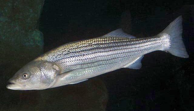
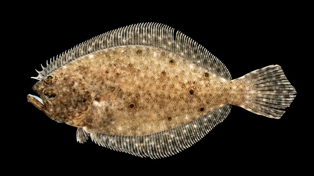
Animals around Apostle Islands Sea Kayak






Maps, GPS & compass for this trip
Carry a waterproof paper map and a compass you can steer by, and treat the GPS as the backup — not the other way round. Buying links go to Amazon; Wild10 earns a commission at no cost to you.
Waterproof topo maps
- Waterproof topographic map — Apostle Islands Sea KayakAmazon search for waterproof, tear-resistant topo maps covering this area.
- National Geographic Trails IllustratedThe waterproof Trails Illustrated series — check for a sheet covering this area.
- Waterproof map case & compass lanyardKeep a paper map readable in rain, spray and a swamped boat.
Fishing at Apostle Islands Sea Kayak
Planning to fish Apostle Islands Sea Kayak, Wisconsin? Fishing licenses, open seasons and catch limits in Wisconsin are set by the local wildlife authority and change every year — check the official source before you cast a line.
Do I need a fishing license at Apostle Islands Sea Kayak?
- A Wisconsin fishing license is normally required for anyone over the local youth age.
- Read the current Wisconsin fishing regulations for special waters, barbless-hook or catch-and-release rules.
- Clean, drain and dry boats and gear between waters to stop invasive species.
Hunting near Apostle Islands Sea Kayak
Thinking about hunting Apostle Islands Sea Kayak, Wisconsin? Hunting seasons, tags and draws in Wisconsin are set by the wildlife authority each year. Confirm the rules for your species and unit before you go.
Is hunting allowed at Apostle Islands Sea Kayak?
- Confirm the land around Apostle Islands Sea Kayak is open to hunting and which management unit it falls in.
What do I need to hunt in Wisconsin?
- A Wisconsin hunting license — most jurisdictions also require hunter education certification.
- Species tags or draw results for big game such as deer, elk, moose or bear where they occur.
- Knowledge of firearm and bow transport rules, which differ by land type and border crossing.
Sea caves and island shorelines
Apostle Islands National Lakeshore offers sea kayaking on Lake Superior off Wisconsin’s Bayfield Peninsula, with 21 park islands available to explore by paddle. Sand beaches, sandstone sea caves, lighthouse visits, hiking and overnight camping give trips several possible focuses beyond time on the water. The main sea-cave areas are along the mainland near Meyers Beach and on Sand Island and Devils Island. At Devils Island, red and gold sandstone formations wrap around the northern shore, with layered rock and ancient ripple patterns visible in the bedrock. These are places to approach in calm conditions, not destinations to reach regardless of the forecast. A mainland cave outing and an island trip require different planning, but both put paddlers on Lake Superior. Choose the day’s objective around conditions and the abilities of the whole group.
Cold water and reflected waves
Lake Superior’s cold water is a central concern even during summer. Average water temperatures in May and June are in the 40s Fahrenheit, and late-summer surface temperatures rarely exceed 60°F. Rough seas, fog and sudden squalls can change a paddle quickly. At the caves, wind waves and boat wakes strike the rock and rebound, creating confused water; fatal kayaking accidents have occurred here. Avoid the caves in rough conditions, stay with the group and do not paddle there alone. Wear a personal flotation device, wetsuit and spray skirt, and carry a whistle, bilge pump and weather radio. Check nearshore and offshore marine forecasts before launching and keep watching conditions underway. Open-cockpit kayaks, sit-on-top kayaks, canoes, small open boats and paddleboards are not recommended for cave visits. In an emergency, call 911 or use marine channel 16 and give an exact location.
Choosing support and keeping alternatives
Beginners should consider a guided trip rather than treating the caves as an independent first outing. Authorized outfitters offer half-day and full-day trips, safety classes and equipment rentals; the park itself does not run guided kayaking tours. Authorized water taxis can also transport paddlers and equipment to park locations. For overnight travel, all camping within the National Lakeshore requires a camping permit, and reservations can be made through Recreation.gov. Review campsite descriptions before building an itinerary. Keep an alternative paddle in mind when Lake Superior is unsuitable: Long Lake offers quiet water, while Bark Bay Slough State Natural Area has a coastal barrier spit and lagoon. Siskiwit Lake is another option on the Bayfield Peninsula. Chequamegon Bay near Ashland and Washburn can be somewhat protected depending on the wind, but still requires a fresh assessment of conditions.
Route options
- Meyers Beach mainland sea caves
Launch at Meyers Beach for a paddle along the mainland cave formations. Assess wind and waves before setting out; reflected waves against the cliffs make rough conditions dangerous. Stay together and avoid the caves when conditions deteriorate.
- Sand Island sea caves
Make Sand Island’s sandstone caves the focus of an island paddle. Plan travel around marine conditions and group ability, with an authorized outfitter or water taxi as possible sources of trip support.
- Devils Island northern shore
Explore the sandstone formations and caves around the island’s northern shore only in calm conditions. Heavy surf strikes the caves forcefully. Ashore, trails connect the light station with eastern and western landings and the southern boathouse and dock.
- Long Lake alternative paddle
Choose this quiet, 32-acre lake in Bayfield County as an alternative when Lake Superior conditions do not suit the group. Fishing and birdwatching are possible focuses for the outing.
Sample itineraries
- Meyers Beach sea caves · 1 day
Launch from Meyers Beach for a conditions-dependent visit to the mainland sea caves. Beginners should book an authorized guided trip. Stay together and avoid the caves in rough water. If Lake Superior conditions are unsuitable, consider Long Lake instead, after checking local conditions.
- Island paddling and camping · 2 days
Arrange an authorized water taxi to an island location suited to the group's skills and reserved campsite. Spend two days combining conditions-dependent shoreline paddling with beaches and hiking. Confirm transport logistics before booking camping, and keep the plan flexible for changing lake conditions.
- Inland alternative at Long Lake · 1 day
Choose Long Lake in Bayfield County when Lake Superior is unsuitable for your group. This 32-acre lake offers quiet-water paddling, fishing, and bird watching. Evaluate conditions there too; an inland alternative is not a reason to skip weather checks or safety equipment.
Seasonal conditions
Spring
May
Average water temperatures in May and June are in the 40s°F. Cold-water protection and practiced rescue skills matter even when the air feels comfortable. Check marine forecasts and evaluate wind and waves before launching.
Summer
June through late summer
June water temperatures average in the 40s°F, and late-summer surface temperatures rarely exceed 60°F. Sea caves at Devils Island, Sand Island, and near Meyers Beach can be viewed by boat when conditions allow. Warm weather does not remove cold-water risk.
Fall
Conditions-dependent
Base paddling decisions on current marine forecasts rather than the calendar. Lake Superior's cold water, fog, rough seas, and sudden squalls demand conservative planning. Keep an alternative inland paddling plan.
Winter
Conditions-dependent
The sea caves also attract winter visitors, but winter sightseeing should not be treated as a kayaking plan. Confirm current access and safety conditions with Apostle Islands National Lakeshore before traveling.
| Season | Window | Conditions |
|---|---|---|
| Spring | May | Average water temperatures in May and June are in the 40s°F. Cold-water protection and practiced rescue skills matter even when the air feels comfortable. Check marine forecasts and evaluate wind and waves before launching. |
| Summer | June through late summer | June water temperatures average in the 40s°F, and late-summer surface temperatures rarely exceed 60°F. Sea caves at Devils Island, Sand Island, and near Meyers Beach can be viewed by boat when conditions allow. Warm weather does not remove cold-water risk. |
| Fall | Conditions-dependent | Base paddling decisions on current marine forecasts rather than the calendar. Lake Superior's cold water, fog, rough seas, and sudden squalls demand conservative planning. Keep an alternative inland paddling plan. |
| Winter | Conditions-dependent | The sea caves also attract winter visitors, but winter sightseeing should not be treated as a kayaking plan. Confirm current access and safety conditions with Apostle Islands National Lakeshore before traveling. |
Permits, fees & closures
Camping permits are required for all camping within Apostle Islands National Lakeshore.
Fees: Meyers Beach parking costs $5. Parking at Little Sand Bay Visitor Center is free. Camping carries a fee.
Reservations: Camping reservations can be made at Recreation.gov. Review campsite descriptions before selecting an overnight destination.
Official source: Kayaking - Apostle Islands National Lakeshore (U.S. National Park ... · Verified September 18, 2026
Hazards & regulations
- Cold-water immersion: average May and June water temperatures are in the 40s°F, and late-summer surface temperatures rarely exceed 60°F.
- Reflected waves at sea caves create confused water as wind-driven waves and boat wakes rebound from rock walls. Fatal kayaking accidents have occurred there.
- Rough seas and sudden squalls can change a trip quickly. Evaluate wind and waves before launching and continue monitoring conditions.
- Fog can reduce visibility and complicate navigation. Carry maps and a compass, and stay with the group.
- Sea kayaks sit low and can be difficult for boaters to see. Wear bright clothing and use a paddle or flag to attract attention.
What to pack for Apostle Islands Sea Kayak
- Sea kayak appropriate for Lake Superior
- Personal flotation device
- Wetsuit
- Spray skirt
- Bright clothing
- Whistle
- Bilge pump
- Spare paddle
- Tow line
- Weather radio
- Marine radio for emergency channel 16
- Maps and compass
- First aid kit
- Rain gear
- Lighting device
- Insect repellent
- Waterproof matches
- Dry storage containers
Wildlife you may see
- Bird watching is an option at Bark Bay Slough State Natural Area, Long Lake, Siskiwit Lake, and Chequamegon Bay.
Apostle Islands Sea Kayak FAQ
- Where are the mainland kayak launches?
- Meyers Beach is off Highway 13 between Cornucopia and Red Cliff, with stairs down to the beach. Little Sand Bay Visitor Center has a launch west of the harbor, reached via Old Highway K and Little Sand Bay Road.
- Is this a suitable trip for beginners?
- Beginners should choose an authorized guided trip rather than exceed their skills on Lake Superior. Outfitters offer half-day and full-day trips, safety classes, and rentals. The national lakeshore does not run guided kayaking tours.
- Can a recreational kayak or paddleboard be used at the caves?
- Small open boats, canoes, open-cockpit kayaks, sit-on-top kayaks, and paddleboards are not recommended at the sea caves. Use suitable sea-kayaking equipment, wear immersion protection, and do not visit the caves alone.
- Where can sea caves be seen?
- Sea caves can be viewed by boat at Devils Island, Sand Island, and on the mainland near Meyers Beach. Devils Island's caves wrap around its northern shore. Avoid cave visits when conditions are rough.
- What are alternatives when Lake Superior is rough?
- Consider Bark Bay Slough State Natural Area, Long Lake, or Siskiwit Lake. Chequamegon Bay near Ashland and Washburn can offer some protection depending on wind direction and conditions. Assess each alternative before entering the water.
- How is emergency help contacted?
- Call 911 or use marine channel 16, monitored by the U.S. Coast Guard and Park Rangers. Give your location clearly. For non-emergencies, park headquarters in Bayfield can be reached at (715) 779-3397.