



Where on earth
Satellite imagery flying in from a world view to Sylvania Wilderness (MI), United States. Use the + / − buttons, or click the map to zoom with your scroll wheel; drag to pan and pinch to zoom on touch.
- Region
- Michigan, USA
- Country
- United States
- Biome
- Northern hardwood & hemlock lake country (500–600 m)
- Best season
- May – October
- Trip length
- 2–7 days
- Difficulty
- moderate
- Canoeing
- Portaging
- Backpacking
- Hiking
- Bushcraft
- Camping
- Winter Camping
- Snowshoeing
Key takeaways
- Biome: Northern hardwood & hemlock lake country (500–600 m)
- Best season: May – October
- Trip length: 2–7 days
- Difficulty: moderate
- Top activity: canoe trips
- Key hazard: Cold-water immersion — spring and autumn lake temperatures will incapacitate an unprepared swimmer long before shore. Wear the PFD, always.
Photos of Sylvania Wilderness (MI)
Topic summary
Thirty-four motor-free lakes inside old-growth hemlock and sugar maple — the Upper Peninsula's quietest paddle-and-portage wilderness.
Key takeaways
- Difficulty: moderate
- Trip length: 2–7 days
- Best season: May – October
- Permit required
- Clark Lake day loop — launch at the Clark Lake landing, work the shoreline under the old-growth hemlock, and return the same day. The easiest introduction and the best option with kids.
- Clark → Loon → Deer Island chain — a short-portage overnight that puts you on quiet water within an hour of the landing.
Intended uses
- canoe trips
- backpacking
- bushcraft camping
- cold weather
Climate suitability
Northern hardwood & hemlock lake country (500–600 m)
Verification notes
Permit source: Sylvania Wilderness campsite permits. Last verified September 15, 2026.
Tools for a trip here
Picked for how, when and where you're going. Free, no signup.
- Water Purification MatrixLake water needs treating — compare filters, chemicals and boiling.
- Layering CalculatorCold water: dress for immersion, not just the air temperature.
- Sleep System Temp CalculatorCold nights: check your bag and pad add up to a safe sleep.
- Bear Country Food StorageBear country: canister, Ursack or hang, and the local rules.
- Base Weight CalculatorEvery ounce is carried — total your kit and find your base weight.
Plan with verified data
Sylvania trip tools
Plan
Before you go
Route options
- Clark Lake day loop — launch at the Clark Lake landing, work the shoreline under the old-growth hemlock, and return the same day. The easiest introduction and the best option with kids.
- Clark → Loon → Deer Island chain — a short-portage overnight that puts you on quiet water within an hour of the landing.
- Crooked Lake entrance route — the second main access, opening the eastern lakes and a different set of campsites when Clark is booked out.
- Multi-lake wilderness traverse — link four to six of the 34 lakes across several days of paddle-and-carry travel, sleeping at a different reserved site each night.
- Shoreline hiking loops — the trail system around Clark Lake and the recreation area lets you walk the old-growth without a boat at all.
Sample itineraries
- Weekend paddle-in · 2 daysDrive to Watersmeet, pick up your permit, launch at Clark Lake in the afternoon and camp one or two lakes in. Paddle out mid-morning on day two. The lowest-commitment way to see the old-growth shoreline.
- Classic four-day lake chain · 4 daysThree reserved campsites on three different lakes, with short portages between them. Fish the mornings, swim or hike the afternoons, and work back toward the landing on the last day.
- Slow week in the hemlocks · 7 daysBase-camp two or three nights at a time on interior lakes and use day paddles to reach the far corners. This is the bushcraft-and-fishing version of the trip rather than a mileage trip.
- Crooked Lake east-side overnighter · 3 daysLaunch at the Crooked Lake landing, work the eastern lakes with one reserved campsite each night, and loop back. The backup plan for when the Clark Lake side is booked out.
Seasonal conditions
| Season | Window | Conditions |
|---|---|---|
| Spring | Ice-out (typically late April) – early June | Cold water, high water in the portage low spots, and the quietest lakes of the year. Black flies and mosquitoes build through late May. Dress for immersion — a spring capsize on a 45°F lake is the most serious risk in Sylvania. |
| Summer | Mid-June – August | Warm, stable paddling weather and the busiest stretch on the entrance lakes. Afternoon thunderstorms roll through fast; open water on Crooked and Clark can build a real chop in wind. Campsites on the popular lakes go first on summer weekends. |
| Autumn | September – mid-October | The best window here. Bugs are gone, the maples and yellow birch turn through late September, and the water is still paddleable. Nights drop below freezing by early October; bring a real sleeping bag rather than a summer quilt. |
| Winter | December – March | Lakes freeze and the area shifts to snowshoe and ski travel on unplowed roads and trails. No paddling, no water access, and deep lake-effect snow off Lake Superior. Treat it as a self-supported winter trip. |
Year-round trip planner
Sylvania changes dramatically across twelve months. Choose a month for likely conditions, realistic activities and the hazards that should shape your plan.
Peak paddling begins
Sylvania in June
Long days, warming water and generally stable weather make June the start of prime canoe-camping season. Water levels are usually high enough to clear most rocks.
Access plan
Reserve campsites early through Recreation.gov; popular lakes fill fast. Pack bug protection and a head net for calm mornings and evenings.
Best uses
- Multi-day canoe loops
- Family paddle trips
- Long evening photography
Plan around
- Afternoon thunderstorms
- Mosquitoes and black flies
- Busy lakes on weekends
- Cold nights after clear skies
Year-round essentials
- Offline map, compass and satellite messenger
- Water purification and backup fire kit
- Headlamp and spare batteries
- Insulating layers plus rain/wind shell
- Bear-safe food storage system
- First-aid kit with blister and wound supplies
Warm-season extras
- Bug head net and effective repellent
- Sunscreen and quick-dry long sleeves
- Dry bag or portage pack system
- Swim-ready footwear with toe protection
- Fishing license and species regulations
Cold-season extras
- Insulated waterproof boots plus spare dry socks
- Snowshoes or skis matched to current snow depth
- Emergency bivy and high-calorie food
- Traction aids for icy portages
- Cold-weather vehicle kit and full fuel tank
Check before leaving
- Ottawa National Forest current conditions
- Ottawa National Forest winter recreation
- Active closures and forest orders
- Recreation.gov permits and campsites
Never treat calendar month as proof of safe ice or calm water. Verify locally, carry rescue equipment and choose a route that matches the actual conditions you find.
How to get there
Sylvania Wilderness is in Ottawa National Forest near Watersmeet, Michigan. Confirm driving directions to the Sylvania Entrance Station and the appropriate departure point for the selected campsite with Ottawa National Forest before traveling.
- Sylvania Entrance Station
Staffed information and registration stop where visitors can obtain wilderness permits, watch the orientation video, and ask about trip plans. Confirm current staffed hours before arrival.
- Kiosk outside the Sylvania Entrance Station
Self-registration point for visitors arriving outside staffed hours. This is at the entrance station, not a separate trailhead or boat launch.
Sources: recreation.gov · Wikipedia · Wikivoyage. Confirm road and trailhead conditions with the managing agency before you leave.
Permits & closures
Overnight trips into the Sylvania Wilderness require a camping permit for a specific designated campsite, reserved through Recreation.gov. Sites are individually numbered on named lakes, so you book the lake you actually intend to sleep on. Day use is also fee-managed at the recreation area. Fees change season to season — confirm the current amount on the Recreation.gov listing before you drive up.
Official permit source: Sylvania Wilderness campsite permits · Verified 2026-09-15
Safety & stewardship
- Cold-water immersion — spring and autumn lake temperatures will incapacitate an unprepared swimmer long before shore. Wear the PFD, always.
- Wind on the big water — Crooked and Clark can build whitecaps that a loaded canoe should not be crossing. Hug the shoreline and wait it out.
- Sudden thunderstorms — open lakes are the worst place to be caught. Watch the western sky and get off the water early.
- Black bears — the Upper Peninsula population is healthy. Hang food or use a canister; never keep food in the tent.
- Bugs — black flies in late May and June, mosquitoes all summer. A head net is not optional in early season.
- No cell coverage on most interior lakes — plan on being out of contact and leave a written itinerary with someone at home.
- Widowmakers in the old-growth — dead hemlock and maple limbs come down in wind. Look up before you pitch a tent.
Water: Sylvania's lakes are exceptionally clear, but all drinking water should still be filtered or boiled. Most parties draw from deep open water well off the campsite shoreline rather than from the shallows.
Wildlife: Common loons nest on nearly every lake and calling starts at dusk. Bald eagles and osprey work the shorelines, white-tailed deer are everywhere, and beaver, otter, mink and pine marten are all regular sightings. Black bear are present; wolves are in the wider Ottawa National Forest and are heard far more often than seen.
Emergency planning: Nearest services are in Watersmeet; the nearest hospitals are in Ironwood and Iron River, both roughly an hour or more by road. There is no reliable cell signal on the interior lakes — carry a satellite messenger for any multi-day trip, and tell someone your exact campsite reservations and take-out time.
Leave No Trace: This is designated wilderness: no motors, no wheeled carts on the portages, and camping only at the numbered designated sites. Use existing fire rings where they exist, pack out every scrap including fish remains where required, and keep group sizes small. Special catch-and-release and size regulations apply to Sylvania's fishery — read the current Michigan DNR rules and the posted Sylvania-specific regulations before you keep anything.
Popular pursuits at Sylvania Wilderness (MI)
- Canoeing
Paddle routes, portages, and put-ins.
- Portaging
Carries between lakes — the real work of a canoe route.
- Backpacking
Multi-day travel with everything on your back — see the packing blocks below.
- Hiking
Day miles on marked trail, with route notes and trail links below.
- Bushcraft
Fire, shelter, and cutting-tool work in this landscape.
- Camping
Established and dispersed camps within reach of the trailhead.
Animals around Sylvania Wilderness (MI)
 Wildlife guideBlack bearUrsus americanus
 Big gameWhitetail DeerOdocoileus virginianus
 GamefishBrook TroutSalvelinus fontinalis
 Wildlife guideNorth American beaverCastor canadensis
 Big gameBlack BearUrsus americanus
 GamefishSmallmouth BassMicropterus dolomieu
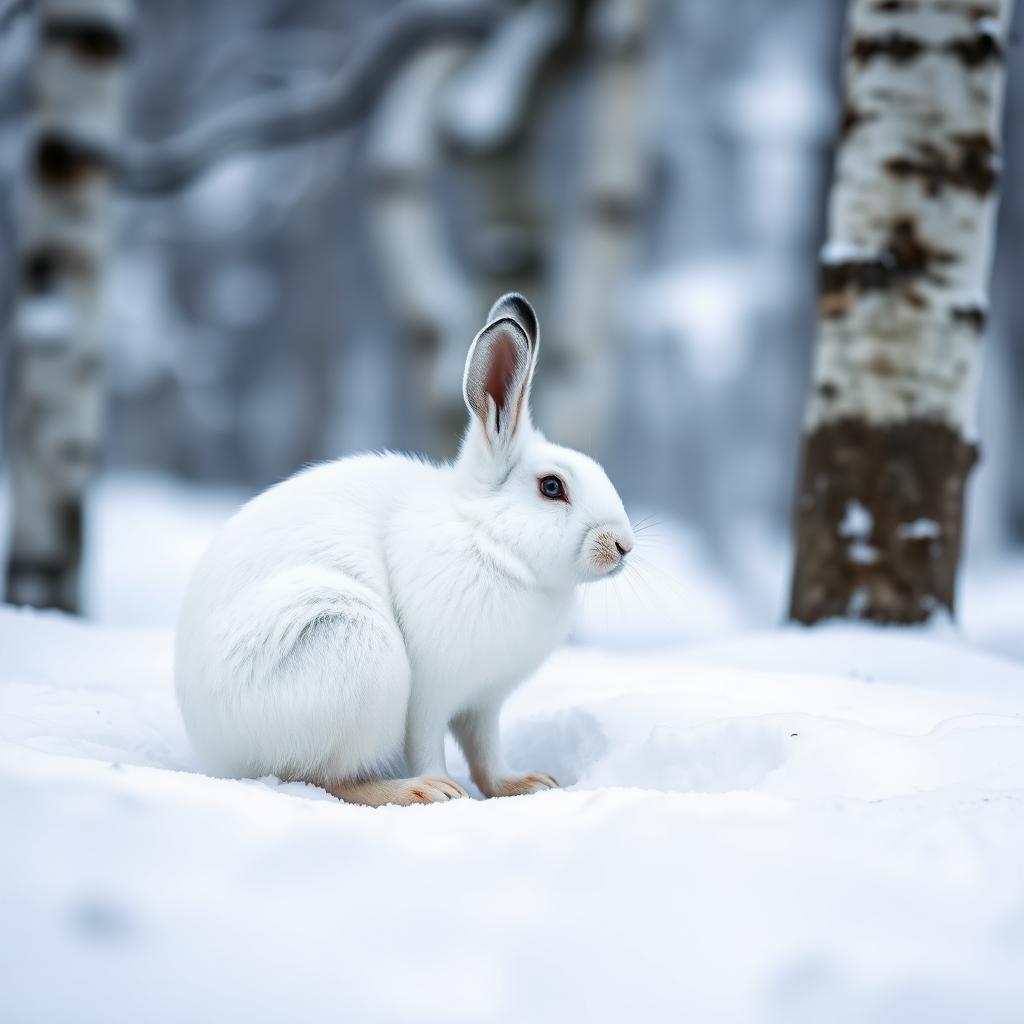 Wildlife guideSnowshoe hareLepus americanus
 Big gameWild HogSus scrofa
Recommended skills
Packing checklist
- Canoe or kayak with a portage yoke
- PFD worn, not stowed
- Spare paddle
- Dry bags for sleep system and clothing
- Bailer and sponge
- 50 ft of throw line
- Freestanding tent (campsite pads are uneven)
- Sleeping bag rated well below the forecast low
- Sleeping pad
- Stove and fuel
- Water filter plus backup treatment
- Bear canister or hang kit with 50 ft of cord
- Rain shell and rain pants
- Insulating midlayer
- Quick-dry paddling clothes
- Camp shoes plus wet-footed portage shoes
- Warm hat and gloves outside midsummer
- Head net in May and June
- Waterproof Sylvania lake map and compass
- Satellite messenger
- Headlamp and spare batteries
- First aid kit
- Printed campsite reservation
- Repair kit — duct tape, cord, multi-tool
- Light spinning or fly setup
- Barbless hooks for catch-and-release
- Current Michigan fishing license
- Landing net
Recommended gear
Maps, GPS & compass for this trip
Carry a waterproof paper map and a compass you can steer by, and treat the GPS as the backup — not the other way round. Buying links go to Amazon; Wild10 earns a commission at no cost to you.
Waterproof topo maps
- Waterproof topographic map — Sylvania Wilderness (MI)Amazon search for waterproof, tear-resistant topo maps covering this area.
- National Geographic Trails IllustratedThe waterproof Trails Illustrated series — check for a sheet covering this area.
- Waterproof map case & compass lanyardKeep a paper map readable in rain, spray and a swamped boat.
Fishing at Sylvania Wilderness (MI)
Planning to fish Sylvania Wilderness (MI), Michigan? Fishing licenses, open seasons and catch limits in Michigan are set by the local wildlife authority and change every year — check the official source before you cast a line.
Do I need a fishing license at Sylvania Wilderness (MI)?
- A Michigan fishing license is normally required for anyone over the local youth age.
- Read the current Michigan fishing regulations for special waters, barbless-hook or catch-and-release rules.
- Clean, drain and dry boats and gear between waters to stop invasive species.
- Sylvania Wilderness (MI) may add its own fishing rules on top of Michigan law — check the managing agency too.
Hunting near Sylvania Wilderness (MI)
Thinking about hunting Sylvania Wilderness (MI), Michigan? Hunting seasons, tags and draws in Michigan are set by the wildlife authority each year. Confirm the rules for your species and unit before you go.
Is hunting allowed at Sylvania Wilderness (MI)?
- Hunting is prohibited or heavily restricted in many national parks, wilderness and protected areas — confirm with the Sylvania Wilderness (MI) land manager before planning a hunt, and look to surrounding public land.
What do I need to hunt in Michigan?
- A Michigan hunting license — most jurisdictions also require hunter education certification.
- Species tags or draw results for big game such as deer, elk, moose or bear where they occur.
- Knowledge of firearm and bow transport rules, which differ by land type and border crossing.
Featured in these Top 10 lists
- Top 10 Extreme Canoe Trips in the U.S. — ranked #5
Browse every destination we cover in the Destination Hub.
Old-growth forest and undeveloped lakes
Sylvania Wilderness protects 18,327 acres in Ottawa National Forest near Watersmeet, Michigan. It contains one of the Midwest’s largest remaining tracts of old-growth forest, with 34 named lakes inside its boundary. Canoeing, hiking, and designated backcountry camping are the main ways to explore it. The landscape supports a trip organized around time on the water and walks through mature forest rather than a string of developed attractions. Choose whether paddling or hiking will be the focus before working out an itinerary; a lake name alone does not establish a practical connection between destinations. Sylvania belongs to the National Wilderness Preservation System, and special regulations protect its wilderness character. Keep plans flexible enough to account for weather and the demands of traveling with backcountry equipment.
Choosing an overnight destination
Sylvania has 50 designated backcountry campsites, so planning an overnight trip starts with choosing a site rather than assuming any shoreline is available for camping. Clark Lake has sites including BIRCH, ASH-1, and CEDAR-1; Crooked Lake includes CHIPMUNK, FOX-1, and MINK-1. Other campsite locations include Mountain, Whitefish, Loon, East Bear, West Bear, and High lakes. These names provide useful starting points for comparing overnight destinations, but they do not establish travel distances or portage connections. Confirm the approach to the selected campsite before committing to a paddling or hiking plan. Pack so equipment can be managed comfortably throughout the journey, carry navigation information independent of a phone connection, and leave enough time to reach camp without depending on an uninterrupted pace.
Registration and trip preparation
The Sylvania Entrance Station is the main information and registration stop. Its posted staffed hours are 9 a.m. to 5 p.m., Thursday through Sunday; confirm current hours before departure. Staff issue wilderness permits, show the wilderness orientation video, and provide trip information. Arrivals outside staffed hours should self-register at the kiosk outside the station. Wilderness permits are required and fees are charged through September 30. Check current facility alerts, watch the orientation video, and review Sylvania’s special rules before setting out. Prepare for undeveloped lake travel with appropriate flotation, weather protection, and a way to treat drinking water. For hiking, carry a map and the essentials needed to manage a delayed return. Do not make staff availability or phone coverage essential to completing the trip safely.
Wildlife you may see
- The broader Upper Peninsula supports bears, wolves, coyotes, deer, foxes, and bobcats; their regional presence does not guarantee sightings in Sylvania.
- Eagles, hawks, and owls occur in the Upper Peninsula. Observe wildlife from a distance and avoid feeding animals.
Sylvania Wilderness (MI) FAQ
- Where is Sylvania Wilderness?
- Sylvania Wilderness is near Watersmeet, Michigan, within Ottawa National Forest. It covers 18,327 acres and belongs to the National Wilderness Preservation System.
- What is the landscape like?
- Sylvania contains 34 named lakes and one of the Midwest's largest remaining tracts of old-growth forest. Its main activities include canoeing on undeveloped lakes, forest hiking, and backcountry camping.
- Where can a backcountry trip stay overnight?
- There are 50 designated backcountry campsites. Listed camping lakes include Clark, Crooked, Mountain, Whitefish, Loon, High, East Bear, and West Bear. Check availability and wilderness camping regulations before choosing a site.
- What if the entrance station is unstaffed?
- Self-register at the kiosk outside the Sylvania Entrance Station. Confirm current staffed hours before travel, and review the wilderness orientation video and regulations in advance.
- Can a multi-lake route be planned from the campsite list alone?
- No. A campsite's lake location does not establish a connecting route or access point. Obtain a suitable map and confirm access details with Ottawa National Forest before planning travel between lakes.