



Boundary Waters Canoe Area
1,175 lakes wired together by portages — the archetypal North American canoe wilderness.
Where on earth
Satellite imagery flying in from a world view to Boundary Waters Canoe Area, United States. Use the + / − buttons, or click the map to zoom with your scroll wheel; drag to pan and pinch to zoom on touch.
- Region
- Minnesota, USA
- Country
- United States
- Biome
- Boreal lake-and-portage canoe wilderness, Superior National Forest, Minnesota
- Best season
- Mid-May – September
- Trip length
- 3–10 days
- Difficulty
- moderate
- Canoeing
- Portaging
- Bushcraft
- Camping
- Kayaking
- Hunting
- Hiking
- Wildlife Viewing
Key takeaways
- Biome: Boreal lake-and-portage canoe wilderness, Superior National Forest, Minnesota
- Best season: Mid-May – September
- Trip length: 3–10 days
- Difficulty: moderate
- Top activity: canoe trips
- Key hazard: Cold water — hypothermia risk at ice-out and in fall
Topic summary
1,175 lakes wired together by portages — the archetypal North American canoe wilderness.
Key takeaways
- Difficulty: moderate
- Trip length: 3–10 days
- Best season: Mid-May – September
- Permit required
- Moose Lake (EP 25) to Knife Lake and the border chain
- Fall Lake (EP 24) into Basswood country
Intended uses
- canoe trips
- bushcraft camping
- fishing
Climate suitability
Boreal lake-and-portage canoe wilderness, Superior National Forest, Minnesota
Verification notes
Permit source: Recreation.gov — BWCAW permits. Last verified September 15, 2026.
Plan with verified data
Boundary Waters Canoe Area trip tools
Route map
Put-in, take-out and named landmarks plotted from agency coordinates, with the source behind every point.
Open the Boundary Waters Border Lakes Traverse route mapRoute options
- Moose Lake (EP 25) to Knife Lake and the border chain
- Fall Lake (EP 24) into Basswood country
- Mudro Lake (EP 23) loops through the smaller interior lakes
Sample itineraries
- Kawishiwi triangle · 3 daysA moderate river-and-small-lake loop that avoids the big wind-swept water — a strong first BWCA trip.
- Moose Lake to Knife Lake · 5 daysThe classic border route: high cliffs, clear water, and a return down the South Arm of Knife.
Seasonal conditions
| Season | Window | Conditions |
|---|---|---|
| Spring | Ice-out – mid-June | Ice-out typically lands in early May. Cold water, few bugs, and peak walleye and lake-trout fishing. |
| Summer | Mid-June – August | Warm and humid with the year's heaviest mosquito and black-fly pressure in June and July. |
| Autumn | September – October | Cool, bug-free days and peak color from late September. Cold nights and early frosts. |
| Winter | November – April | Deep snow and extreme cold — ski and dogsled country, not canoe season. |
Permits & closures
A quota permit is required for every overnight trip from May 1 through September 30, reserved in advance through Recreation.gov — popular entry points sell out the day the season opens. Day use and off-season overnights use self-issued permits at the entry point.
Official permit source: Recreation.gov — BWCAW permits · Verified 2026-09-15
Closures & advisories: Superior National Forest alerts & notices
Safety & stewardship
- Cold water — hypothermia risk at ice-out and in fall
- Black bears at camps with poor food discipline
- Portage injuries: slips on wet rock and root tangles
- Sudden severe thunderstorms on big water
- Ticks and Lyme disease
- Giardia in untreated lake water
Water: Treat every drop from lakes and streams — boil at least one minute, filter, or purify chemically. Wind, not current, is the force that sets your schedule on the big lakes.
Wildlife: Black bears, moose, timber wolves, bald eagles and common loons. Keep a clean camp and hang or canister your food — habituated bears get camps closed.
Emergency planning: Cell service is effectively nonexistent. Carry a satellite communicator, leave a detailed route with your entry point and dates, and know that help is measured in hours-to-days, not minutes.
Leave No Trace: Group size is capped at 9 people and 4 watercraft. Cans and glass bottles are banned in the wilderness — repackage food before you drive up. Camp only at designated sites with fire grates.
Popular pursuits at Boundary Waters Canoe Area
- Canoeing
Paddle routes, portages, and put-ins.
- Portaging
Carries between lakes — the real work of a canoe route.
- Bushcraft
Fire, shelter, and cutting-tool work in this landscape.
- Camping
Established and dispersed camps within reach of the trailhead.
- Kayaking
Sheltered and open-water paddling lines.
- Hunting
Seasons, tags, and the units that hold animals.
Animals around Boundary Waters Canoe Area
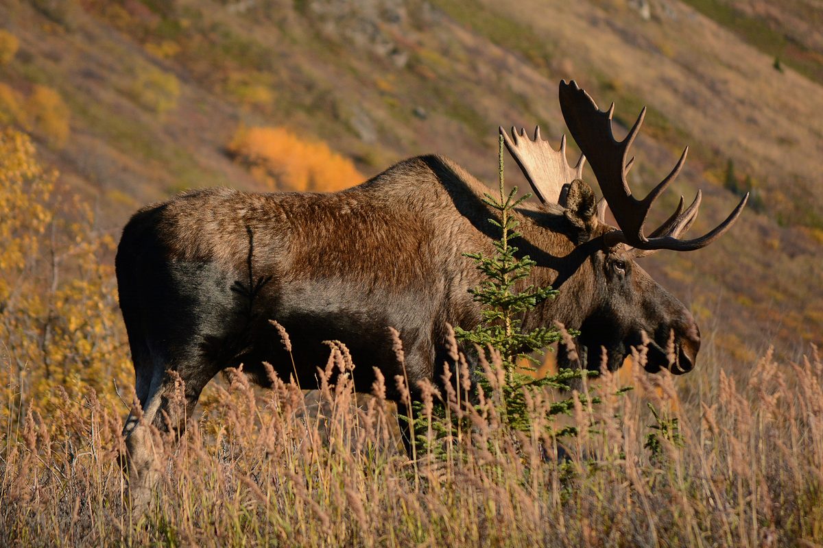
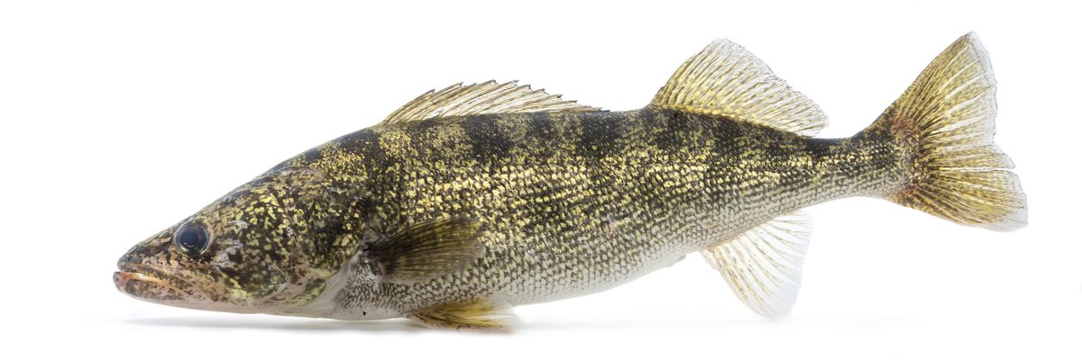

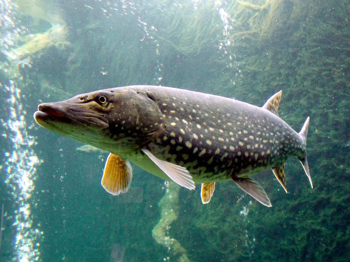
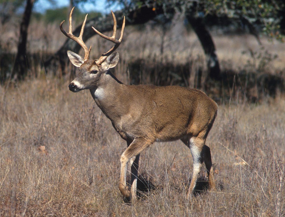
Packing checklist
- PFD per person
- Lightweight canoe with yoke
- Spare paddle
- Portage packs
- Map and compass
- Water filter
- Bear hang kit or canister
- First aid kit
- Rain gear
- Synthetic layers
- Sturdy boots for portages
- Insect repellent and head net
- Sun protection
Recommended gear
Featured in these Top 10 lists
- Top 10 Outdoor Adventure Locations — ranked #1
- Top 10 Winter Camping Locations — ranked #1
- Top 10 Extreme Canoe Trips in the U.S. — ranked #6
Browse every destination we cover in the Destination Hub.
An Enduring Wilderness
The Boundary Waters Canoe Area Wilderness (BWCAW) is a vast, protected area within the northern third of Minnesota's Superior National Forest. Spanning over 1,098,000 acres, it stretches nearly 150 miles along the International Boundary with Canada, bordering Quetico and La Verendrye Provincial Parks. This unique wilderness contains over 1,200 miles of interconnected canoe routes, 12 hiking trails, and more than 2,000 designated campsites. Established in 1926 to preserve its primitive character, it became part of the National Wilderness Preservation System in 1964, with additional protections and acreage added by the BWCAW Act of 1978. The area offers an experience of solitude, challenge, and a deep connection with nature, allowing visitors to travel by canoe and portage as people have for centuries. It stands as a significant wilderness area and a popular destination for paddling, hiking, and fishing.
Navigating the Waterways
The BWCAW is primarily explored by canoe, offering extensive routes across its many glacial lakes and streams. Canoeing provides a close perspective on the natural environment, allowing access to shallow and narrow passages where larger boats cannot go. The wilderness is designed for self-propelled travel, with portages connecting lakes and allowing passage around rapids or unnavigable sections. This traditional mode of travel defines the experience, encouraging a slower pace and deeper immersion in the surroundings. Whether traversing vast lakes or winding through smaller channels, the network of waterways allows for extensive exploration and multi-day trips, reaching remote campsites and offering a sense of self-reliance and adventure.
Planning Your BWCAW Experience
A permit is always required to enter the BWCA Wilderness, regardless of the season or type of trip. For trips between May 1 and September 30, known as the Quota Season, visitors undertaking overnight paddle, motor, or hiking trips, or motorized day trips, must obtain a quota permit through Recreation.gov. Reservations for these permits become available on the last Wednesday of January at 9:00 a.m. CT. During the Non-Quota Season, from October 1 to April 30, and for non-motorized day use visitors year-round, self-issued permits are required. These are available at entry point kiosks and Forest Service offices without reservation or recreation fees. Each permit covers a group, with a strict limit of nine people and four watercraft per group, whether on water, portages, or campsites. Planning ahead and understanding the permit system is crucial for a successful trip into this protected area.
Getting to Boundary Waters Canoe Area
The BWCAW is located within the Superior National Forest in northeastern Minnesota. Visitors typically access the wilderness through various entry points scattered around its perimeter.
Boundary Waters Canoe Area FAQ
- Is a permit always required to enter the BWCA Wilderness?
- Yes, a permit is always required to enter the BWCA Wilderness, regardless of the season or type of trip.
- When is the Quota Season for permits?
- The Quota Season runs from May 1 through September 30. During this time, specific quota permits are required for most trips and should be reserved in advance.
- When is the Non-Quota Season for permits?
- The Non-Quota Season runs from October 1 through April 30. During this time, self-issued permits are required and can be obtained at entry points or Forest Service offices.
- What is the maximum group size allowed in the BWCAW?
- The maximum group size allowed is nine people and four watercraft, which applies to all locations within the BWCAW, including on water, portages, and campsites.
- Where can I reserve a quota permit?
- Quota permits for the Quota Season (May 1 - September 30) can be reserved through Recreation.gov. Reservations become available on the last Wednesday of January at 9:00 a.m. CT.
- Is mobile phone service available in the BWCAW?
- Mobile phone coverage is generally poor to non-existent, with users reporting major issues across all major carriers (AT&T, Verizon, T-Mobile, Sprint).